"For the contents before December 2017, just click this line.
2017年12月以前の写真はここをクリックしてください。"
"For the contents from January to September 2018, just click this line.
2018年1月から9月までの写真はここをクリックしてください。"
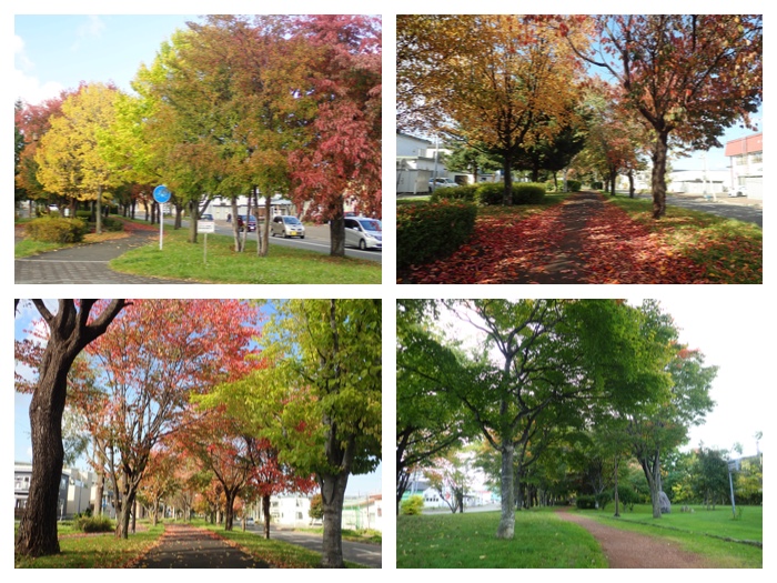
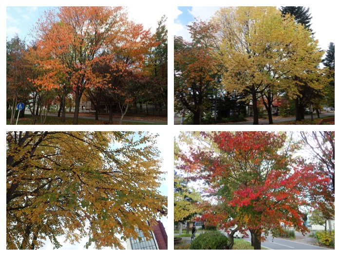
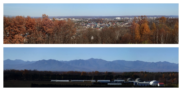
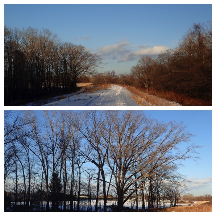
2018年10月から12月までの私の写真日記です。
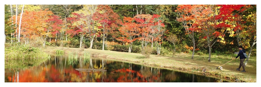
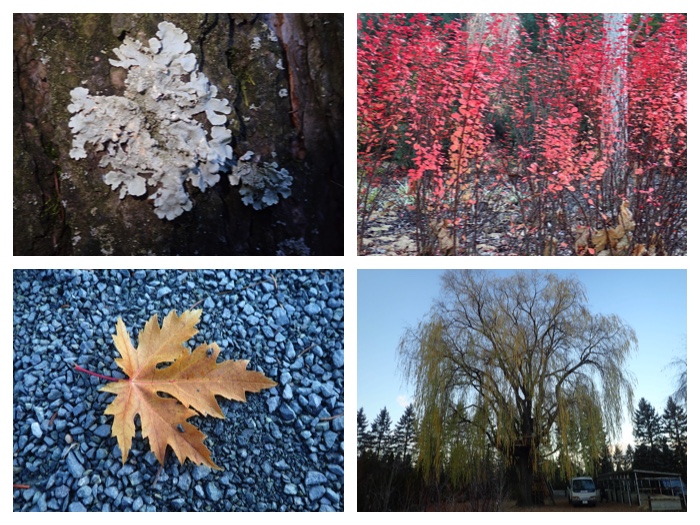
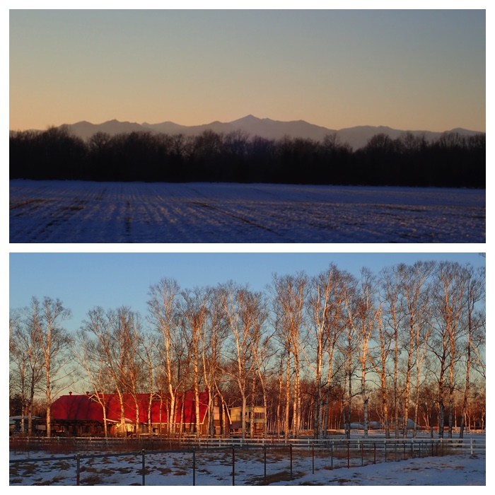
"福原山荘の紅葉"
私の投稿はテーマごと、期間ごとに分けられています。左のサイドバーから飛んでください。
My articles are sorted according to the subjects and period. Please jump from the left side bar.
Photos after October 2018 are shown here.
"For the contents before December 2017, just click this line.
2017年12月以前の写真はここをクリックしてください。"
"For the contents from January to September 2018, just click this line.
2018年1月から9月までの写真はここをクリックしてください。"
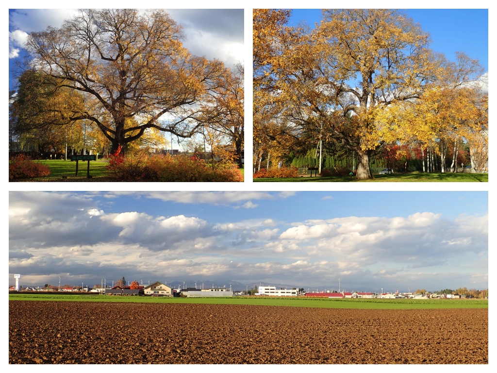
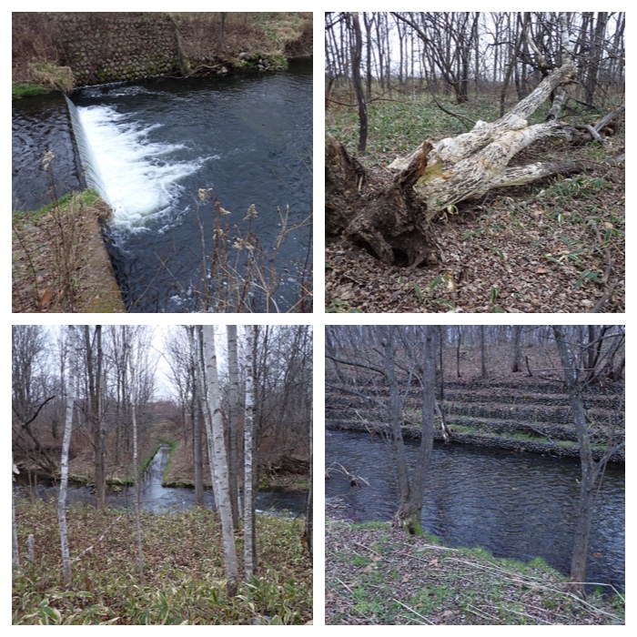
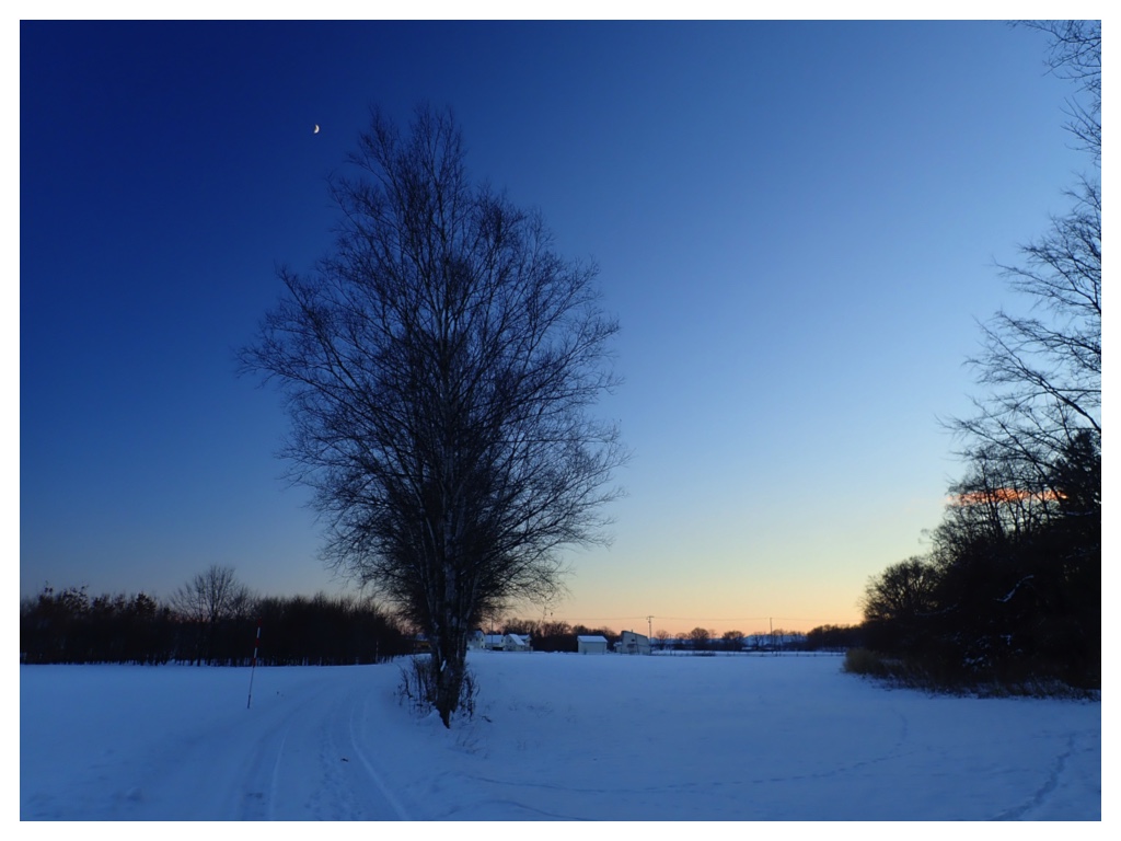
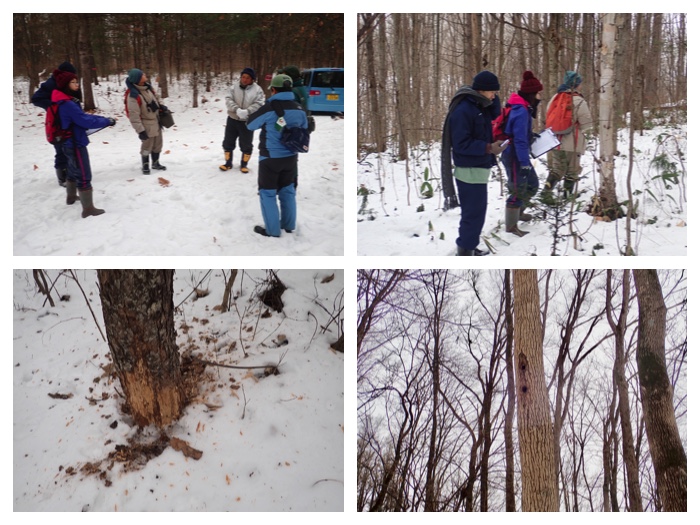
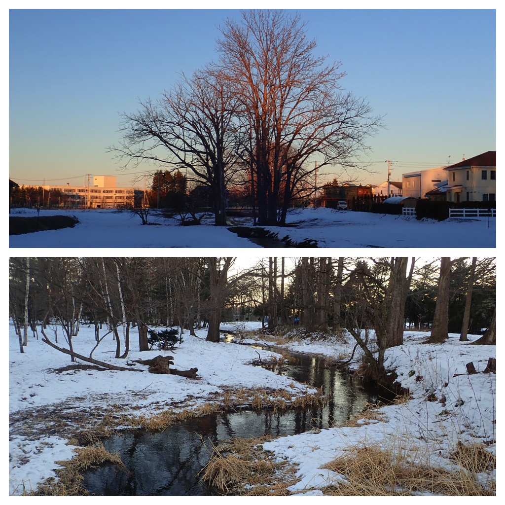
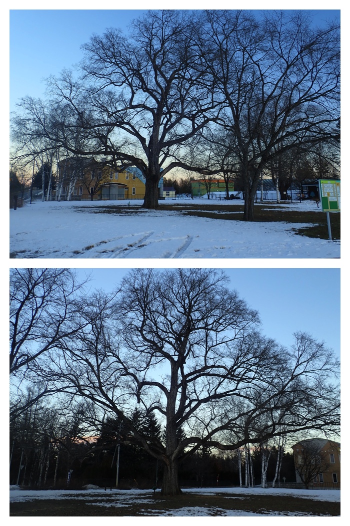
A 200 years old elm tree near the Inada water pump station, and a big elm tree with many combined tree trunks near Kikanko river. Monuments of pioneers from Sakauchi village, Gifu prefecture, settled in Kawanishi village, and an another monument in the campus of OUAVM, praising the pioneer land owner who offered his land to Obihiro Agricultural High School and OUAVM. How are they related each other?
When the elm tree near the Inada water pump station started to grow, no people from the main island of Japan lived in this place. Later, people settled in this place cut the trees around this tree. Therefore, this tree could spread its branches and twigs widely from its very thick trunk with around 3 m diameter.
On the other hand, when I saw the elm tree near the Kikanko river, I wondered why this tree has so many combined trunks. A curator of the Obihiro Centennial Museum, Mr. Ikeda, taught me that this tree should have been cut once. After being cut, many new stems grew again from the stump and grew big again. Many trunks from the stump were combined together and formed the present tree.
When this elm tree was cut once? It should have been the age when people settled in Kawanishi village around 120 years ago. In 1897 (Meiji 29), people from the Sakauchi village in Gifu prefecture, central Japan, settled in this place. One or two years ahead, Mr. Nakamura from Fukui prefecture, central Japan, also settled in this place, and started clearing the forest and cultivating the land. The land cultivated by the family of Mr. Nakamura was later-on donated to Obihiro Agricultural High School and the Obihiro University of Agriculture and Veterinary Medicine.
稲田浄水場の隣の樹齢200年のハルニレの木と機関庫川のほとりのたくさんの幹が寄せ集まったハルニレの木。岐阜県坂内村から帯広市川西村に入植した人たちの渡道百年記念碑と、帯広畜産大学と帯広農業高校に用地を提供した初期開拓者の顕彰碑。これらはどのように関係しているのでしょうか?
稲田浄水場の隣のハルニレの木は樹齢200年ですから、この木が生え始めた頃には、まだ和人はこの土地にほとんど住んでいませんでした。この木は直径3メートルほどもある太い幹からたくさんの枝が広く拡がっています。入植者によって周りの木々が切られたことによって、残されたこの木は枝を広く拡げることができたのでしょう。
他方、機関庫川の辺りの幹がたくさん寄せ集まった大きなハルニレの木を見て、どうしてこのような生え方をしているのか不思議に思っていたところ、百年記念館学芸員の池田さんが、いったん切られたためだろうと教えてくださいました。いったん切られたあと切り株から再びひこばえが生えて大きく育ち、お互いに密着してこのように寄せ集まったもののようです。
それでは、このような大きなハルニレの木がいったん切られたのはいつのことかというと、川西村に人々が入植した時代(約120年前)ということになります。明治29年に岐阜県坂内村からの人々がこの地に入植しました。この年に「北海道国有未開地処分法」という法律が施行され、移住者1戸あたり5ヘクタールの未開拓地が貸し与えられ、その土地を5年以内に開拓し終えた移住農家には無償でその土地が与えられるという法律です。そのため、この期間に森林の伐採が急激に進みました。またその少し前に福井県平泉寺村出身の中村善右衛門という人が同じく川西村に入植し現在の農業高校付近の土地を開拓しました。その後、中村家の開拓地は帯広農業高校に提供され、さらに帯広畜産大学に分譲されることになりました。
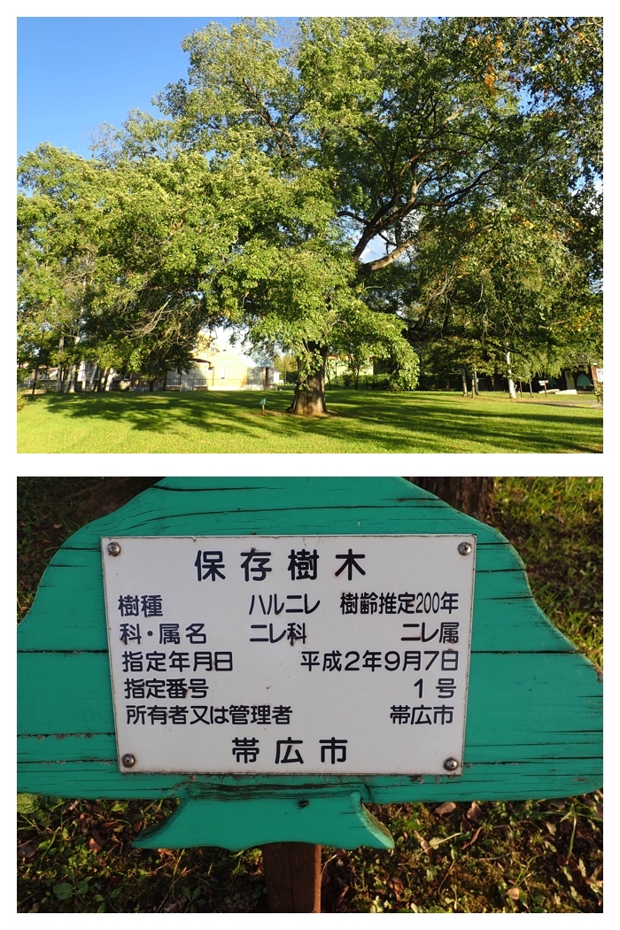
A 200 years old elm tree near the Inada water pump station.
稲田浄水場の隣の樹齢200年のハルニレの木。
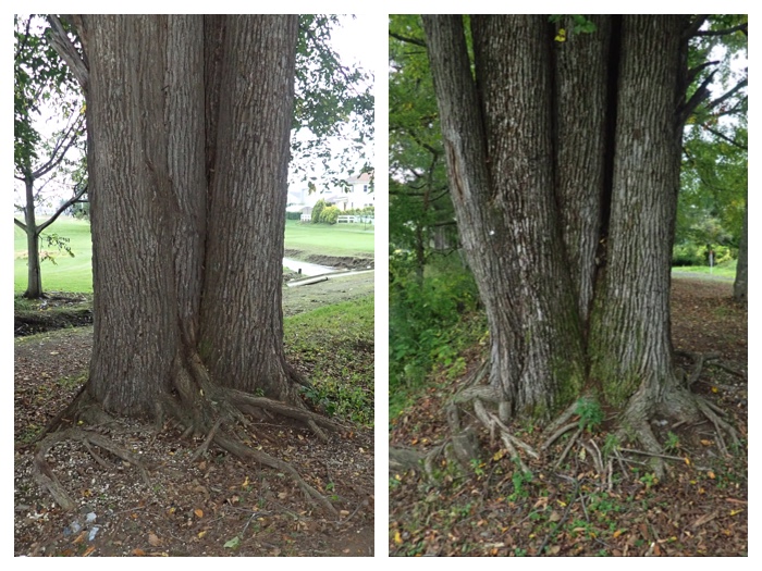
A big elm tree with many combined tree trunks near Kikanko river.
機関庫川のほとりのたくさんの幹が寄せ集まったハルニレの木。
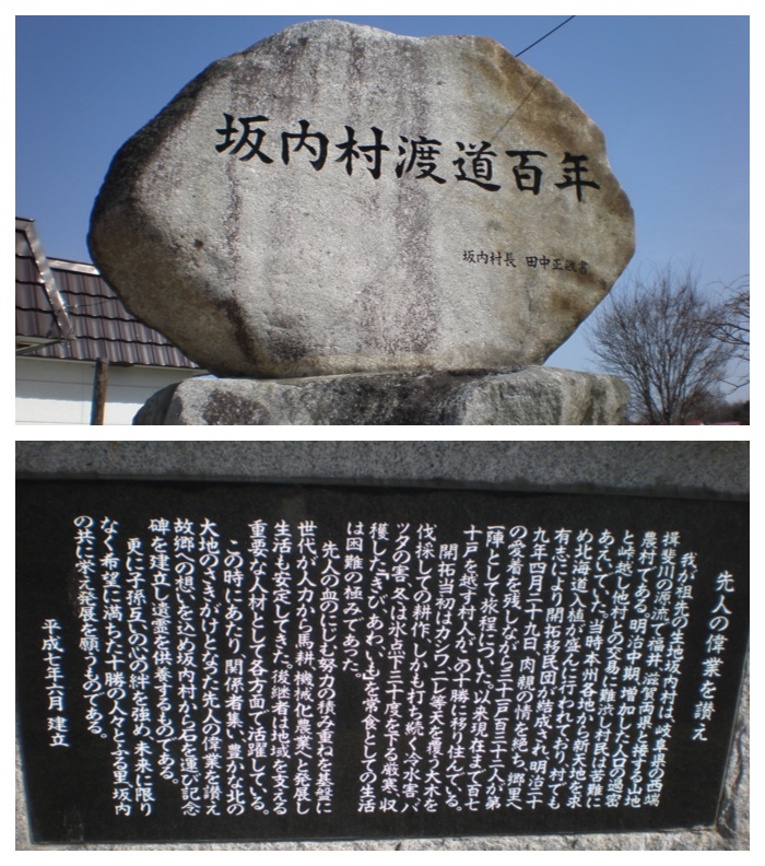
Monuments of pioneers from Sakauchi village, Gifu prefecture, settled in Kawanishi village.
岐阜県坂内村から帯広市川西村に入植した人たちの渡道百年記念碑。
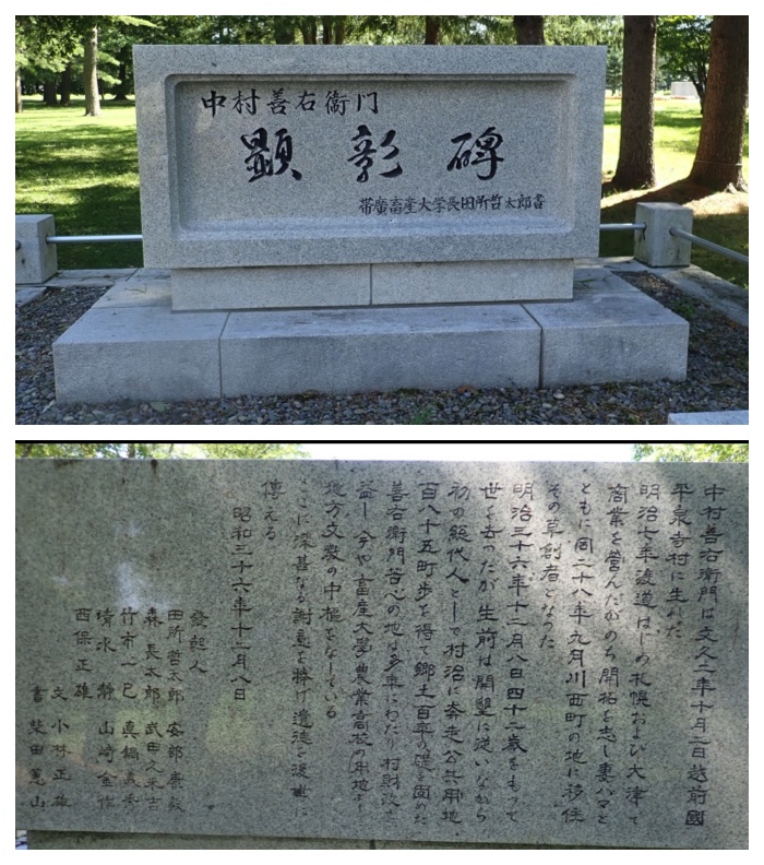
An another monument in the campus of OUAVM, praising the pioneer land owner who offered his land to Obihiro Agricultural High School and OUAVM.
帯広畜産大学と帯広農業高校に用地を提供した初期開拓者の顕彰碑。帯広畜産大学キャンパス内。
"To Page Top"
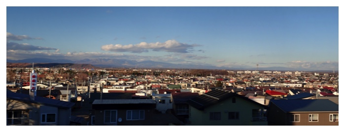
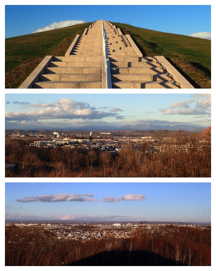
My friend during my student age visited me after 37 years absence since the occasion of my wedding ceremony with my wife. I brought him to some places in Obihiro where we can enjoy the nice view.
名古屋大学の学生時代の友達が、37年ぶりに訪問してくれたので、十勝ヒルズ、旧愛国駅、畜大、森の山などへ案内しました。快晴で眺めもよくて良かったです。私たち夫婦の結婚式に来てくれて以来の再会でした。
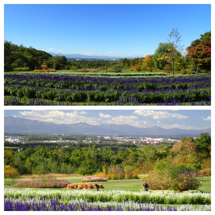
十勝ヒルズガーデン内からの帯広市街方向の眺め。
十勝ヒルズガーデン導入路付近からの日高山脈の眺め。
もりの山からの眺め。

白いリスとコエゾゼミ。遠来の友に見てもらえて良かったです。
"To Page Top"
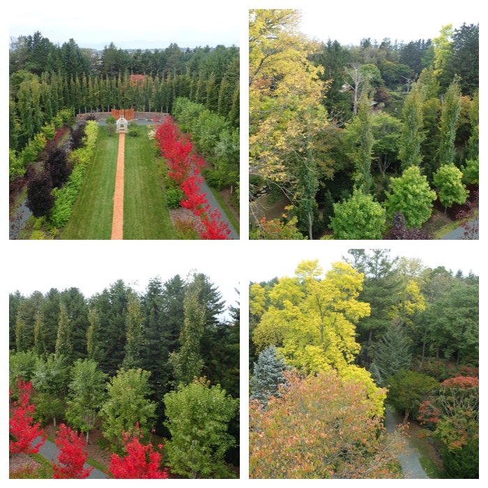
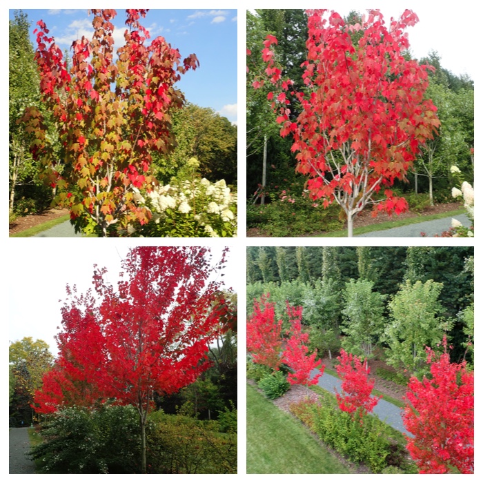
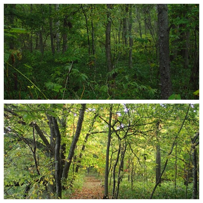
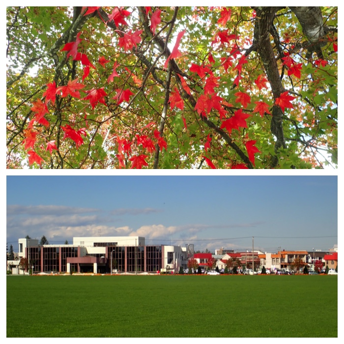
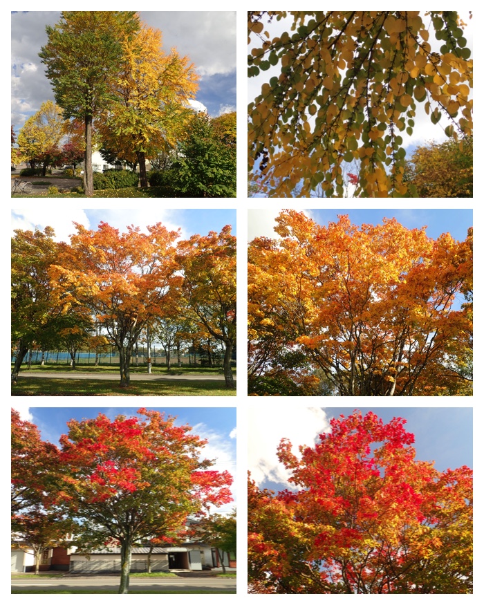
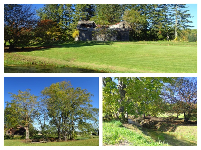
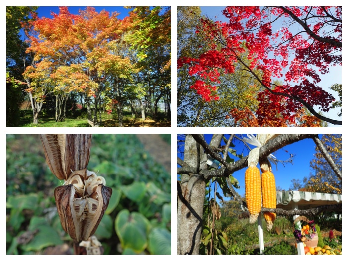
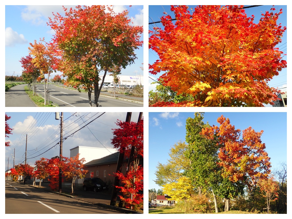
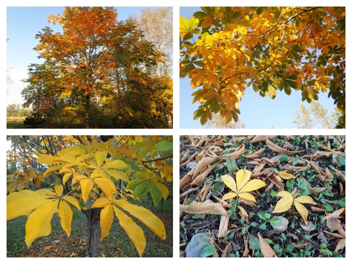
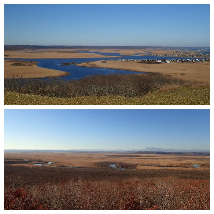
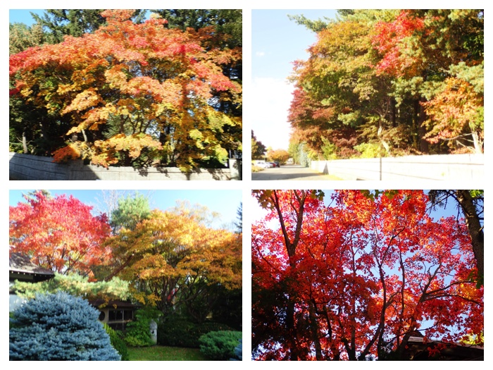
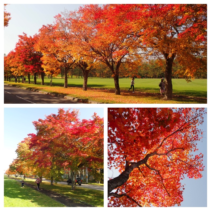
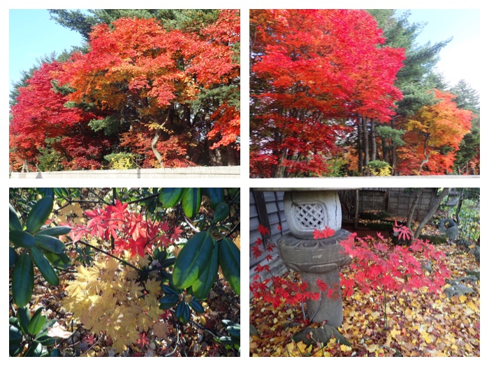
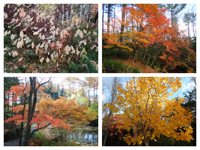
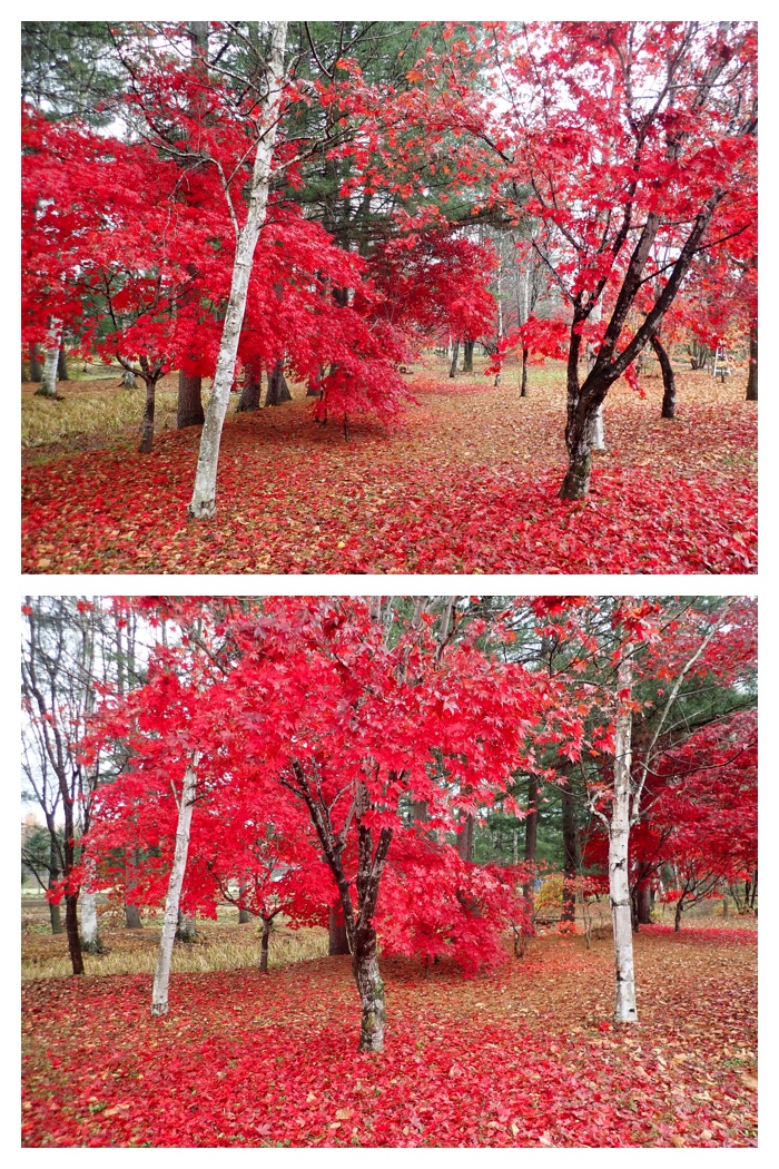
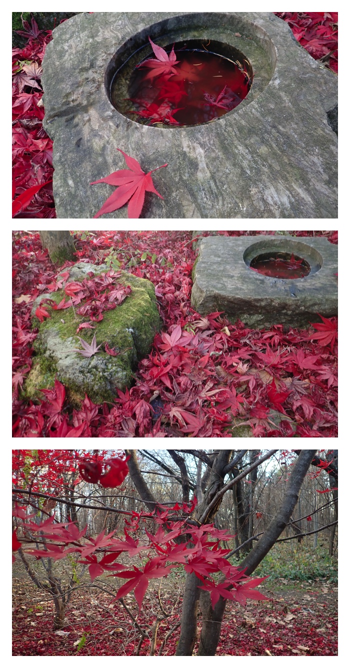
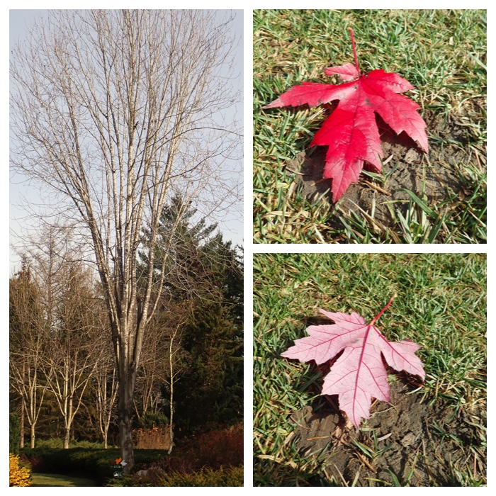
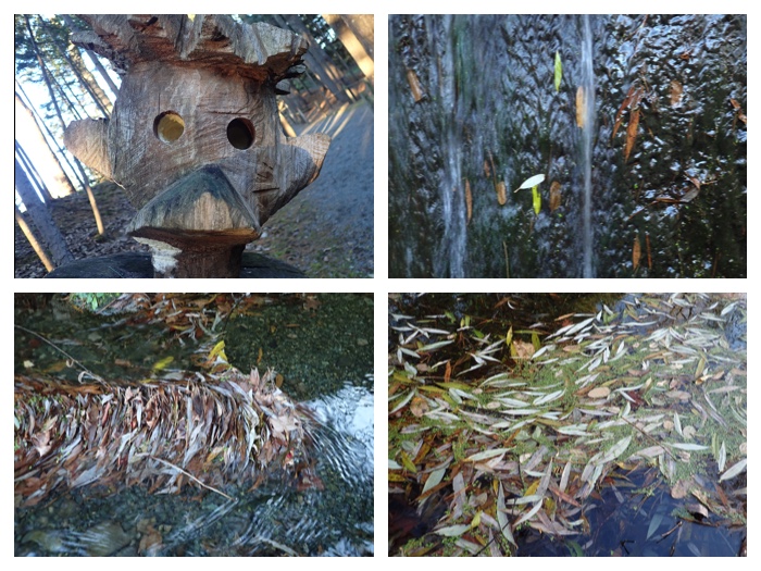
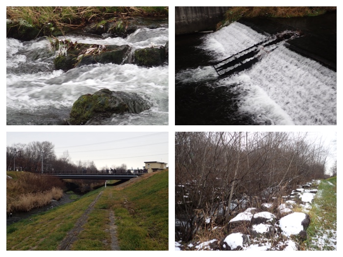
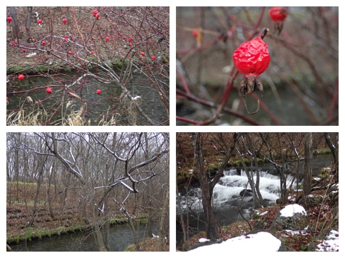
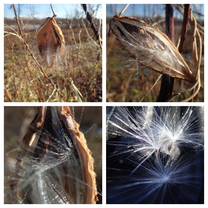
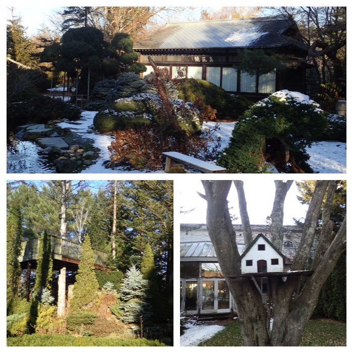
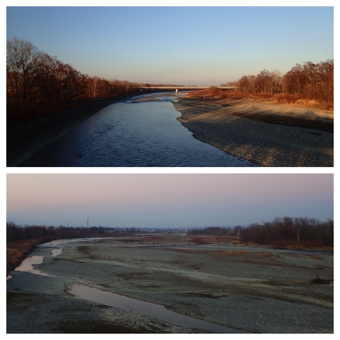
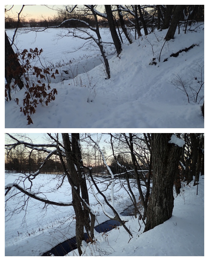
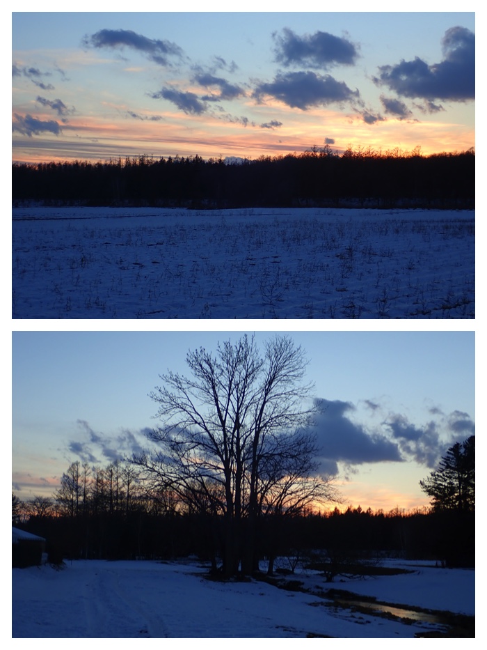
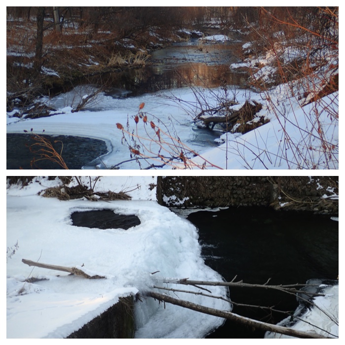
On October 5, I went out to see red maple leaves in the garden of Fukuhara-Sanso lodge in the mountain foot area of Shikaribetsu. It is a private garden, and open to public only in this season until October 21.
After visiting the garden of Fukuhara-Sanso lodge, I proceeded to Shikaribetsu lake and Mt. Haku-un-san. As it was already after 3 o'clock when I arrived at the starting point of Mt. Haku-un-san, I could not climb to the summit of the mountain. I walked around 2 hours in the mountain and came back. It was a very comfortable walk, because the weather was fine and not hot.
台風25号の接近で連休中はお天気が崩れそうなので、10月5日の昼過ぎから福原山荘と然別湖・白雲山に行ってきました。福原山荘には初めて行きましたが、紅葉がとてもきれいでした。場所は菅野温泉に向かう道に入って、3キロほど進んだところにあります。個人の庭園なので、今の時期だけ特別開園されています(10月21日まで)。
福原山荘で紅葉を見たあと、然別湖と白雲山に行きました。白雲山の登山口に着いたのが15時過ぎだったので、山頂まで行って帰ってくる時間はなく、最初の尾根まで登って帰ってきました。往復2時間くらいでした。去年も10月の連休に白雲山に登りました。天気も良く、暑くもなく、快適な山歩きとなりました。
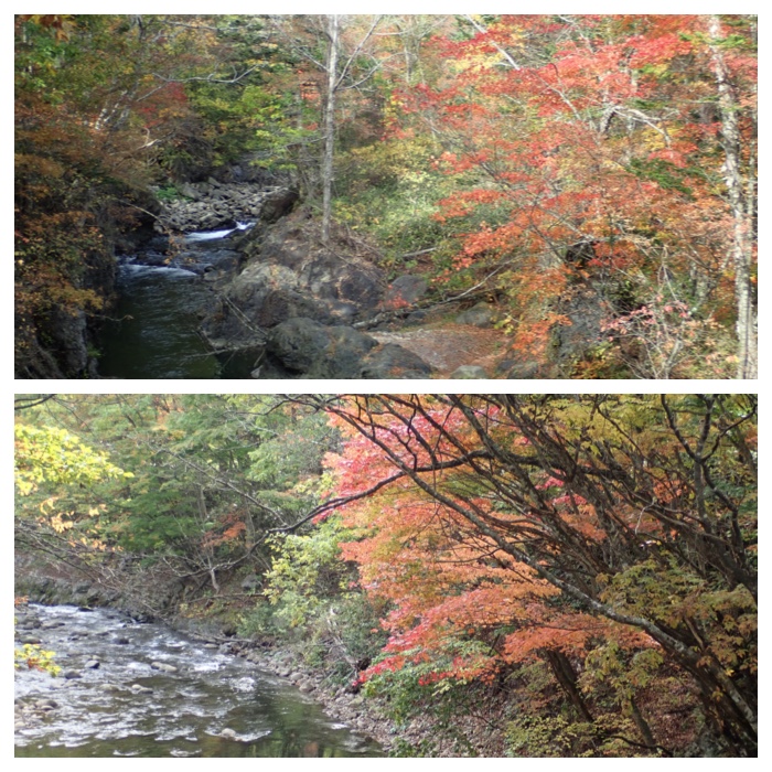
第2駐車場東側の渓流。
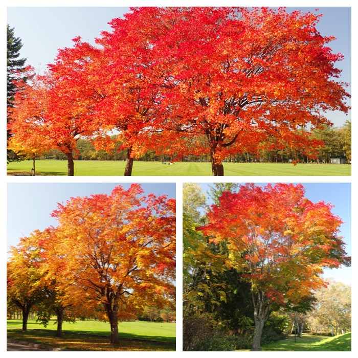
福原山荘内の紅葉。
福原山荘内の紅葉。
福原山荘内の紅葉。
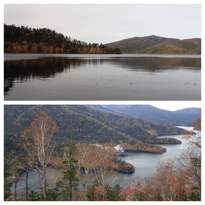
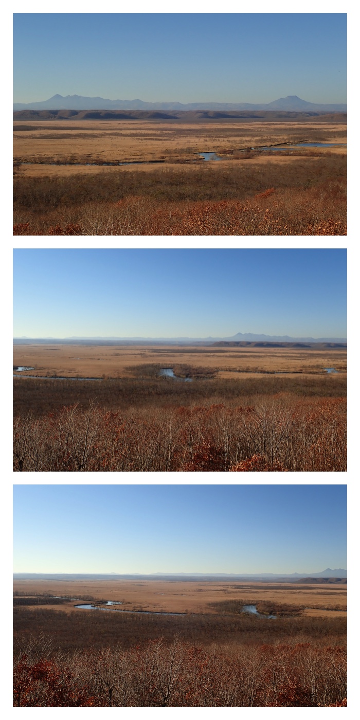
登山口、登山道と湖畔からの然別湖の眺め。
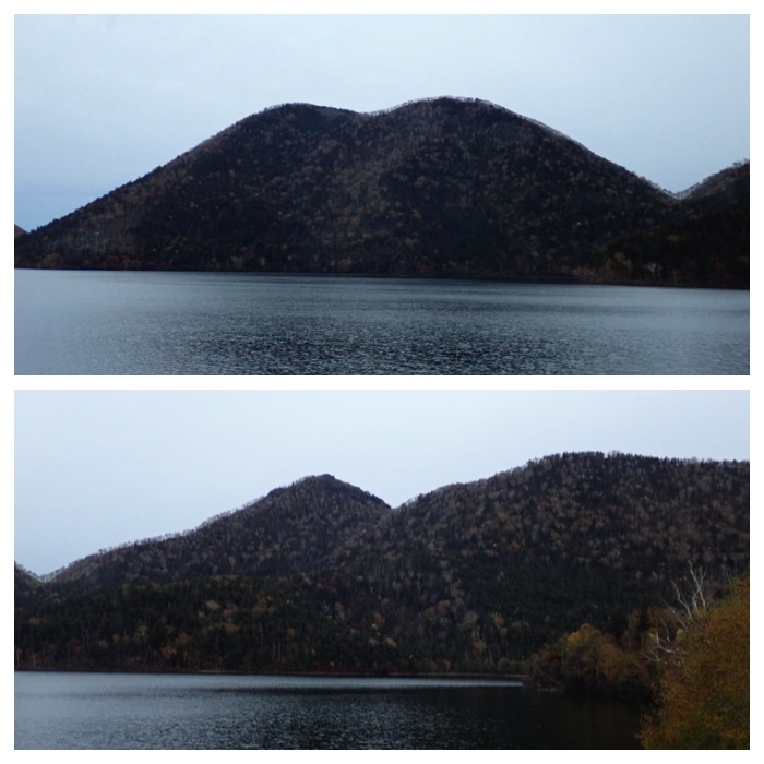
然別湖の眺め。 天望山と白雲山。
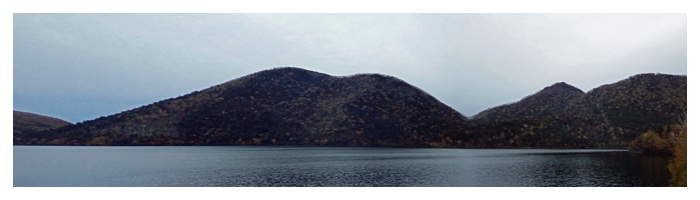
然別湖、天望山と白雲山のパノラマ。
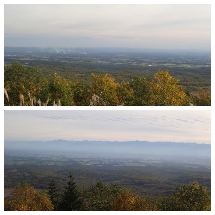
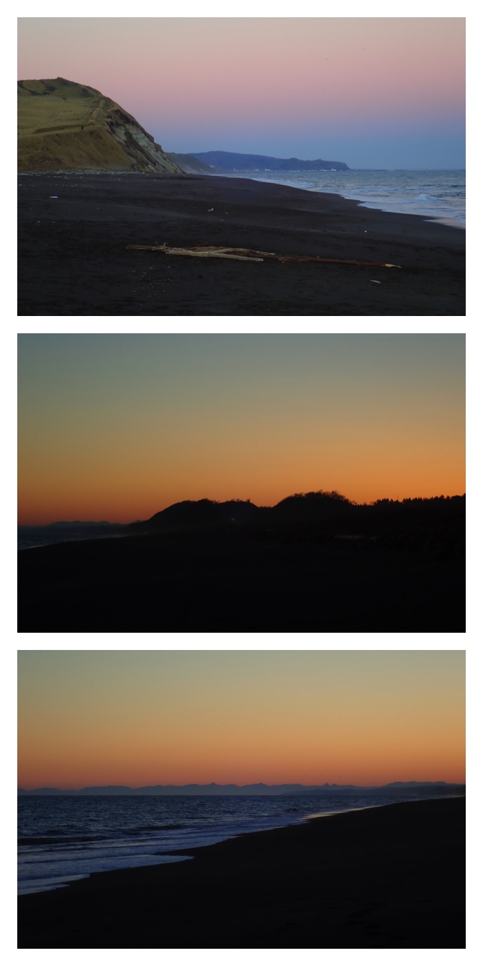
扇ヶ原展望台からの眺め。
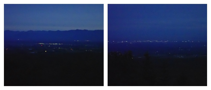
扇ヶ原展望台からの夕刻の眺め。at 17:22, October 5.
"To Page Top"
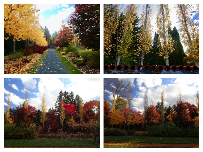
リバースボーダーガーデン周辺の眺め。秋の祭典の特別企画で高所作業車の作業台に乗せてもらって撮りました。
カナディアンメープルが赤く色づいていく様子を9月17日、9月24日、10月6日に撮りました。
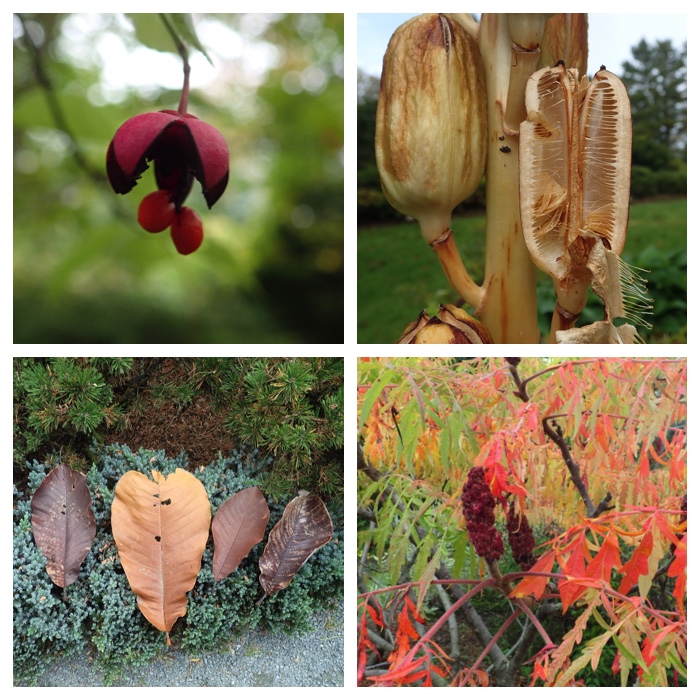
ツリバナ、オオウバユリ、ホオノキの落ち葉、名前不明の草花。
小麦の芽が発芽したハローウィーンデコレーション。
生き物探しゲーム。
園路の片隅で。
ガーデンセンターのツタと吊り下げられたフクシアの花。
"To Page Top"
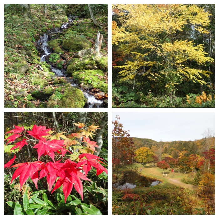
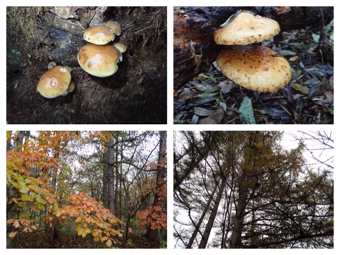
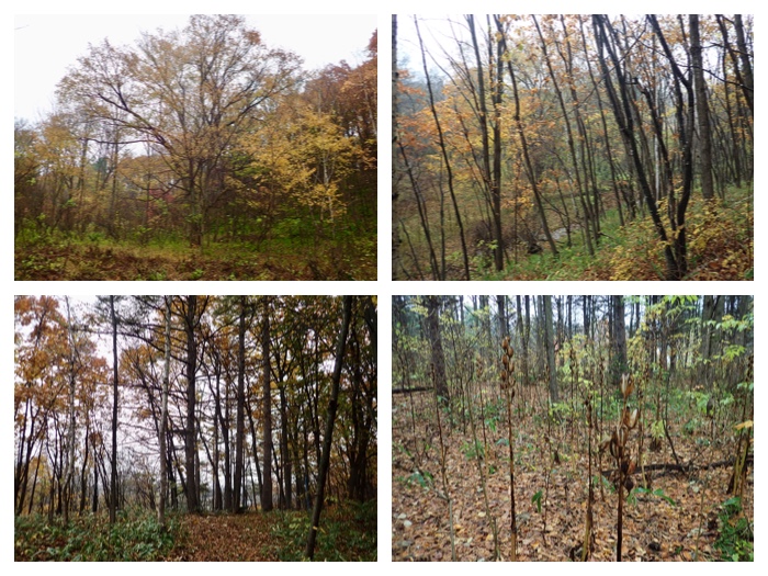
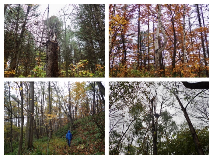
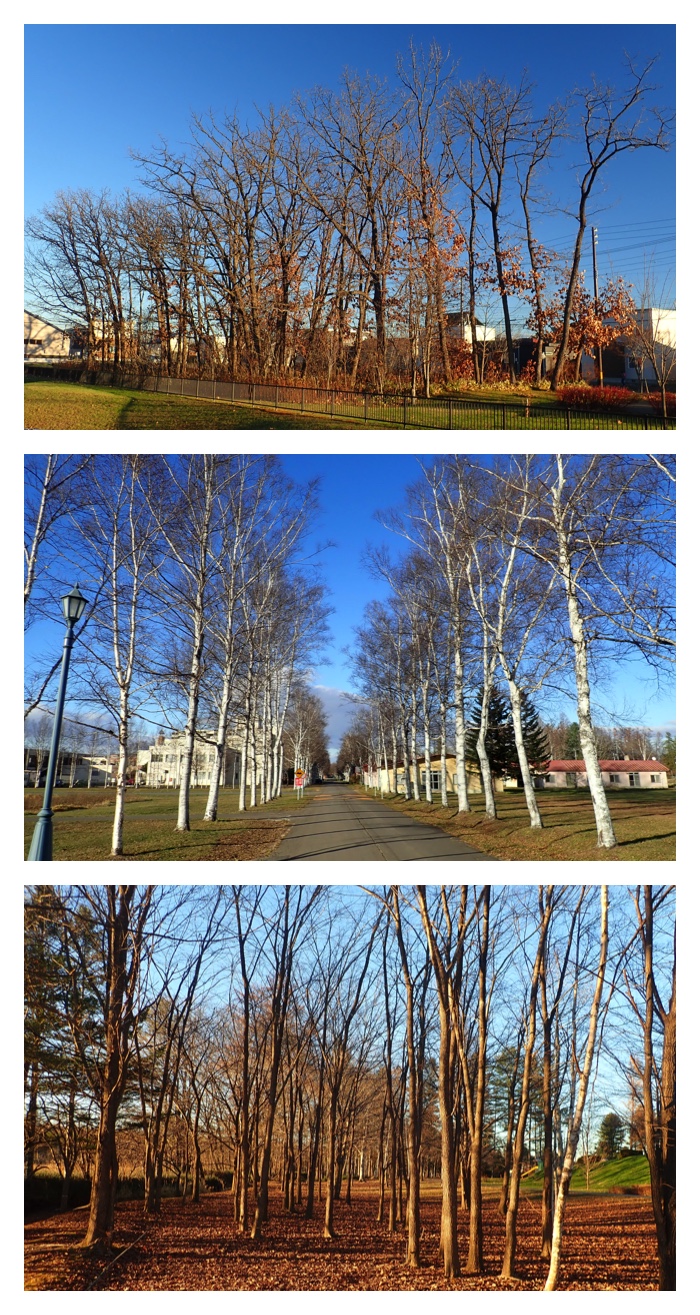
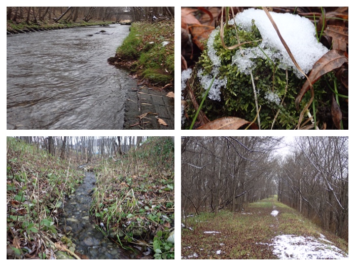
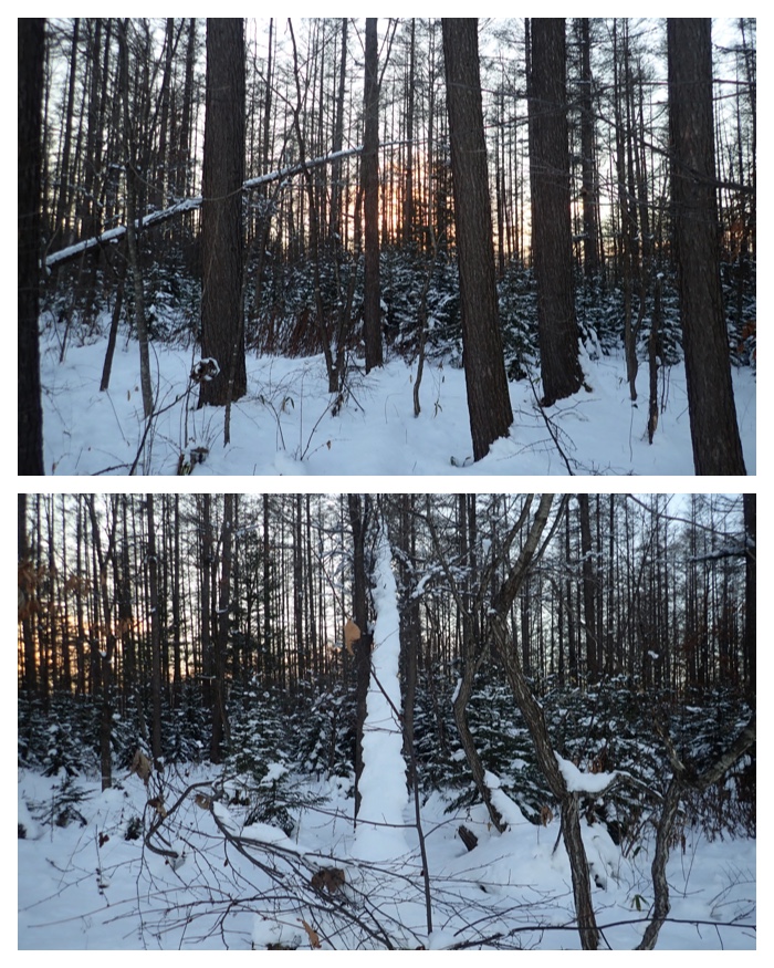
農業高校の森。 上は湿地林、下は段丘崖の上の道。October 9.
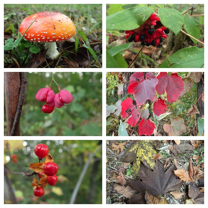
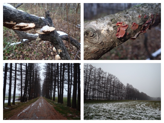
林内の道沿いに見つけた草木の種、落ち葉、キノコなど。 October 9.
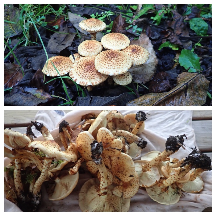
機関庫川沿いの林床に生えていたツチスギタケ。人によっては食中毒を起こすこともあるそうなので注意が必要です。 October 11.
黄色い葉と緑の葉のヤチダモ。木によって葉の色の変わり具合が違うのは何故?エゾヤマザクラの葉の色は枝ごとに違っています。ヤマグワの葉は下の方から黄色になっていました。 October 11.
"To Page Top"
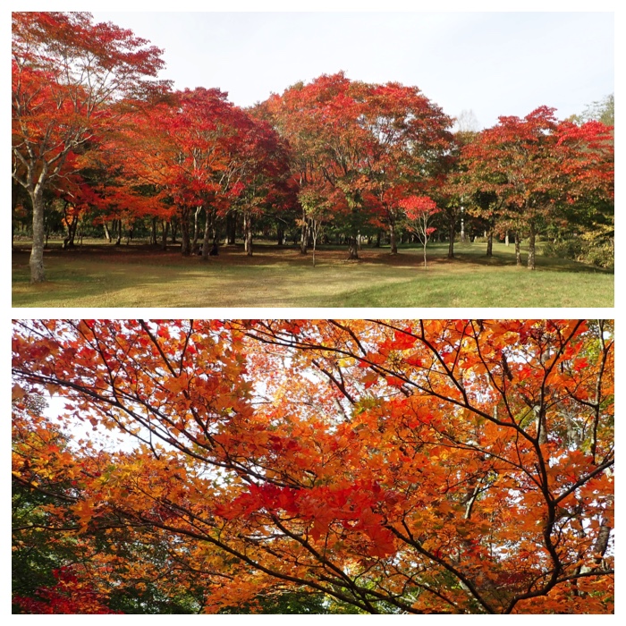
I visited the green park of Obihiro by bicycle to enjoy the colored leaves. Compared with last year, the autumn color is delayed and not so brilliant maybe damaged by the strong typhoons which attacked Japan repeatedly.
Red maple leaves and the lawn of the green park.
Yellow and red leaves of katsura and maple trees.
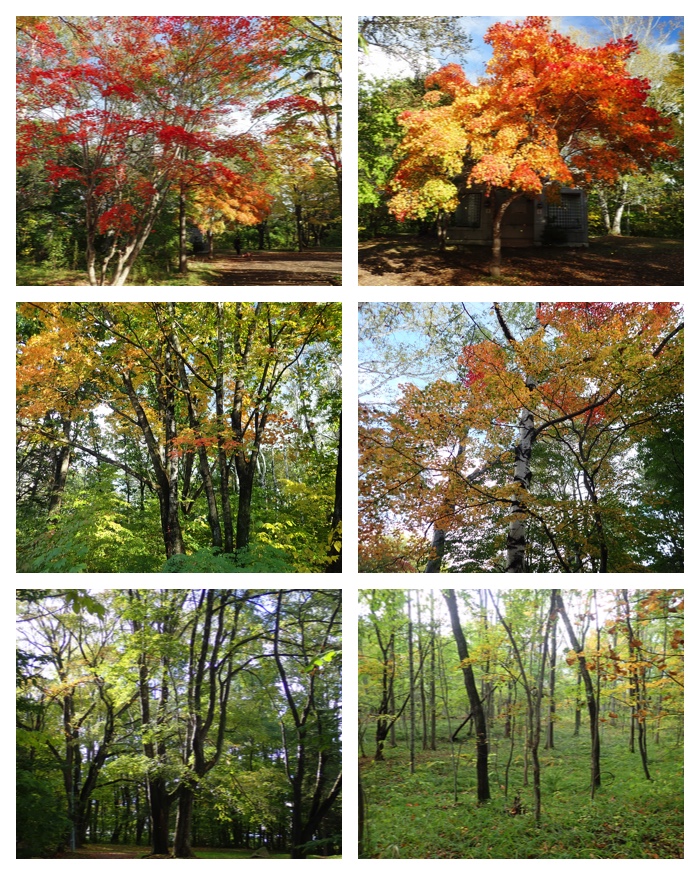
Maple trees and forest in the park.
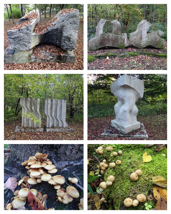
Art stone carvings along the walking path and mushrooms found along the way.
"To Page Top"
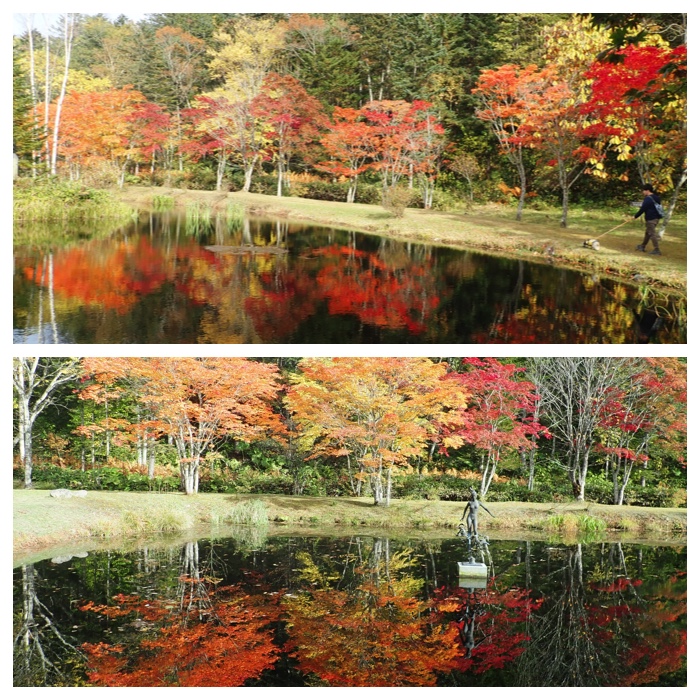
今日は久しぶりの十勝晴れでした。朝からキノコ採り、庭の作物の片付けなどをしたあと、岩内仙境まで行きました。わが家から真南に25kmほど離れたところにありますので、自転車では無理と思い、自家用車で行きました。去年も同じ時期に行きましたが、去年のほうが紅葉はきれいでした。その後、帰り道に紫竹ガーデンにも寄り、さらに真鍋庭園も巡って帰ってきました。
Today, we had a very fine day here in Tokachi. People in Tokachi, Hokkaido, are proud of such fine day calling "Tokachi-bare". I went to the river-side forest of Kikanko river to pick mushrooms, cleaned my crops in the garden, then visited three view spots in the suburbs of Obihiro city, Iwanai Senkyou (hidden valley in Iwanai), Shichiku garden, and Manabe garden.
An abandoned farm house beside Kikanko river.
View of Hidaka mountains, "Tokachi-Poroshiri" and "Tsurugi-san" .
View of the hidden valley in Iwanai, "Iwanai Senkyou".
Shichiku garden. Two types of magnolia (Kobushi and Mokuren) and their seeds. An oak tree is also shown (upper right).
Shichiku garden. Yellow and red maple trees, a hatched seeds of wild lily (Ooubayuri) and the ears of dent corn hung on a tree branch.
Manabe garden. Two different types of maple tree, leaves of wild grape, and open air art works covered with needle leaves.
Manabe garden. A grass with purple colored seeds (Murasaki-shikibu) and a Canadian maple tree, and fallen leaves floating on the water surface.
"To Page Top"
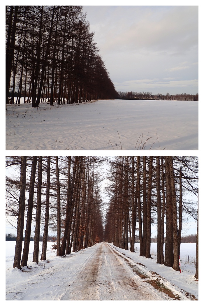
10月14日(日)にはトテッポ通りに展示してある十勝鉄道蒸気機関車の内部を公開していたので見に行ってきました。帯広工業高校の生徒さんが案内してくれました。
トテッポ通りは現在歩行者と自転車の専用道路(遊歩道)になっていますが、かつては十勝鉄道の汽車が走っていた軌道の跡です。もみじ、エゾヤマザクラ、コブシ、カツラなど様々な街路樹が植えられていて、四季を通じて美しい通りです。十勝鉄道は日本甜菜糖株式会社が1920年から運営していて、主な用途は南部の農山村から甜菜を始めとする農産物や木材、砂利などを運ぶことでしたが、旅客も乗せていました。学校前を通っていたので帯広農業高校や帯広畜産大学の学生さんも通学に利用していたそうです。しかし、甜菜工場より南の農村部の路線は1959年に廃止になり、帯広駅と甜菜工場の間の路線も1977年に廃止となりました。
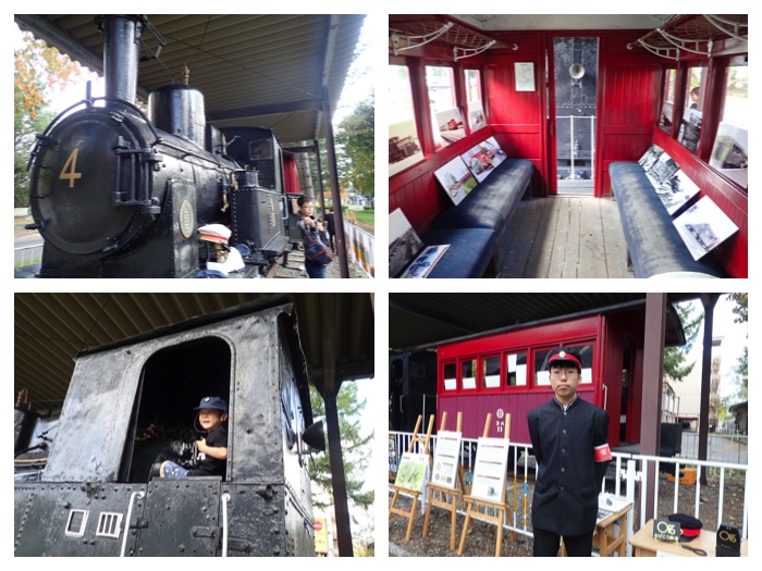
An old small locomotive exhibited in the Toteppo alley.
Tree-lined path in the Toteppo alley.
Various colored leaf trees in the Toteppo alley. Hokkaido-Cherry (upper left), Kobushi (upper right), Katsura (lower left), and maple (lower right).
Seeds of trees in the Toteppo alley. Upper two: "Tsuribana", lower two photos: "Kobushi".
"To Page Top"
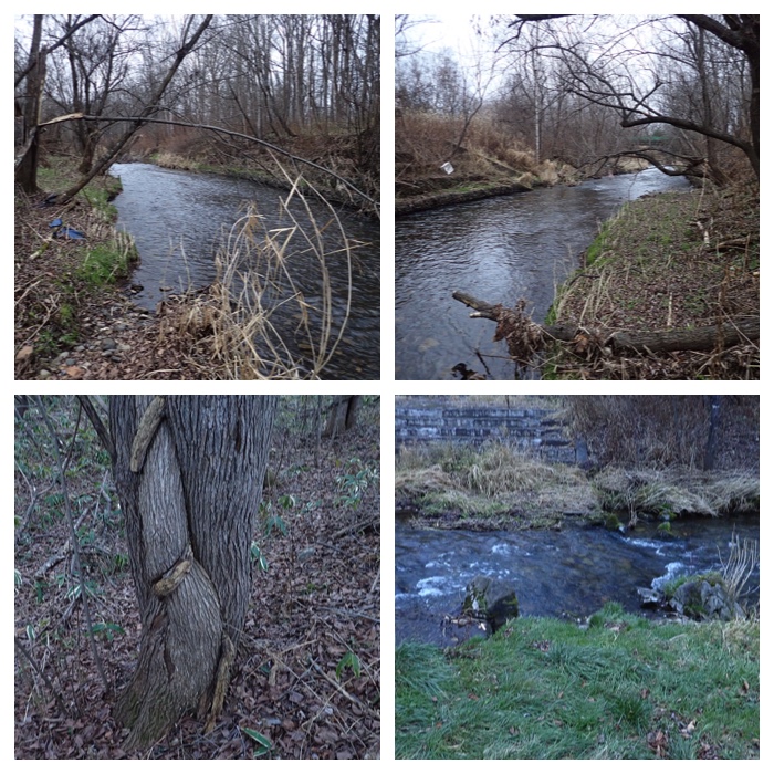
帯広市清流付近の街路樹と札内川西岸の風景です。街路樹や公園の樹々もきれいに色づいてきました。もうすぐ霜が降りると一斉に落葉してしまい、あとは冬の訪れまでもうすぐです。札内川の堤防はときどき散歩するのですが、この日はガガイモの実がどうなっているのか見てみたいと思っていました。昨年の秋に堤防を散歩したときには、ガガイモの実が全て弾けて、中の綿が飛び散ったあとでした。河原沿いの薮のなかでは野生のホップ、「カラハナソウ」を見つけました。また写真には載せてありませんが、ヤナギタケも見つけました。
Scenes of roadside trees and park trees in autumn color are shown. I also walked along the western bank of Satsunai river. I was interested to see the seed bags of Metaplexis japonica, which contain wooly hair and seeds inside. When I visited here last year, all seed bags were already hatched and the wooly hair and seeds have blown off by winds. This time, the seed bags were still colored green. I also found the Japanese native wild hop.
Colored leaves of the roadside trees in Seiryu, Obihiro. 帯広市清流地区の街路樹。
Japanese horse chestnut tree in a park in Seiryu town. 公園のトチノキ。
River side view along the western bank of Satsunai river. 札内川西側堤防からの風景。
Riverside trees on September 17 and October 17. 9月17日と10月17日の河畔林。
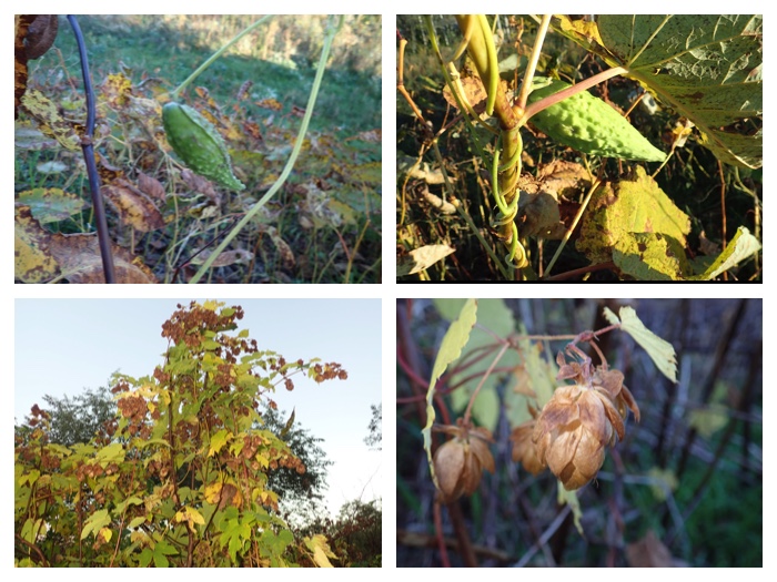
Upper two: Seed bag of Metaplexis japonica, lower two photos: Japanese native hop, "Karahanasou". 上の写真:ガガイモの実。下の写真:日本産の野生ホップ。
"To Page Top"
今日の午後は快晴だったので、国見山へ行ってきました。然別川が十勝川に合流するあたりにある標高128メートルの山です。国有林で、自然観察教育林にもなっているので、登山道は非常に良く整備されていました。私の家族が帯広に引っ越してきた1991年に、帯広営林署が運営する「森林クラブ」に家族で加入し、そのバスツアーに参加して家族皆で登ったことがあります。エゾハルゼミが鳴いている頃でした。それ以来ずっと登っていなかったので、27年ぶりということになります。
駐車場にあるコース案内図の写真を載せました。今日はチャシコースを登って展望台に行き、尾根をドングリコース分岐まで歩き、ドングリコースを降りて帰ってきました。樹々にさえぎられて頂上からの展望はあまりよくありませんでした。傾斜がゆるいのはドングリコースで、のんびりと疲れずに登るのならドングリコースから登ると楽かもしれません。ドングリコースの登山道には丸太が50cmおきくらいに敷き詰められ、登り降りしやすくなっていました。
This afternoon (October 19), I climbed a small mountain named “Mt. Kunimi-yama” to the north of Obihiro city. It belongs to national forest and managed as a forest for nature observation and education by the national forest management bureau in the west Tokachi area. I climbed this mountain 27 years ago with my family (my wife and three kids) joining the bus tour organized by the forest management bureau. Since then I have not climbed this mountain. It was very fine today, and I could enjoy an exercise in a refreshing air and a beautiful forest with yellow and red colored leaves. It is only 30 minutes drive from my house, and the climbing is easy as the height of the mountain is only 128 m and the climbing routes are managed in very good condition.
Route guide panel and colored leave trees along the route.
Views near the top of the hill.
Views along the ridge of the hill.
A Hokkaido squirrel on a twig of a needle tree and the views along the going-down route. The route was managed in very good condition.
"To Page Top"
Cover photos which I used in the past. Photos were taken by myself mostly near my living place. Some photos were taken during my trips.
過去に使用したカバー写真。写真は全て私が撮ったものです。撮った場所はほとんど私が住んでいる十勝周辺ですが、旅行中に写したものもあります。
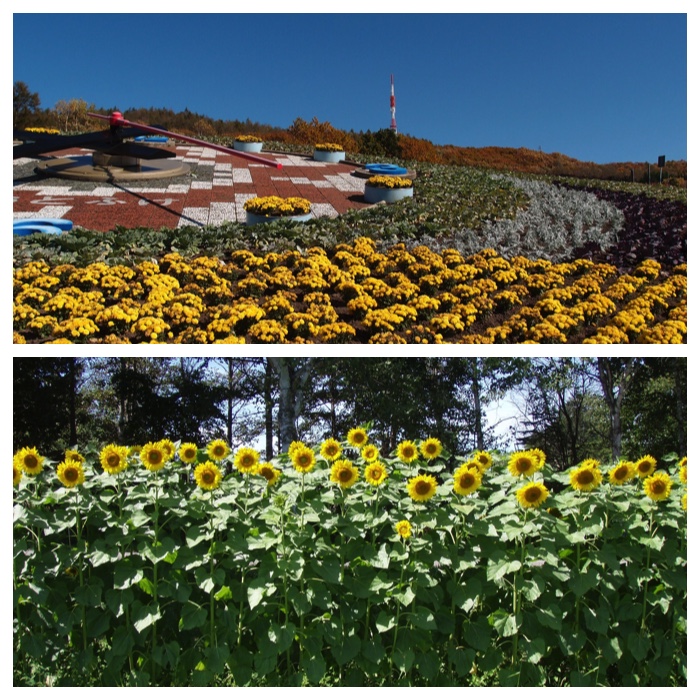
上:音更町十勝川温泉にあるハナック公園。2012 10.31
下:ヒマワリ。畜大精密圃場。2012 8.31
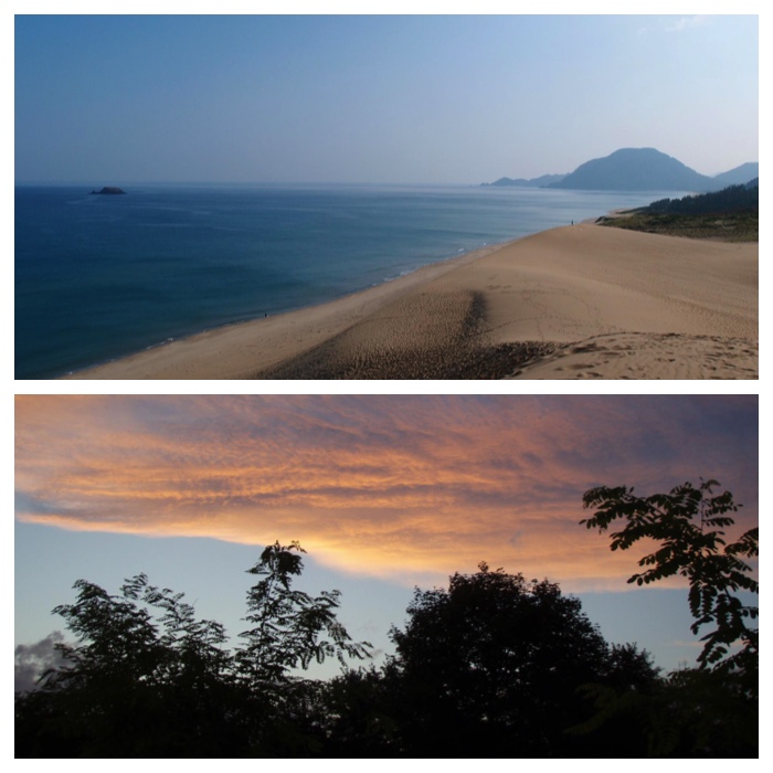
上:鳥取砂丘 2012 9.12
下:畜大キャンパス内から見た夕焼け雲。 2012 9.20
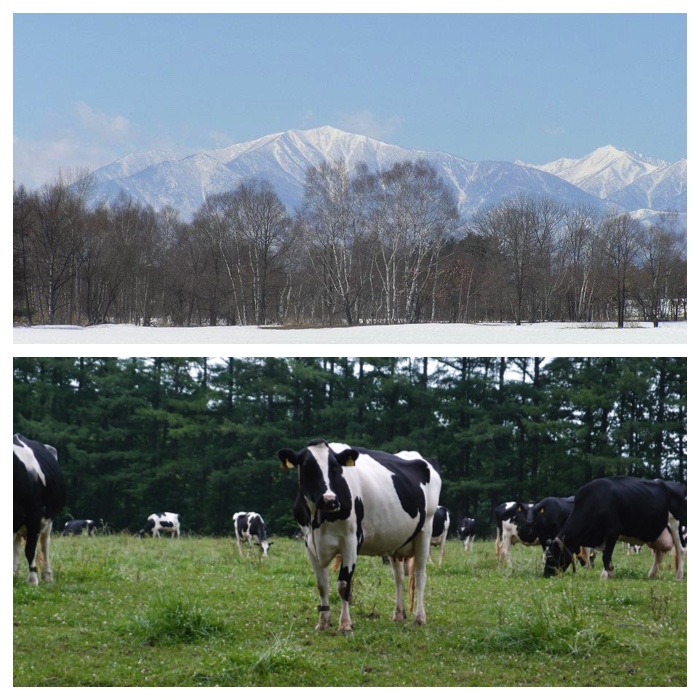
上:十勝幌尻岳。 2012 4.12
下:帯広農業高校の牛たち 2012 7.12
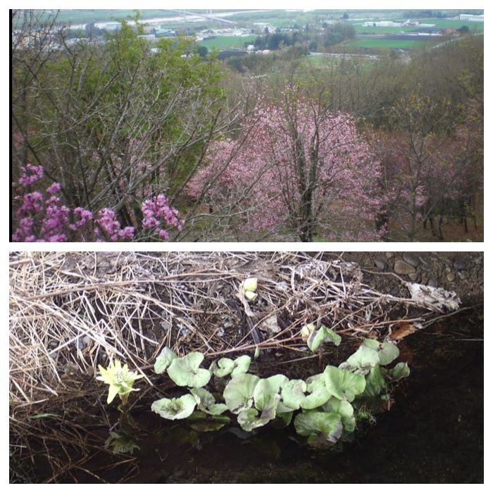
上:十勝ヶ丘展望台 2012 5.10
下:ヤチブキとフキノトウ。機関庫川。 2016 4.10
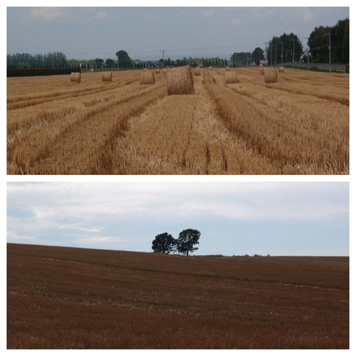
上:収穫後の小麦畑と麦わらロール。 2012 7.29
下:富良野 2012 8.16
上:畜大農場の牧草地。 2012 5.18
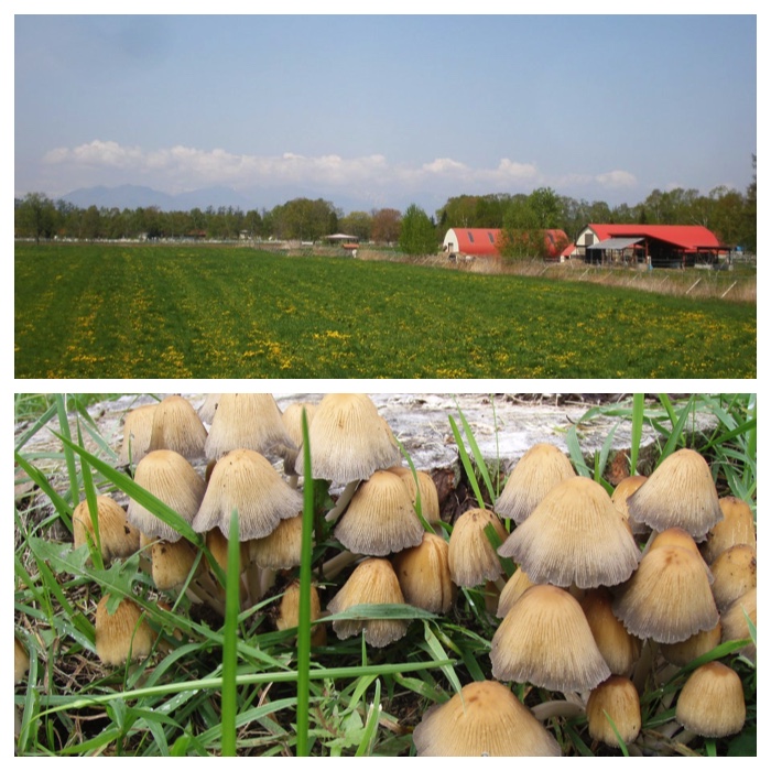
下:ヒトヨタケの仲間。畜大キャンパス内のヤナギの切り株周辺。 2012 10.3
上:オイカマナイ沼。 2015 6.25
下:千年の森 2014 8.15
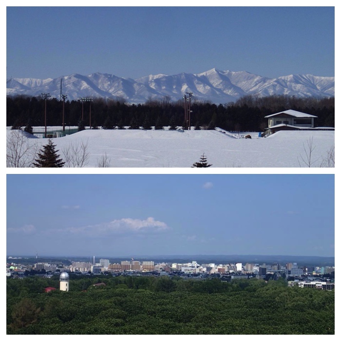
上:帯広の森運動公園から見た日高山脈。 2015 1.25
下:おびひろ動物園の観覧車からみた帯広市中心部。 2015 9.4
上:帯広農業高校の圃場 2012 6.24
下:畜大の白樺並木 2012 6.3
上:フランスギク。畜大キャンパス内。 2015 6.3
下:ベカンベウシ湿原。糸魚沢付近。チライカリベツ川。2015 7.13
上:十勝幌尻岳 2015 9.15
下:剣山と芽室岳 2015 10.11
上:畜大農場の牧草地。 2015 11.12
下:JRの車窓から。石勝線新得・トマム間。日高山脈の北の方。2016 4.30
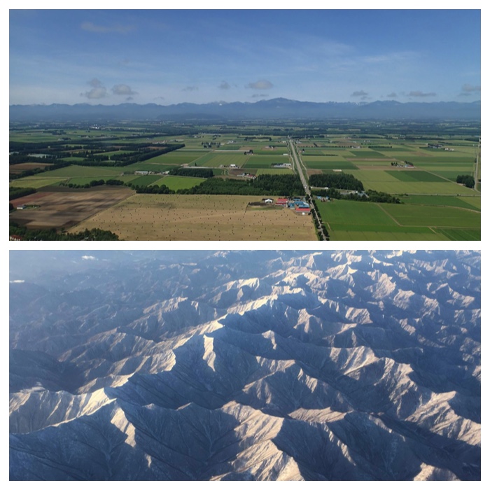
上:帯広空港から北に向かって離陸直後に見えた十勝平野の風景。 2016 8.26
下:日高地方と十勝地方を隔てる日高山脈です。この視野の中にはほとんど人はいないでしょう?冒険好きな登山家は数名いるかもしれませんが。2017 1.9
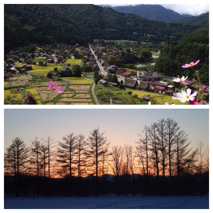
上:A view of Shirakawa-gou, from the observatory, where I visited in the excursion of IHSS18 meeting on 14 September. Shirakawa-gou in Gifu prefecture is famous for the traditional old thatched houses of the villagers. Each house is a triangle shaped, three storied very high building. Villagers raised silk worm in the higher stories, and produced the ingredient for gun powder by fermenting the soil in the basement. Shirakawa-gou had been an isolated village deep in high mountains. It had been one of the hidden villages in Japan. These years, however, millions of peaple visit there thanks to the construction of a highway, though only a thousands of people are living there.
2016 9.17
下:Sunset from the rugby court of my university, taken on February 4, 2015.
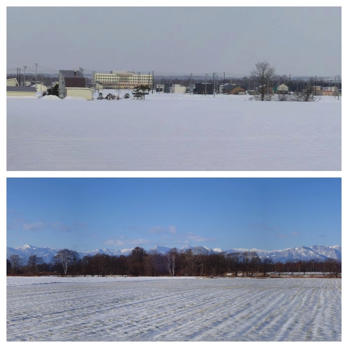
上:清流4丁目の雪景色。 2012 3.20
下:Hidaka mountain range viewed through the field of Obihiro University of Agriculture and Veterinary Medicine (November 19, 2017).
帯広畜産大学の圃場越しに見た日高山脈(平成29年11月19日) 2017. 11.19
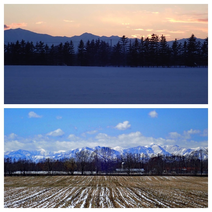
上:畜大圃場からの冬の夕焼け。 2018 1.12
下:雪解けの進んだ畜大圃場。 2018 4.18
"To Page Top"
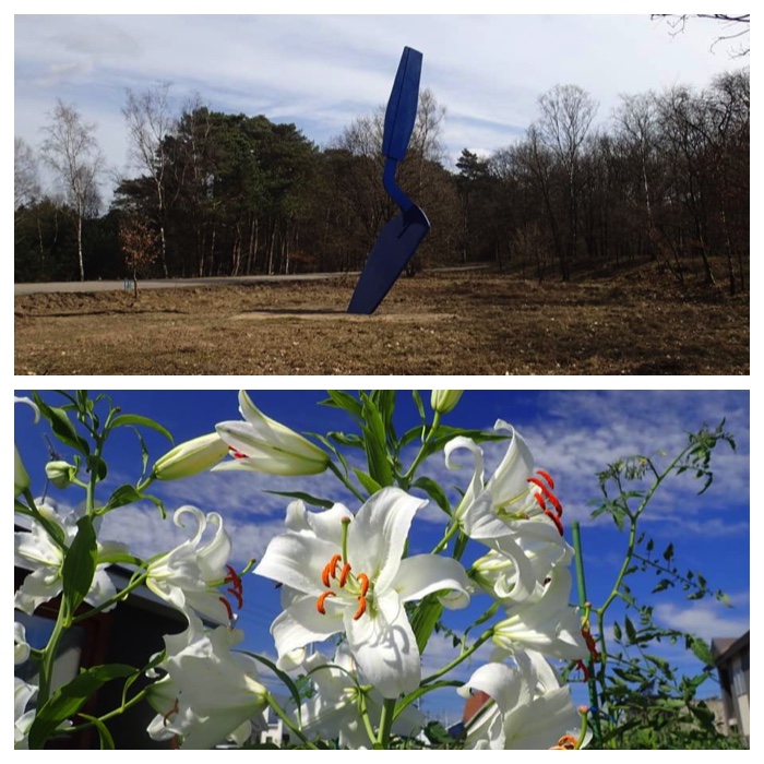
上:オランダのアーネム郊外のKröller Müller 野外美術館の入口にあった大きなショベルの像。この像を立てるにはかなり苦労したそうです。最初は1年で倒れてしまい、その後地下部の構造を補強し、色を塗りなおして現在の像になったそうです。美術館内に説明のパネルがありました。
This statue of large shovel stands near the entrance of the Kroeller Mueller open air museum in the Netherlands. Construction of this statue was a hard work. After one year of the settlement, this statue fell down. The artist improved the underground structure of this statue and painted it blue from silver, then settled it again. What does this large shovel mean? Maybe it is because Van Gogh drew often shovels in his pictures. This museum owns many works of Van Gogh.
2017 4.11
下:わが家の庭の百合。A lily in my garden. 2018 8.19
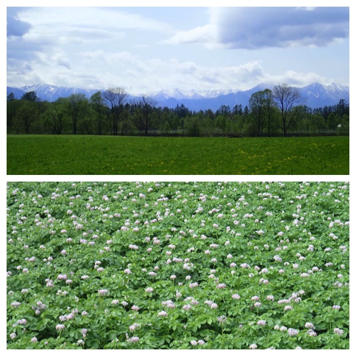
上:Pasture field of OUAVM with the background of Hidaka mountain range. May 17, 2018.
下:帯広市大正町の農家圃場で、栽培されている品種はメークイーンです。撮影は2017年7月6日朝9時頃。
This photo was taken at around 9 am on July 6, 2017. Potato variety "May Queen" is grown in the farmer's field in Taisho town, Obihiro. The first and second weeks of July are the full-blooming season of potato flowers.
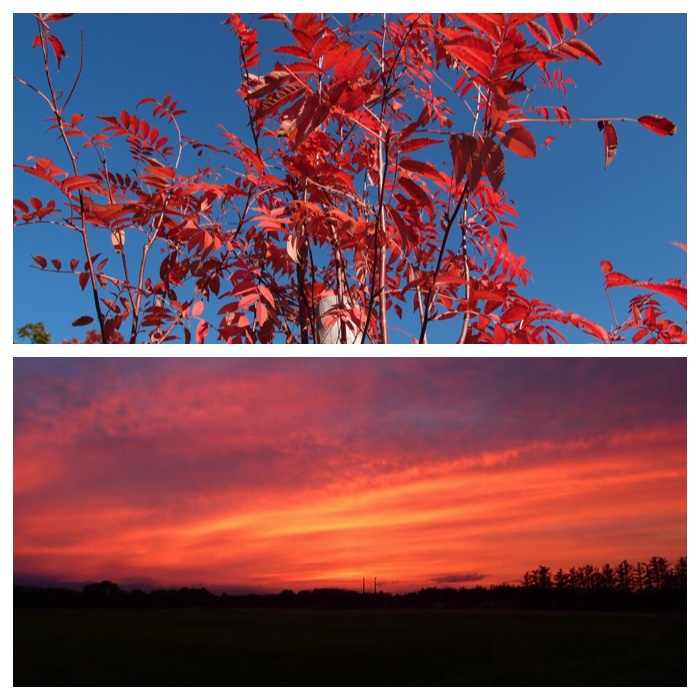
上:ナナカマドの紅葉。わが家の前の街路樹。 2012 10.28
下:Evening glow seen through the field of Obihiro University of Agriculture and Veterinary Medicine.
While I was watching this scenery, I reminded myself of a nursery song.
While my baby is sleeping, what can I do?
Adzuki bean cake and horse chestnut cake.
Bring it to red mountains, then red bird will pick it.
Bring it to blue mountains, then blue bird will pick it.
Bring it to white mountains, then white bird will pick it.
——- A nursery song in Obihiro district. Translated by myself.
28. June, 2018, 19:25.
この景色を見ていたら、「帯広地方の子守唄」を思い出しました。
「ねんねのねたまに、なにせよいの。
あずきもちのとちもちや、
あかいやまにもっていけば、あかいとりがつつく。
あおいやまへもっていけば、あおいとりがつつく。
しろいやまへもっていけば、しろいとりがつつくよ。」
"To Page Top"
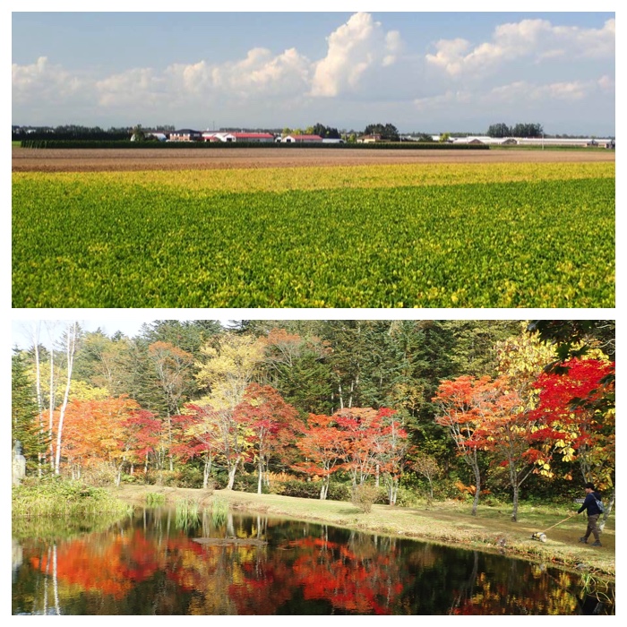
上:9月14日帯広市豊西町の風景。手前の作物は大豆。裸地はバレイショの収穫後。右奥は牛舎。
View of farmland at Toyonishi town in Obihiro on September 14, 2018.
下:Red colored maple trees in the Fukuhara-Sanou lodge in Shikaribetsu mountain foot area, Tokachi, Hokkaido.
十勝、然別山麓、福原山荘の紅葉。2018.10.5
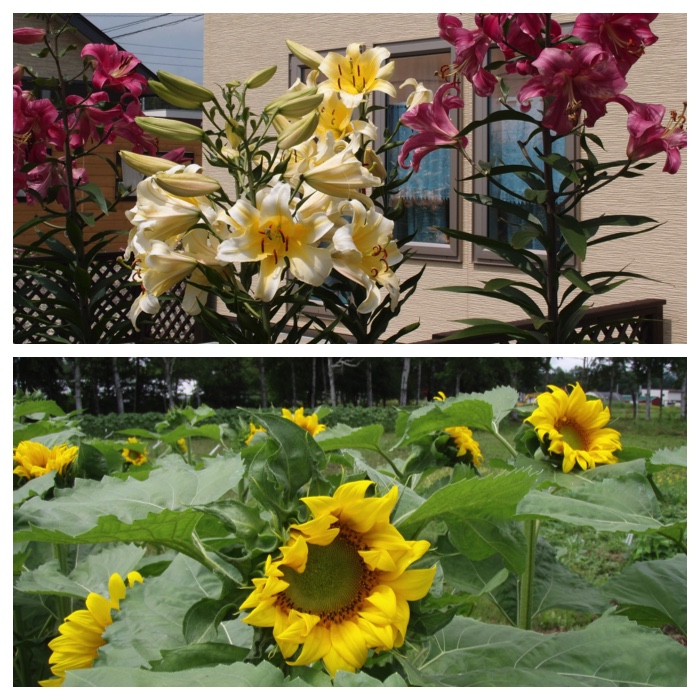
上:わが家の庭のカサブランカ 2012 8.13
下:別科圃場の緑肥用ヒマワリ 2012 8.7
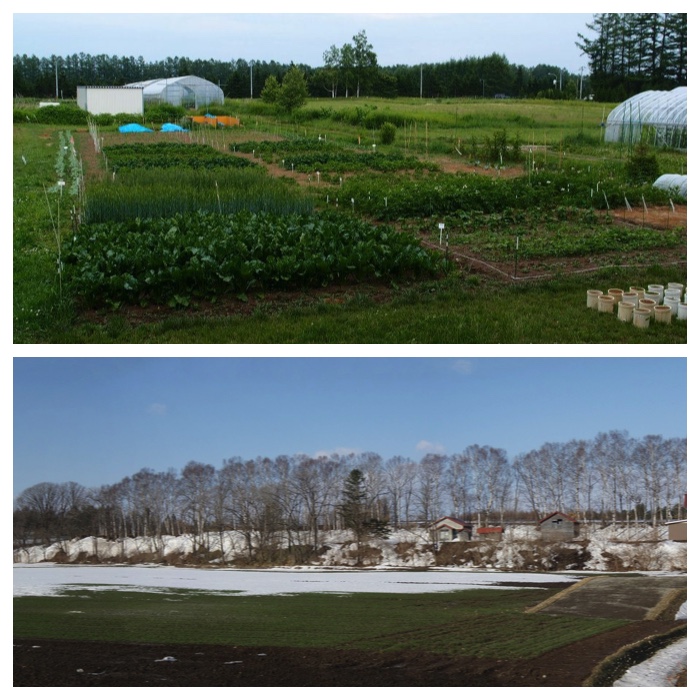
上:別科圃場 2012 7.5
下:下川西の段丘崖にある農家。2013 3.31
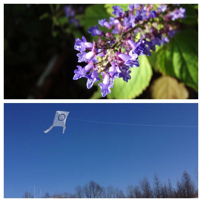
上:シモバシラ。畜大の武田教授が栽培したもの。2012 10.24
下:手製のタコ。帯広運動公園にて。2015 1.26
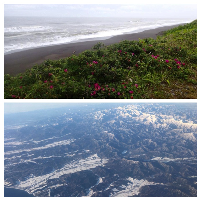
上:大樹町トイトッキ沼付近の海岸とハマナス。2016 6.29
下:The view around "Samani" port on the coast of Hidaka region in southern Hokkaido. The photo was taken by my daughter from the airplane flying from Obihiro to Haneda on January 8.
手前の小さな港は様似漁港、その北にある少し幅広い平野には十勝の豊似とつながる天馬街道が走っています。平野を流れる川は日高幌別川です。沿岸には日高本線が敷設されていますが、昨夏の台風被害以来不通のままです。この写真は東京に帰る娘が機上から写したものです。 2017 1.9
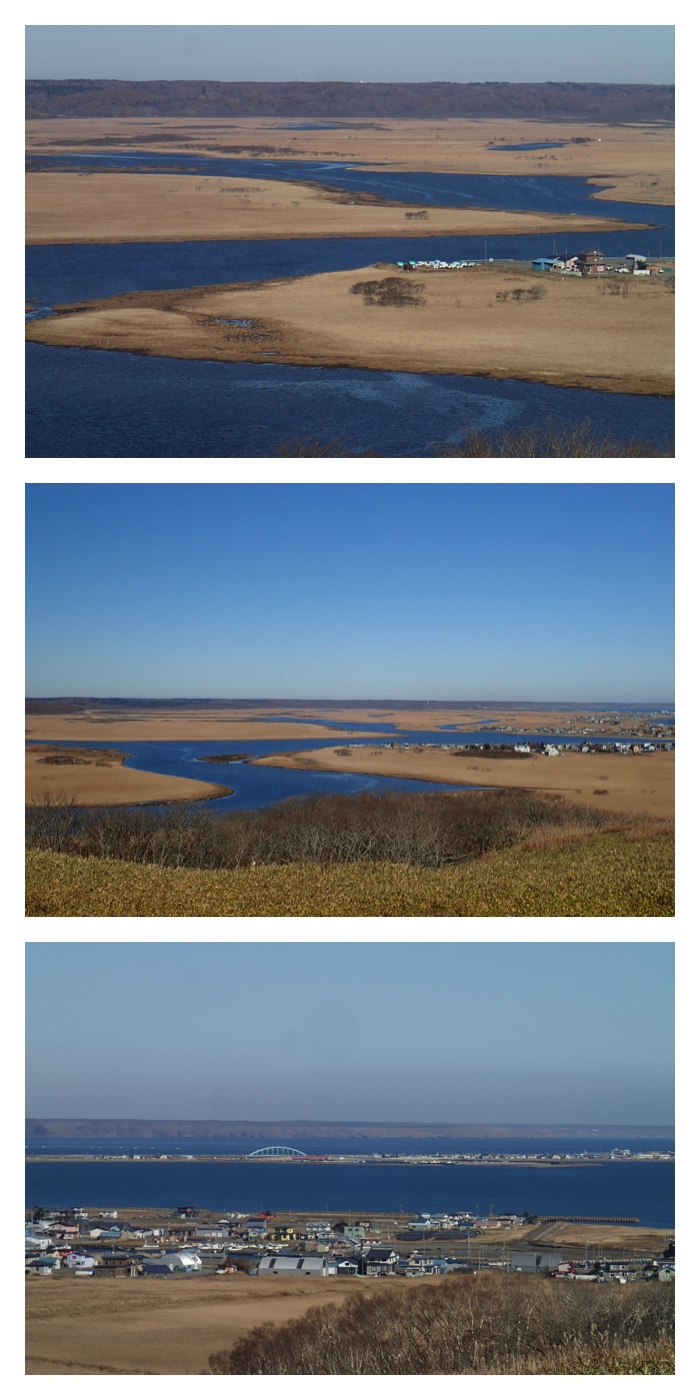
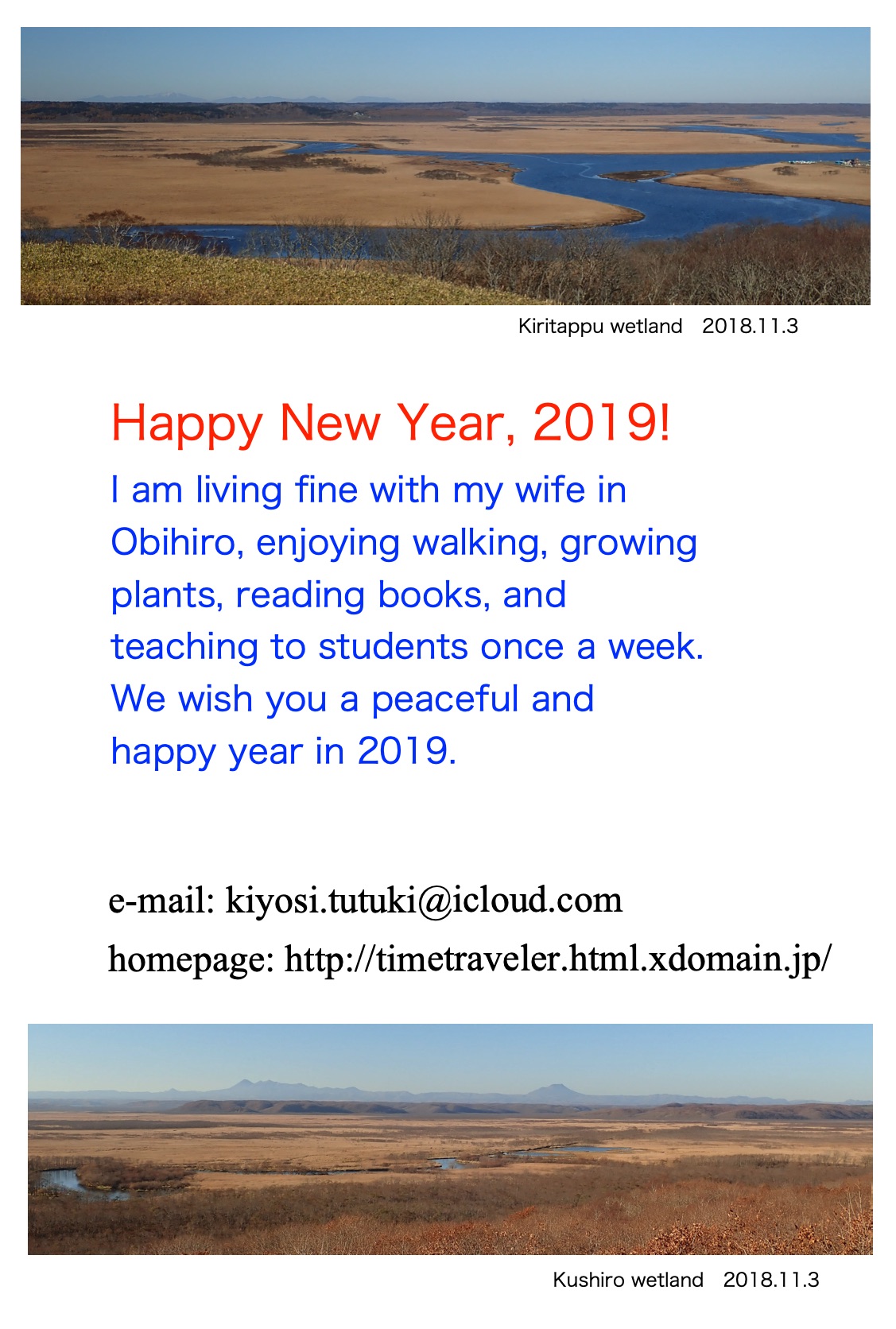
上:琵琶瀬展望台から見た霧多布湿原。2018, 11.3
Above: Kiritappu wetland viewed from Biwase observatory on November 3, 2018.
下:細岡展望台から見た釧路湿原。遠くに雌阿寒岳が見えました。2018, 11.3
Below: Kushiro wetland viewed from Hoso-oka observatory on November 3, 2018. Mt. Meakan-dake was seen beyond the wetland.
"To Page Top"
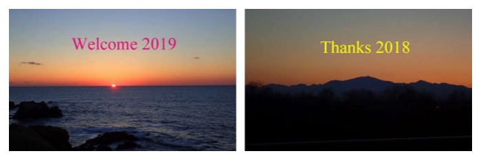
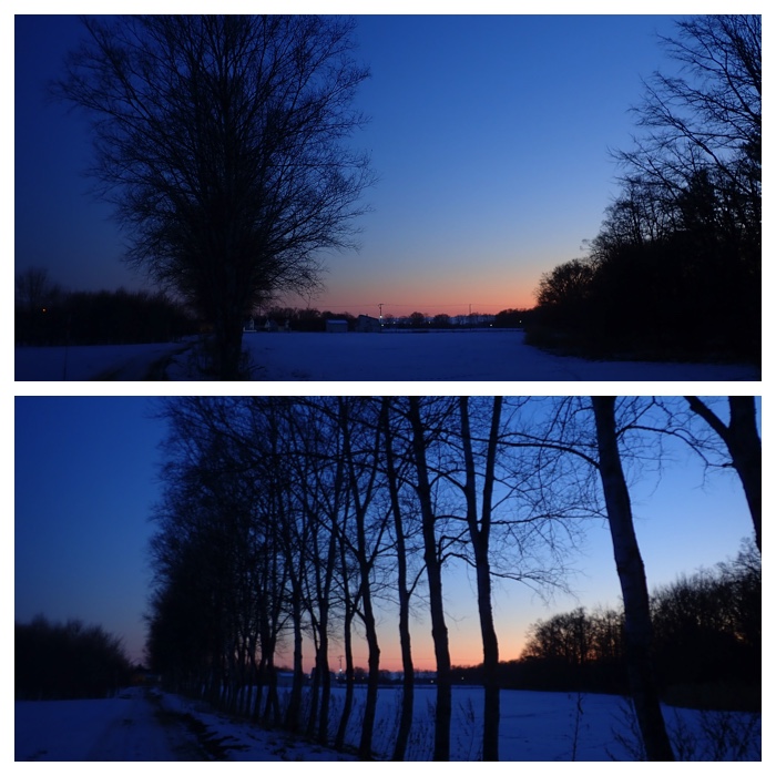
新年のご挨拶。2019.1.1
New Year Greetings on January 1, 2019.
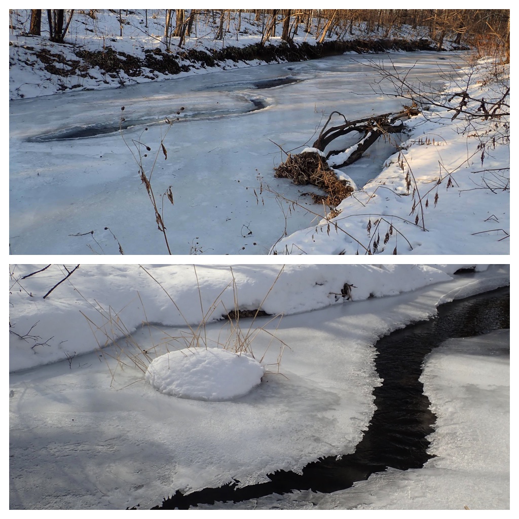
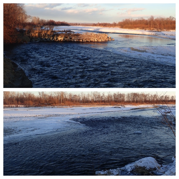
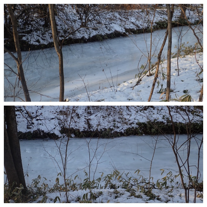
Frozen Urikai river. 2019.1.14
Frozen Kikanko river. 2019.2.18.
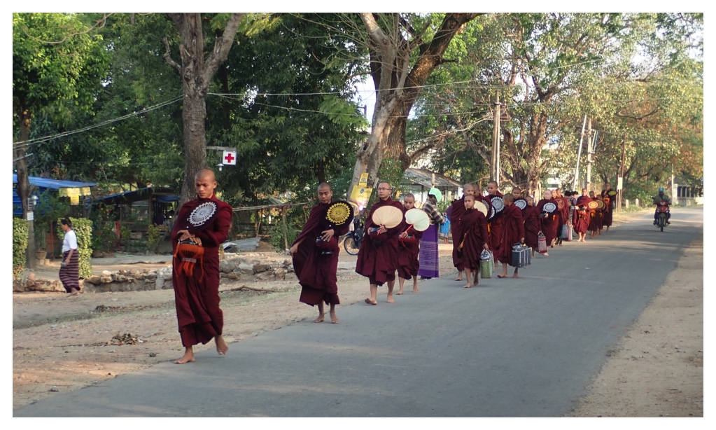
ミャンマー 、イェジン村を歩く托鉢僧たち。2019.3.10
Buddhist monks walking in the village of Yezin on March 10, 2019.
別府町のウツベツ川源流部から見た日高山脈。4月21日、2019.
View of Hidaka mountains from the original point of Utsubetsu river in Beppu town, Obihiro, on April 21, 2019.
"To Page Top"
7月の花
Flowers in July, 2019.
7-8月の野菜の花
Flowers of vegetables in July - August, 2019.
9月のキノコ
Mushrooms in September, 2019.
10月の紅葉
Yellow and red leaves in October, 2019.
11月のグリーンパーク
Green park s in November, 2019.
11月31日の日高山脈
Hidaka mountains on November 31, 2019.
"To Page Top"
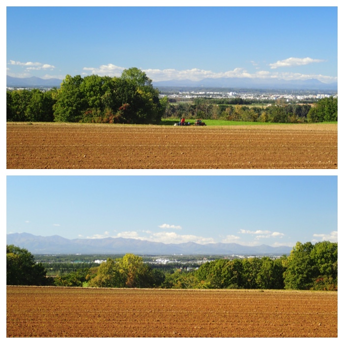
10月20日の午後は、紅葉のピークを迎えた真鍋庭園に行きました。運動不足対策もかねて、往復ともに歩いて行きました。行きは機関庫川沿いの道を、帰りには札内川の堤防上の道を通って帰ってきました。
In the afternoon of October 20, I visited the Manabe garden, where the autumn colored leaves are at their maximum peak. I walked the path along the Kikanko river to the garden and came home through the path on the bank of Satsunai river.
The way to the Manabe garden. Ripe red seeds of Japanese spindle tree, swamp ash trees along Kikanko river (two photos) and three trees (maple, elm, and swamp ash) near the athletic ground of Obihiro Kita high school.
Colored maples along the outer fence of Manabe garden and beside the "Shinseikaku".
Red maple leaves and the fallen maple leaves sunk in the pond water.
Forest floor with the carpet of needle leaves, and streams flowing in the garden with fallen leaves around them.
The way home along the bank of Satsunai river from Manabe garden. The big elm tree near the water pump station, the seeds of swamp ash, a tractor plowing the field, and the seeds inside the sheath of Metaplexis japonica (Gagaimo in Japanese name).
"To Page Top"
今日は帯広市図書館の帰りにグリーンパークの紅葉を見てきました。帯広市の紅葉の名所のひとつだけあってさすがに見事でした。グリーンパークの長辺は400m以上あるので、駐車場から紅葉並木の端まで往復すると1 kmくらい歩いたことになります。
この公園には400 m の長さを誇る木のベンチがあり、これが作られた1981年時点では世界一長いベンチでした。その記録は1987年に破られましたが、それでも日本で3番目に長いベンチだそうです。
Today, I visited the Green Park of Obihiro on the way home from the Obihiro library. Here also, the red color of the maple tree is at its maximum now. Green Park is a very wide park, and the length from the end to end is larger than 400 m. Therefore, I walked 1 km for the round way from the parking place to the end of the maple alley.
There is a 400 m long wooden bench in this park, and it was the longest bench in the world when it was constructed in 1981. Now it is the third longest bench in Japan.
"To Page Top"
10月27日は6:30 から帯広の森でのエゾリス生息数の調査に1年ぶりに参加しました。1年前も小雨でしたが、今朝も雨でした。雨でもエゾリスは現れるとのことで、調査は続けているそうです。藪こぎをしながらの調査なので大変でした。約2kmを2時間くらいかけて歩き、エゾリスは6匹みつかりました。
After a one year blank since October 28 of last year, I joined the census activity of Hokkaido squirrels in the forest of Obihiro. It was a rainy day, but squirrels appeared. We could find 6 squirrels along the around 2 km walk in the bush and forest.
Next day, I visited Obihiro river near the area where I conducted the census of squirrels. I used to come here for fishing when my kids were the age of elementary school.
Riverside trees along Obihiro river and Kikanko river on the same day.
"To Page Top"
10月28日の午後は真鍋庭園に行きました。紅葉もそろそろ終盤かと思いますが、朝晩の冷え込みのせいか紅葉は一層鮮やかになっていました。
In the afternoon of October 28, I visited the Manabe garden. The autumn colored leaves are approaching their final stage. However, they looked very brilliant due to the cold temperature in the morning.
Big elm tree near the Manabe garden. Leaves have turned yellow and fallen. Trunks and branches could be seen through the leaves. Fields along the Satsunai river have been plowed, preparing for the crops in next year.
"To Page Top"
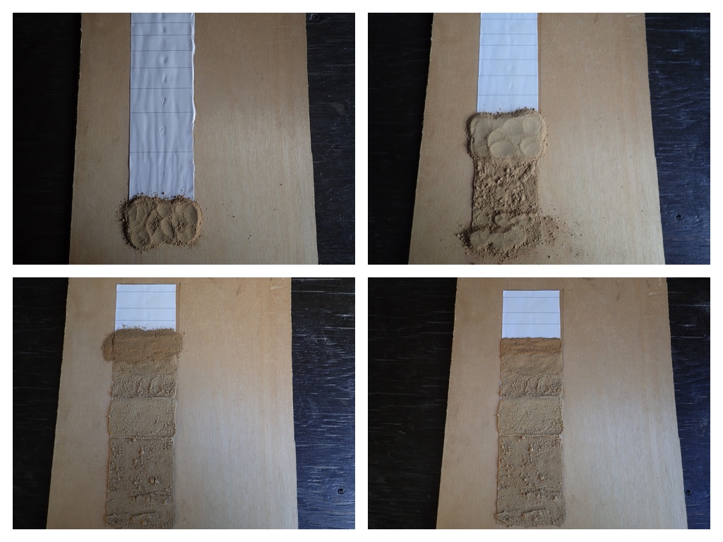
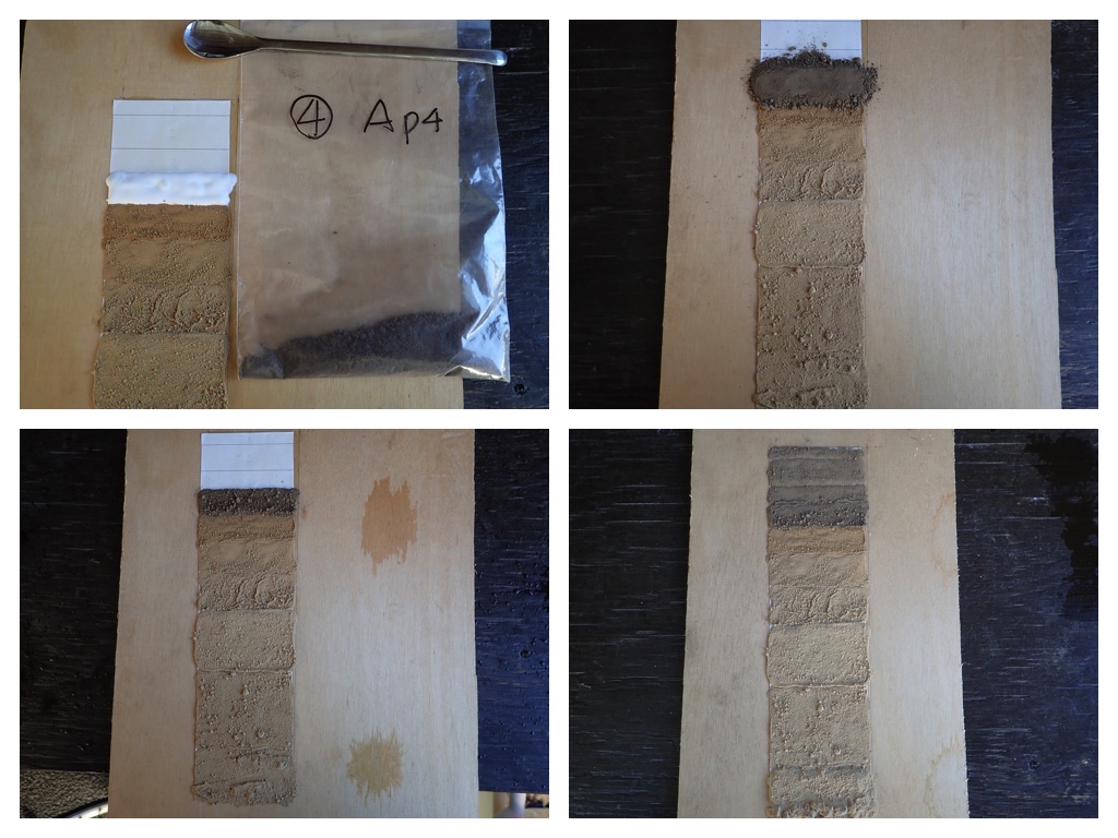
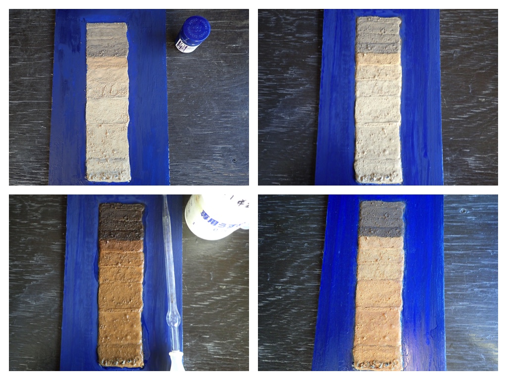
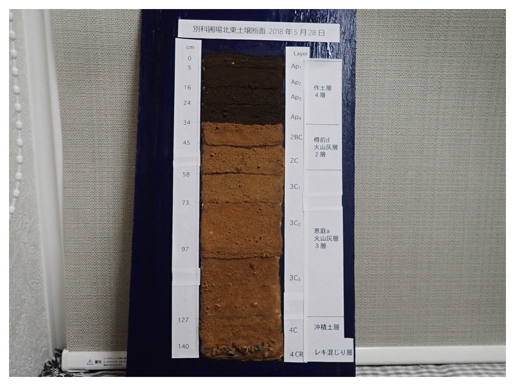
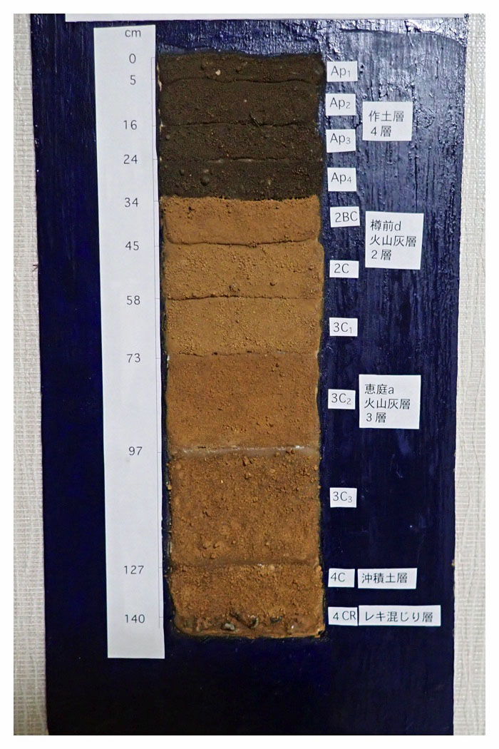
今年別科圃場で調査した土壌断面の試料を使ってミニ土壌モノリスを作成しました。本当の土壌モノリスのように土壌構造の質感を表すことはできませんが、表層から下層にかけての色の変化や母材の風化の様子を手軽に再現することができます。
I prepared a soil monolith using the soil samples collected from the soil profile in the Junior Course field in May - June, 2018. The change in color and the degree of weathering in different soil layers can be represented easily.
"To Page Top"
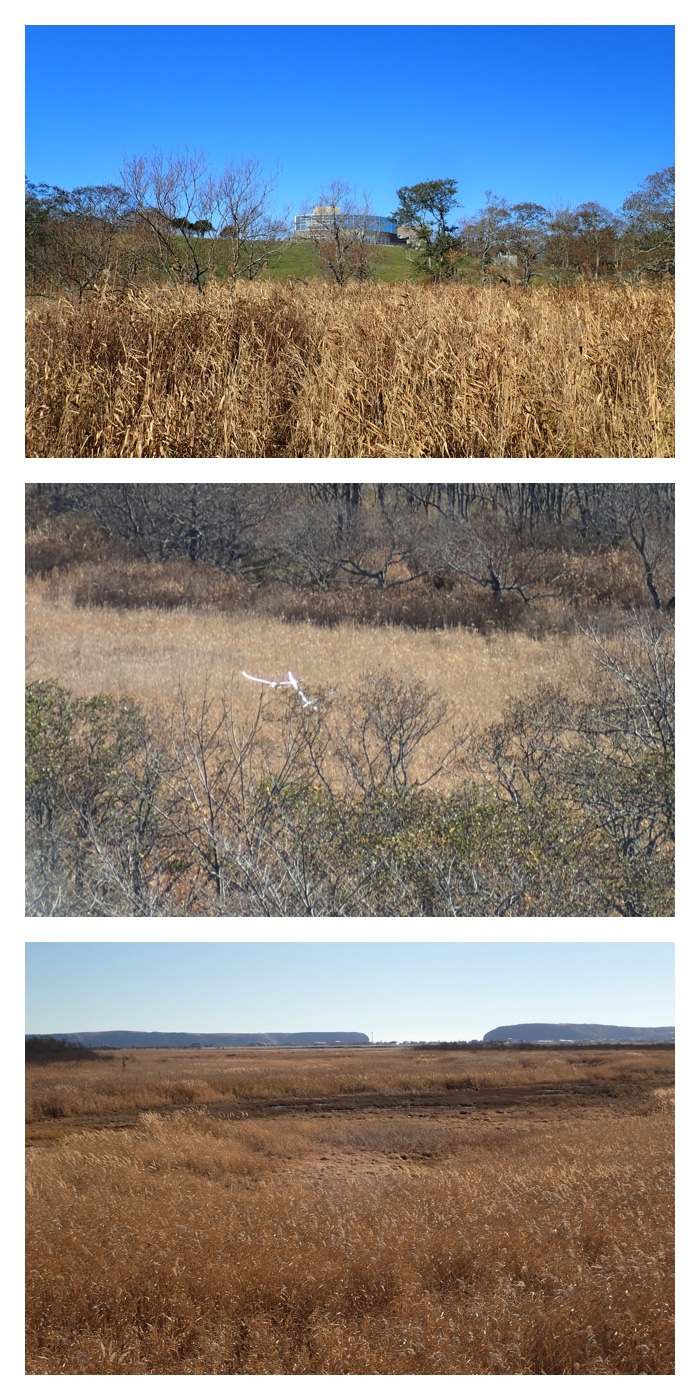
11月2日午後に釧路市で所用があり、前日から鶴居村のホテルに泊まり、午前中は鶴居・伊藤丹頂サンクチュアリーと釧路湿原温根内ビジターセンターを訪問しました。
As I had some appointment in the afternoon of November 2, I stayed in a hotel in Tsurui village on November 1. In the morning of November 2, I visited the Japanese crane sanctuary in Tsurui village and the Kushiro wetland visitor center at Onnenai, Kushiro.
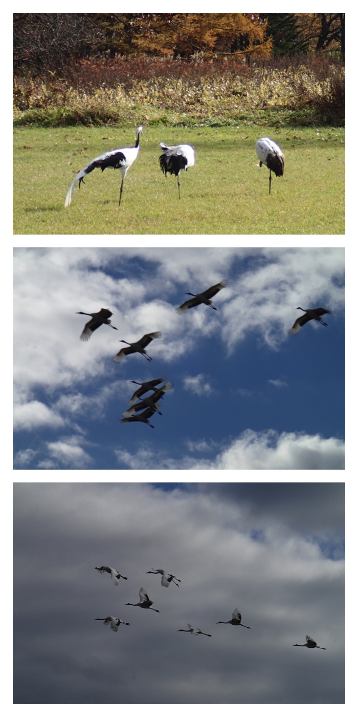
Japanese crane sanctuary in Tsurui village. When I arrived here, I could find three cranes, male, female and their child bird. They were eating the dent corn fed by the staff of the center. After a while, another family flied into the same site. The newly arrived family cried loudly, then the family which was there from the beginning left the site. The staff of the center told me that the male bird which came later is an older and stronger bird. A crowd of Japanese crane also flied over the site, but they did not land on the site, noticing the family of strong male bird was already there.
Kushiro wetland visitor center at Onnenai, Kushiro. I walked along the wooden path in the wetland, in total 3 km long.
There had been here a narrow type rail road connecting Shin-Fuji in Kushiro city and Naka-Setsuri in Tsurui village since 1928 to 1968.
この湿原横の道には1928年から1968年まで、釧路市新富士駅と鶴居村中雪裡駅を結ぶ簡易軌道鶴居軌道が走っていました。
"To Page Top"
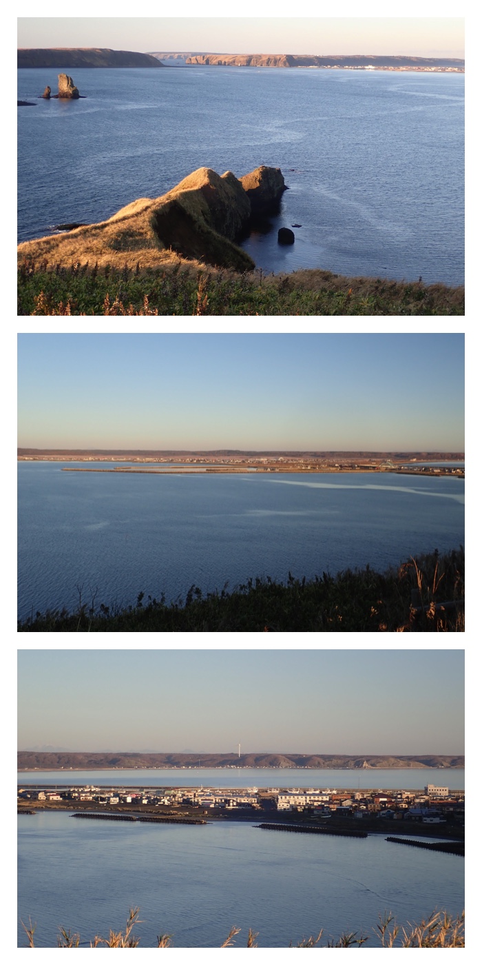
11月2日午後の釧路市での所用のあとは霧多布に移動し、霧多布岬にある「えとぴりか村」という民宿に泊まりました。翌朝は早く起きて湯沸岬からの日の出を見に行き、朝食後は湯沸下海岸に行き、拾い昆布漁の漁師さんの仕事を見ました。チェックアウト後はラッコの家族が見られるかもしれないとのことで再び湯沸岬に行きましたが、あいにくラッコは見つかりませんでした。
After my appointment in Kushiro, I moved to Kiritappu to stay in a private B and B lodging "Etopirika-mura". On November 3, I woke up early and went to
the cape Tohfutsu to see the sunrise before breakfast. After the breakfast, I walked down to the beach to see the fishermen harvesting the sea tangle which were washed ashore. After checking out the lodging, I visited the cape Tohfutsu again, as I might be able to see a family of sea otter in the sea, but I could not find them.
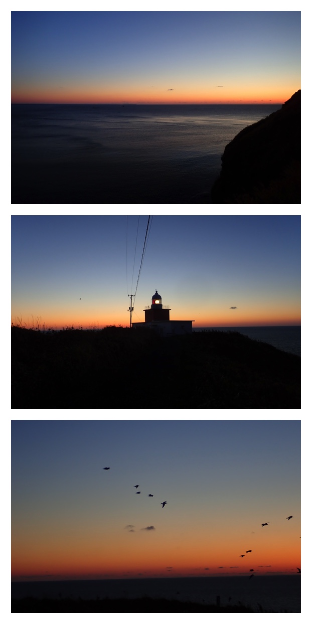
Before the sunrise from the cape Tohfutsu.
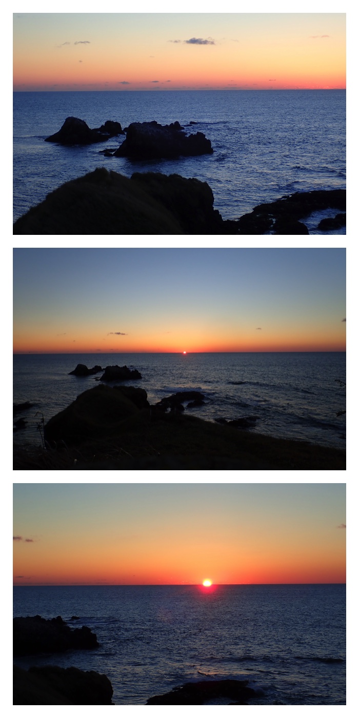
Sunrise from the cape Tohfutsu.

After the sunrise from the cape Tohfutsu.
View from the cape Azechi after sunrise.
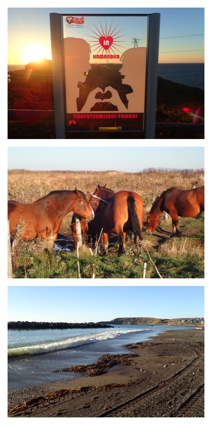
Scenes around the cape Tohfutsu. New sign board for the young tourists, horses in a meadow, and the scene of the beach under the cape Tohfutsu.
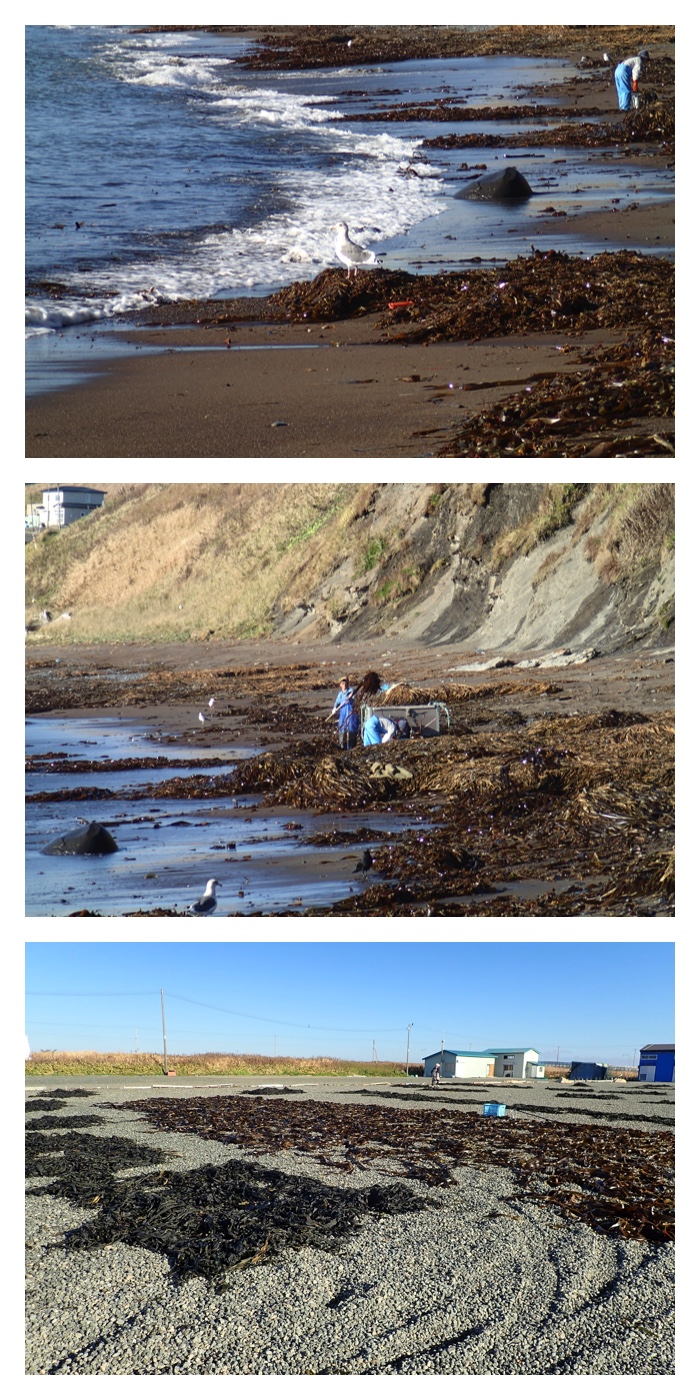
the fishermen harvesting the sea tangle which were washed ashore.
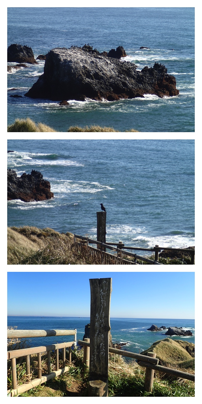
Tip point of the cape Tohfutsu, with the monument of Mr. Takeshirou Matsuura inscribed with one of his poems. He was a prominent explorer in the end of Edo era who traveled around Hokkaido, and named this big island as "Hokkaido".
"To Page Top"
湯沸岬とアゼチ岬を後にして、霧多布湿原センターと琵琶瀬に行き、霧多布湿原を眺めました。
After leaving the capes Tohfutsu and Azechi, I forwarded to the Kiritappu wetland center and the observatory at Biwase to view the Kiritappu wetland.
View of the wetland at the Kiritappu wetland center. Some Japanese cranes were flying in the wetland.
View of the wetland at the Biwase observatory.
"To Page Top"
霧多布から帯広へ帰る途中、釧路湿原の細岡展望台に立ち寄りました。釧路湿原の雄大な眺めを楽しむことができました。
On the way from the Kiritappu wetland to Obihiro, I dropped at the observatory at Hosooka to enjoy the majestic view of Kushiro wetland.
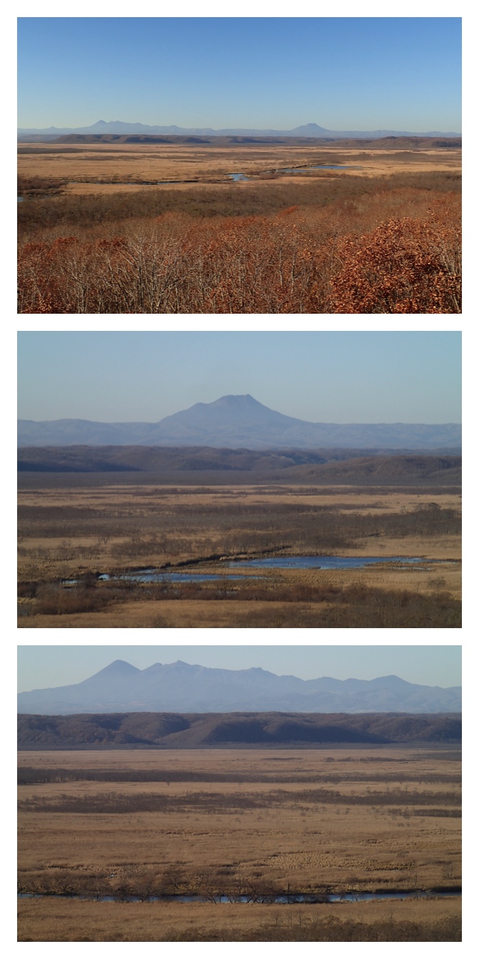
View of the Kushiro wetland at the observatory at Hosooka.
View of the Kushiro wetland at the observatory at Hosooka.
"To Page Top"
釧路から帯広へ帰る途中、馬主来駐車場に立ち寄りました。既に夕暮れ時で、太平洋の夕焼けを楽しむことができました。
On the way from tKushiro to Obihiro, I dropped at the Pasukuru parking area along the route 38. It was already sunset time, and I could enjoy the beautiful evening glow over the Pacific Ocean.
The beautiful evening glow over the Pacific Ocean.
"To Page Top"
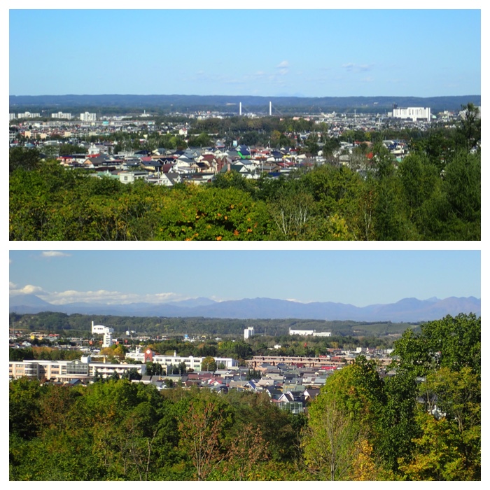
帯広へ帰った翌日、国見山と「もりの山」に散策に行きました。この日も快晴で十勝の山々がよく見えました。山々の頂きは既に雪で白くなっていました。
実は2週間前に行った時、入口のゲート付近に「11月4日に国見山の自然観察会(詳しい名称は忘れました)をやります。定員は20名です。」というポスターが掲示してあったので、飛び入りでも入れてもらえるかもしれないと思い行ってみました。集合時刻15分前の8時15分に駐車場に着いたらまだ誰もおらず、30分になっても誰も来ません。しばらくして年配の方が来られたので聞いてみたら、たしかにそのお知らせの紙は以前貼ってありましたねとのことで、私の勘違いではなかったようです。
そこで、その方と一緒に登ることにしました。もともと観察会には運が良ければ入れてもらおうくらいの気持ちでしたので、それで構いませんでした。初めて会った私より7歳年上の方といろいろお話ししながら登れて良かったです。
今回は前回には通らなかった国見山の外周を1周するコースを歩きました。外国の森コースを登り、展望台コースを降りてきました。外国の森コースは道がぬかるんでいて歩きにくかったです。これは、同行の方のお話によると、登山道を整備するために重機で道を削ったためだそうです。人手不足と予算不足で安易な整備をしたための失敗のようです。
On the next day after I returned from my trip, I visited Mt. Kunimiyama in the suburbs of Obihiro and "Morinoyama" in the forest of Obihiro. It was also very fine and I could enjoy the nice view of the mountains in Tokachi. Summits of the mountains were already white with snow.
Views from Mt. Kunimiyama in the suburbs of Obihiro.
Views from "Morinoyama" in the forest of Obihiro.
Views from "Morinoyama" in the forest of Obihiro.
"To Page Top"
11月9日、天気がだんだん悪くなっていくようなので、朝のうちに散歩に出かけました。もみじはほとんどの木が葉を落としてしまいましたが、まだ街路樹や公園の木の中には赤い葉の残っているものもありました。森の中の道も落ち葉が積もっていました。
On November 9, just before it rained, I made my routine walk along the stream of Kikanko river and in the forest of agricultural high school. Though most of maple trees have fallen down their leaves, some trees still remained their red leaves. The path in the forest was also covered with oak leaves.
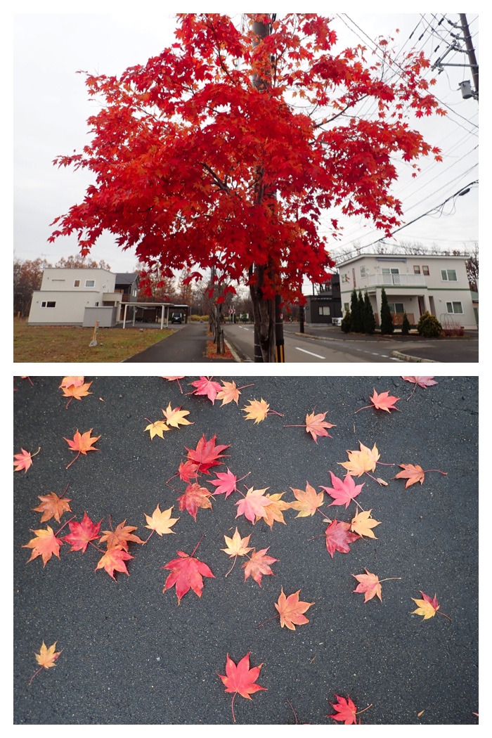
Roadside maple tree with still red leaves in Seiryu town.
Red maple trees with their fallen leaves carpet.
Upper photo: Swamp ash and walnut trees beside the "Kikanko" river. Lower photo: Plowed pasture field.
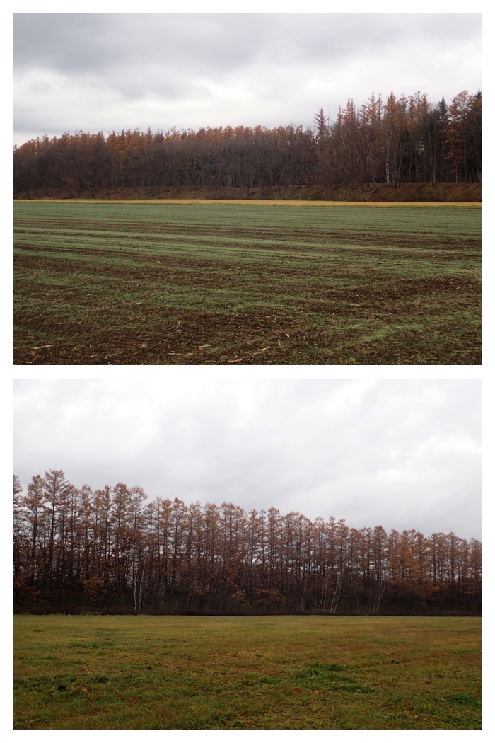
Upper photo: Newly germinated pastures. Lower photo: Larch trees in the cliff beyond the pasture field.
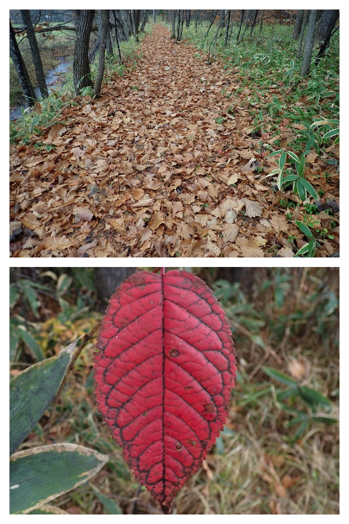
Upper photo: My routine path in the forest covered with oak leaves. Lower photo: Unknown red leaf.
"To Page Top"
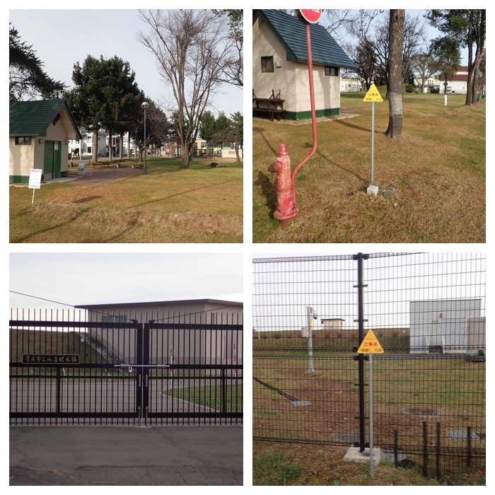
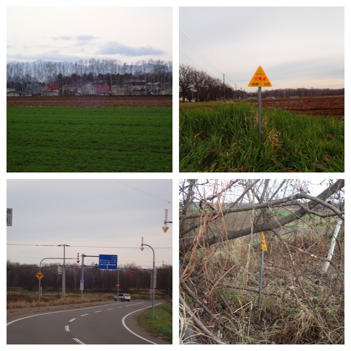
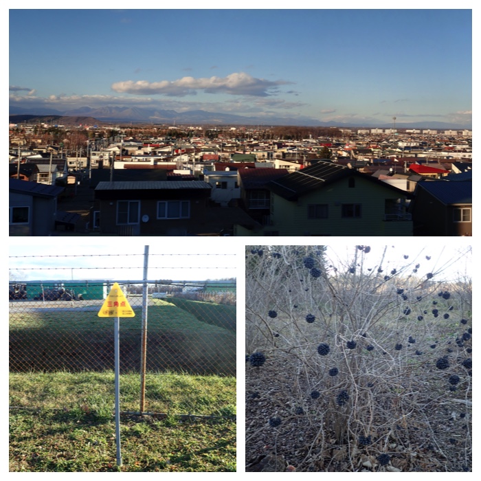
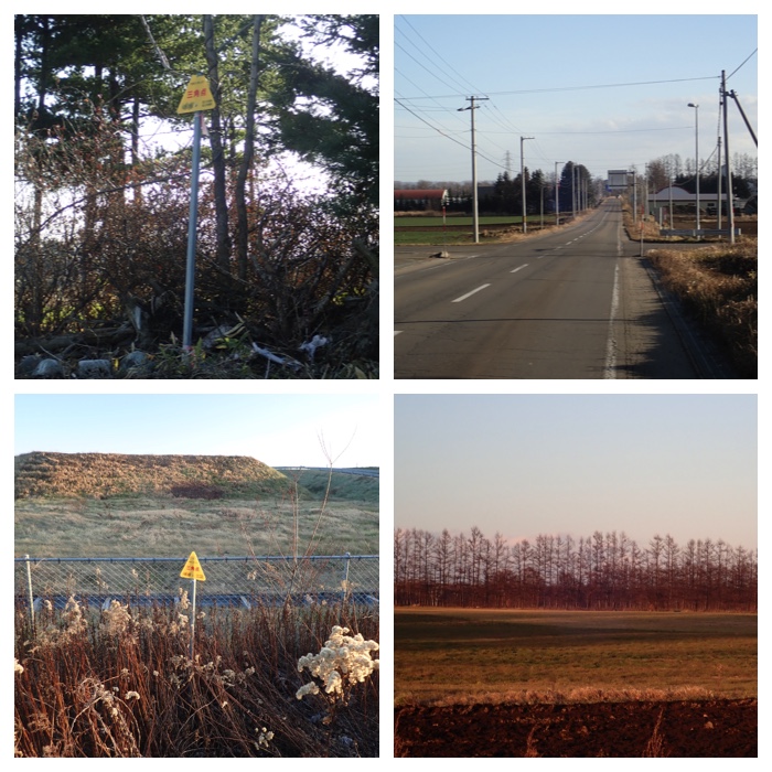
10年ほど前にもやったことがありますが、再び三角点・水準点探しをやってみました。緑ヶ丘公園に行ったのも三角点探しの一環です。三角点は地形図上に三角の記号で、水準点は四角の記号で表してあります。水準点の方がたくさんあります。あらかじめ地形図で確認しておいたのですが、三角点は予定のものが全てみつかりましたが、水準点はみつかりませんでした。宅地化などで失われたものもあるのか、私の探しかたが不足しているのかもしれません。いずれも木立の中とか、あまり目につかないところにひっそりと佇んでいます。
Triangulation points and survey level points found around my house.
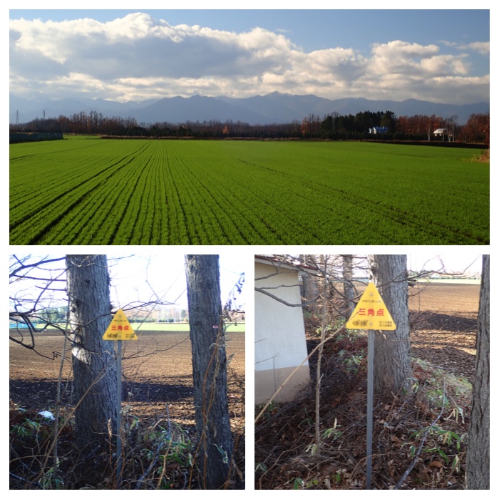
Triangulation point in Shimo-Kawanishi town. 82.1 m.
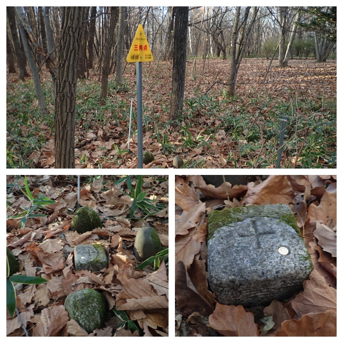
Triangulation point in the Green Park. 66.6 m.
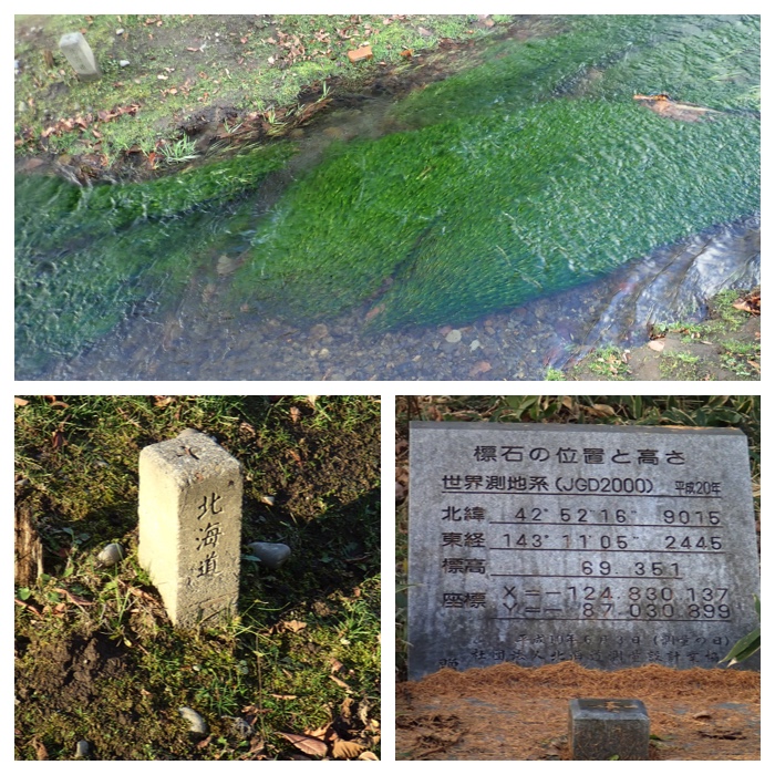
Survey level point in Seiryu town beside the Kikanko river. 66.5 m. The photo in the lower right is the memorial bench-mark stone in the forest of Obihiro Agricultural High School. 69.4 m.
Triangulation point near "Nantai" bridge beside the western bank of Satsunai river. 78.0 m
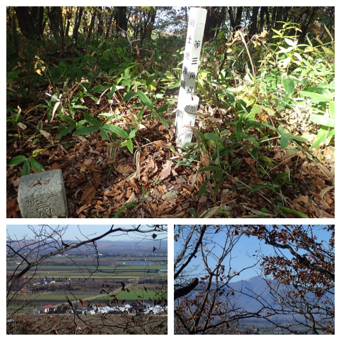
Triangulation point near the summit of Mt. Kunimi-yama. 116.7 m. The summit is 129 m.
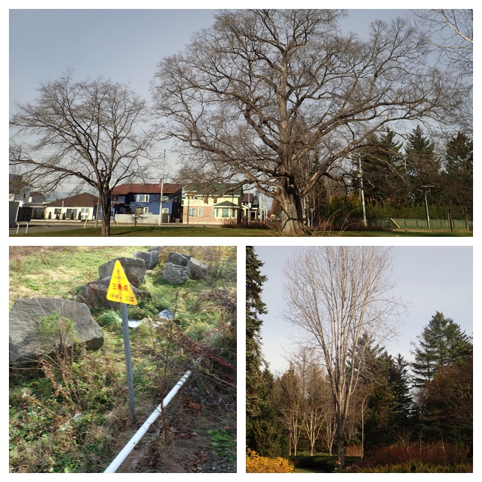
Triangulation point near the Elm park to the south of Manabe garden. 57.2 m. The photo lower right is a tall Canadian maple tree in Manabe Garden.
Upper: In the park at West 3, South 33. 51.4 m.
Lower: Near the fence of water pump station in Minami-no-mori machi. 76.2 m.
Upper: To the south of Kounan Hospital in Ohzora town. 82.7 m.
Lower: To the west of prison at the crossing of West 7 and South 13 road. 84.6 m.
Upper: View from the Jiyuugaoka Takadai town.
Lower: Triangulation point near the northern gate of Japanese Self Defense Army Obihiro Base. 82.9 m.
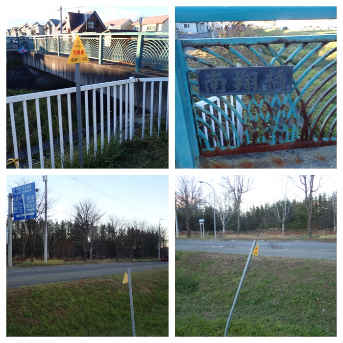
Upper: Beside the Nanshou bridge on Dai_2_Hakurindai river. 58.3 m.
Lower: Near the Ohzora 10 choume crossing. 87.7 m.
"To Page Top"
緑ヶ丘公園、彫刻の径の散策と帰り道。
The path of sculptures in the Green Park of Obihiro and the scenes on the way home.
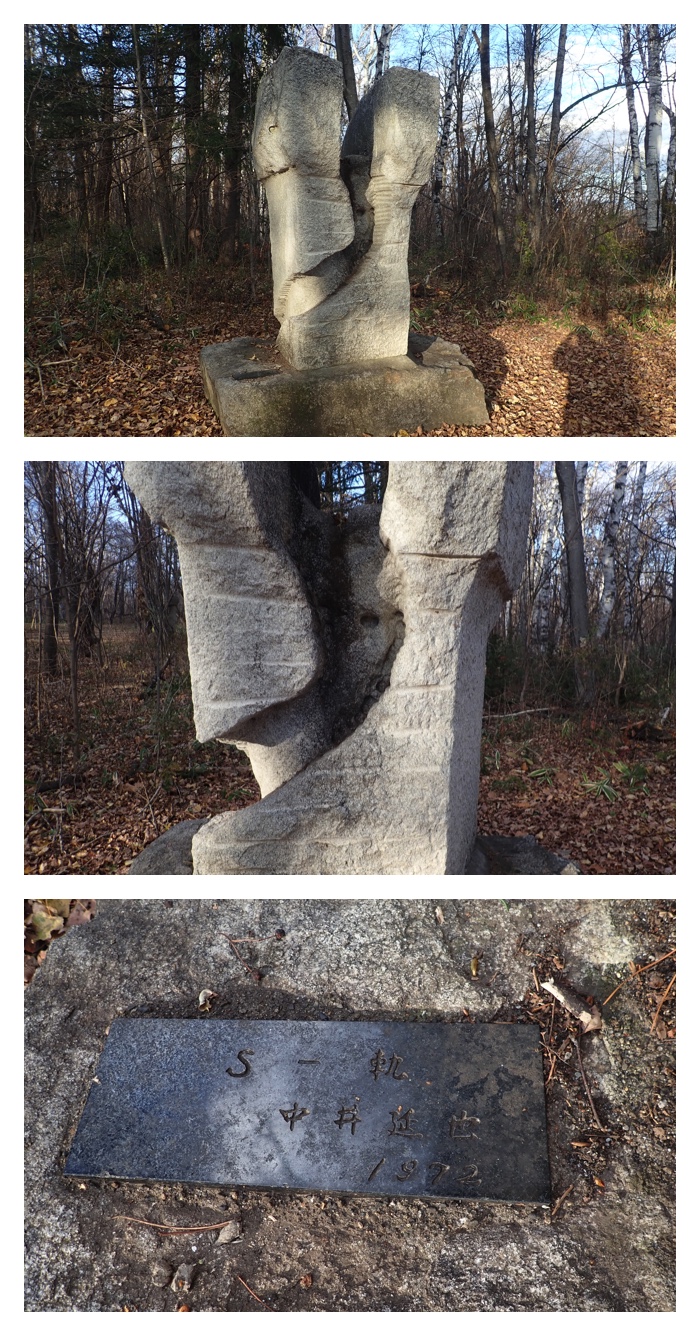
中井延也氏1972年「S-軌」という作品。
Sculpture by Mr. Enya Nakai in 1972.
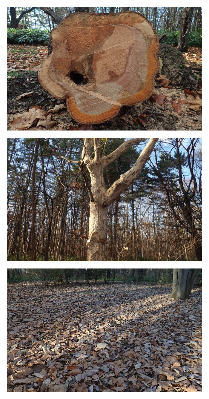
最近倒れて切られた樹。切り口の模様が不思議。上部の色が濃い部分は帯広百年記念館学芸員の池田さんによれば菌に侵されている部分だそうです。2番目の写真は彫刻の径沿いに生えていた大きなプラタナスの樹。帯広ではあまりみかけない樹です。
The cut end of the big tree that fell recently. Patterns of tree rings are irregular. Upper half in dark color is infected by fungi according to Mr. Ikeda, the curator of Obihiro Centennial Museum. The second photo is a big plane tree along the path of sculptures. We rarely see this tree in Obihiro.
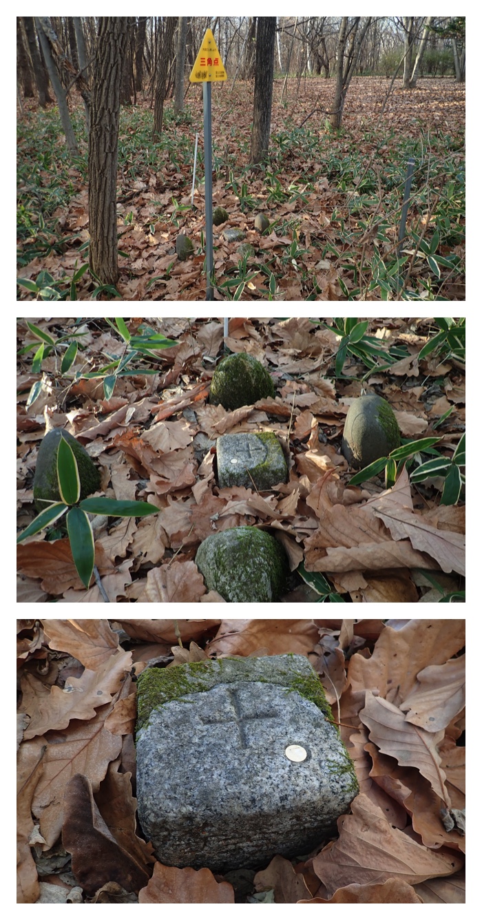
Triangulation point with the altitude of 66.6 m.
緑ヶ丘公園内の三角点。彫刻の径沿いにありました。66.6 m。
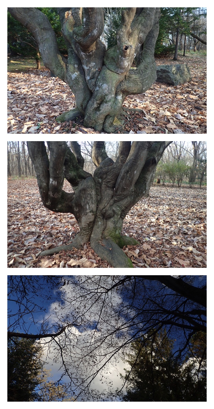
Very old maple tree in the park.
緑ヶ丘公園内の非常に古いカエデの木。
Maple tree with red leaves.
赤く紅葉したヤマモミジ。
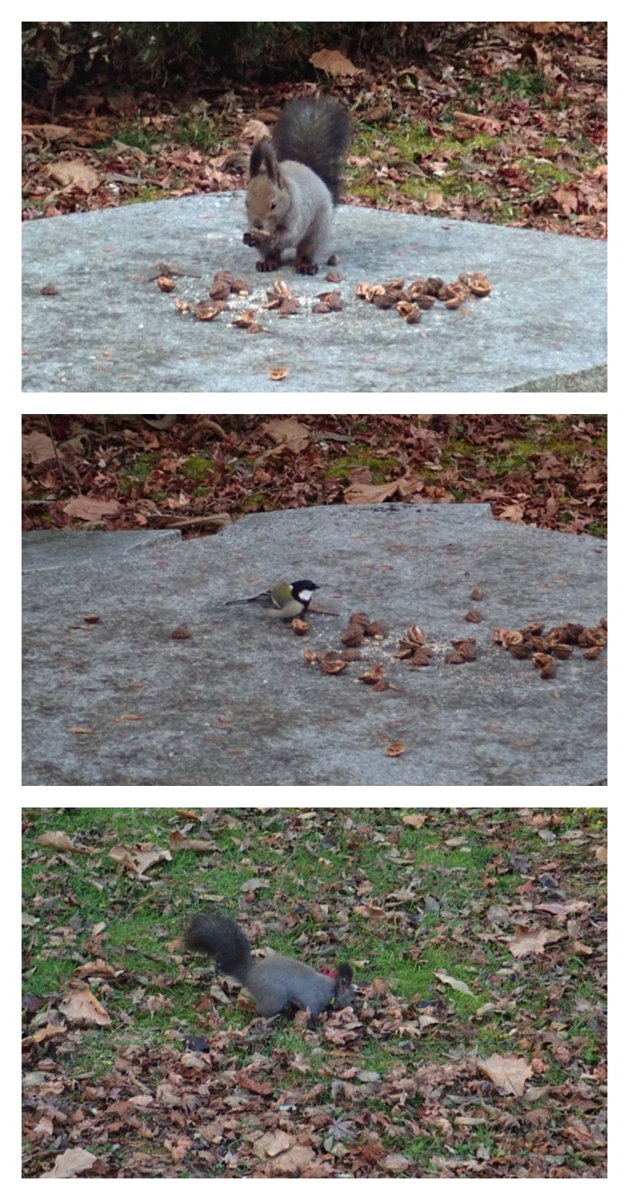
A squirrel and a Japanese Tit were eating the walnuts fed by some passenger, though the feeding to wild animals is not recommended.
誰かが置いていったくるみを食べるエゾリスとシジュウカラ。野生動物への餌やりは好ましいことではありませんが。
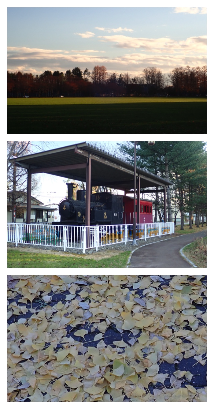
The lawn of the Green Park. A locomotive on the "Toteppo street". Fallen leaves of Ginko tree.
グリーンパークの芝生広場。トテッポ通りの機関車。イチョウの落ち葉。
Trees (swamp ash and alnus) in the evening glow.
夕焼けの中の木立(ヤチダモとハンノキ)。
"To Page Top"
三角点探索の道筋の秋の風景。
Late autumn scenes on the way searching the triangulation points.
自由が丘高台町からの風景
View from Jiyuu-ga-oka town.
もりの山からの風景
View from Mori-no-yama.
晩秋の公園とキャンパスの木立
Trees in parks and campus.
畜大野球場の夕暮れ
Evening view of the baseball ground of OUAVM.
Tall Canadian maple tree in Manabe Garden.
真鍋庭園のカナディアンメープルと最後の落ち葉。
Garden cyclamen in the Manabe Garden.
真鍋庭園内のガーデンシクラメン、水面の落ち葉、メギ。
"To Page Top"
真鍋庭園も12月3日から冬季休業となります。しかし今ならではという景色もあるものです。
Manabe garden before closing the business during the winter season from December 3. I enjoyed the special view in this season.
上:ガーデン入り口の赤い帽子。まだ残っていた紅葉。
下:ニシキギとヤギ2頭の飾り付け。
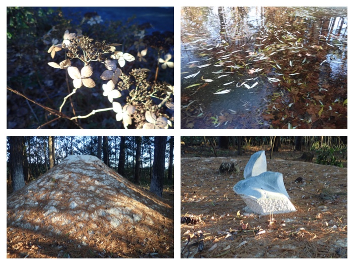
上:枯れた紫陽花の花。水面の落ち葉。
下:白イルカの森と題した作品。
上:カッパとS字の滝。
下:水面の落ち葉。
上:地衣類。紅葉したメギ。
下:カエデの落ち葉。大きなヤナギの木。
"To Page Top"
帯広はじめ全道で11月22日には雪が降りました。一昨日も少し降りましたが、今日は雪らしい雪でした。去年と比べるとほぼ1ヶ月遅れで、別に早く雪が降ってほしかったわけではありませんが、いつ降るのだろうと気になっていました。最近はいろいろと災害でも気象でも例外的なことが続きますが、この遅雪も関係があるのでしょうか?雪が降らない間に私は三角点探し、散歩、庭園散策などを楽しませてもらいましたが、雪が降ったあとも務めて散歩などの運動は続けたいと思います。
機関庫川と売買川沿いの散歩。朝晩白鳥の鳴き声が聞こえるので、売買川にももう白鳥が来ているかもしれないと思い、散歩がてら行ってみましたが、まだいませんでした。しかし、散歩の帰り道で、鳴きながら飛んでいく白鳥の群れを見ることができました。
On November 22, snow fell allover in Hokkaido including Obihiro. Though it also snowed the day before yesterday, it snowed more. The first snow was very late this year, and almost one month later compared with last year in Obihiro. Though I was not waiting for the snow, I felt strange that it did not snow until such late date. Recently, irregular weather and natural calamities are continuously occurring. The late first snow may also have something to do with such tendency. I could enjoy going out looking for the triangulation points, walking in parks and forests before it snowed. However, even after becoming the snow season, I would like to continue my walking.
In my place, we can hear the voice of swans mornings and evenings these days. I thought that they are already in Urikai river as I saw them there last year. This afternoon, I walked to Urikai river and walked along the river bank. Swans were not there yet, but I could see swans flying in the sky crying to each other on my way home.
上:庭の雪。
下:公園の落ち葉。
上:凍った機関庫川沿いの池。
下:売買川。
上:売買川の流れと堰。
下:堤防沿いの道。
上:赤いバラ科の木の実。
下:小さな堰。
上:いなっこ橋の下流。
下:売買川の小さな支流。
上:枯れ木のキノコ。
下:農業高校のカラマツ並木。
"To Page Top"
いよいよしばれてきたので、庭に残してあった大根と人参を収穫しました。もっと小さいかと思っていましたが、まあまあの大きさに育っていました。午後には散歩に出かけました。いつも通る機関庫川沿いと農業高校の学校林の端の道でした。森の中は風も弱められ、足元もすべらず歩きやすいです。
As it has become very cold in the morning, I harvested the white radish and carrot in my garden. In the afternoon, I made a routine walk.
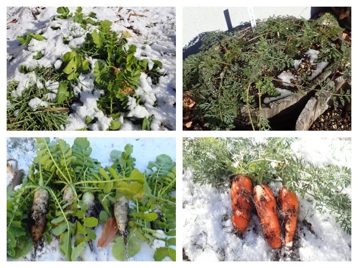
上:雪の中にまだ残してあった大根と人参。
下:掘り上げた大根と人参。
上:洗って並べた大根と人参。
下:農業高校の牧草地と農家さんの小麦畑。
農業高校の森。
"To Page Top"
今日(11月24日)は札内川の堤防を通って真鍋庭園まで行ってきました。堤防ではガガイモの実がほとんど全てはじけて綿毛を飛ばしていました。真鍋庭園では一昨日の雪が残っていて雪景色を楽しむことができました。
In the afternoon of November 24, I went to Manabe garden passing through the western bank of Satsunai river. Seed bags of Metaplexis japonica have already opened and wooly haired seeds have appeared. Snow remained in Manabe garden, and I could enjoy the snowy scene of the garden.
Trees along the western bank of Satsunai river.
札内川西側堤防の河畔林。
Opened seeds of Metaplexis japonica.
弾けたガガイモの実。
"Shinshoukaku" building in snow. Observatory over the waterfall in the garden. House of squirrel in front of the cafeteria.
真正閣の雪景色。滝の上の展望台。カフェテリアの前のリスの家。
Plants and cones in the garden.
園内の植物とマツカサ。モミの木のマツボックリは種がすっかり落ちていました。コムラサキはまだきれいな薄紫色の実を残していました。ニシキギにヤギの顔がつけられていました。トウヒのマツボックリはリスに食べられていました。
Fallen leaves of willow trees on the pond.
池の水面のヤナギの落ち葉。 魚の群れのように見えます。
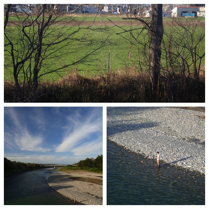
"To Page Top"
札内川と十勝幌尻岳。今日(11月26日)は非常勤講師とミニバレーと散歩(サイクリング)をしたらもう日が暮れてしまいました。三角点探しも兼ねていたのですが、見つからず、家に帰って地図を確認したら水準点でした。水準点には黄色の標識はありません。
View of Satsunai river and Mt. Tokachi-Poroshiri in the evening. One day is very short these days. This morning, I had a lecture as a part-time lecturer in the college, at lunch break enjoyed playing mini-volley ball, and after coming back home, went out again to ride a bicycle along the eastern bank of Satsunai river. I intended also to find another triangulation point, but I could not find it. It was my mistake, the point I expected was not a triangulation point but a bench mark, which does not have a yellow indicator.
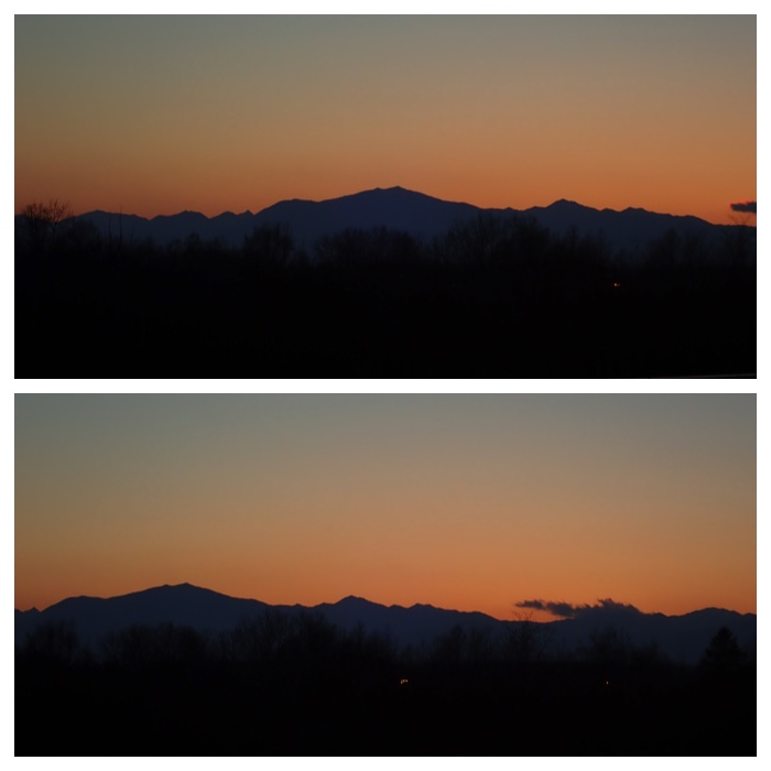
Mt. Tokachi-Poroshiri seen from the eastern bank of Satsunai river in the evening. A photo of swans flying over this site was also uploaded.
札内川東側堤防から夕暮れ時に見た十勝幌尻岳。この場所を偶然飛んでいった白鳥の群れの写真も載せました。
Mt. Tokachi-Poroshiri seen from the Aikoku-Ohashi bridge of Satsunai river in the evening.
札内川愛国大橋から夕暮れ時に見た十勝幌尻岳。
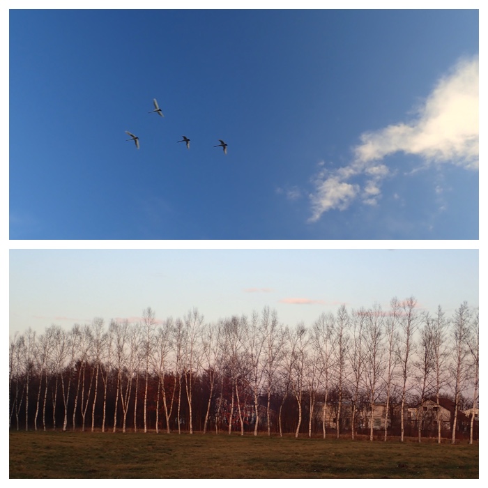
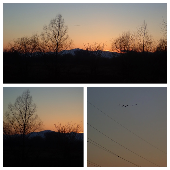
A row of white birch in Seiryu town and a flock of swans flying over them.
清流町の白樺並木とその上を飛んで行った白鳥の群れ。
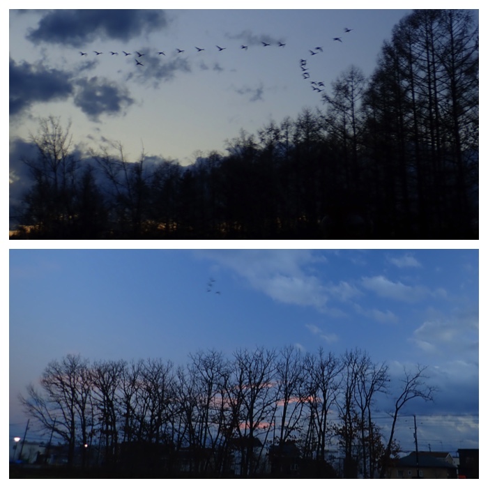
A row of oak trees in the park beside Kikanko river and a flock of swans flying over them.
機関庫の川公園のカシワ並木と公園の上を飛んで行った白鳥の群れ。
Views from Nantai bridge and Aikoku-Ohashi bridge on Satsunai river in the evening.
札内川南帯橋と愛国大橋からの夕刻の眺め。
Views from Nantai bridge and a farm house to the east of Satsunai river in the evening.
札内川南帯橋からの眺めと札内川東岸の農家。
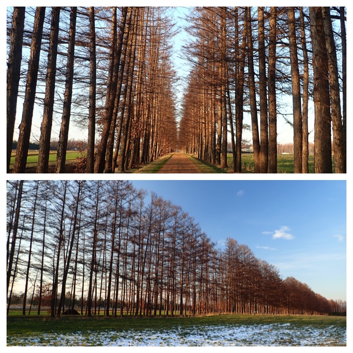
Views of the row of larch wind break trees in the field of Obihiro Agricultural Senior High School.
帯広農業高校のカラマツ防風林。
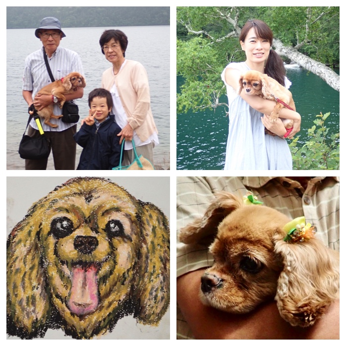
Photos of "Mame" taken in 2017. For the memory of "Mame", the dog of my daughter, which passed away on November 18, 2018 at the age of 13.
2017年中に撮ったマメの写真。マメは長女の飼い犬でした。11月18日に亡くなりました。思い出のために載せました。
"To Page Top"
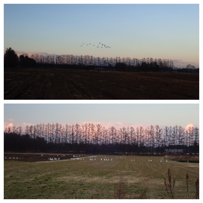
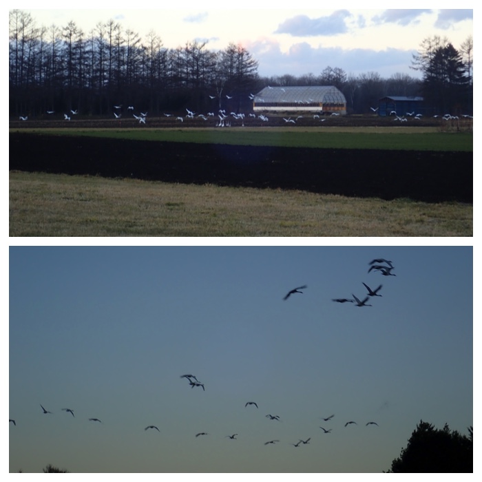
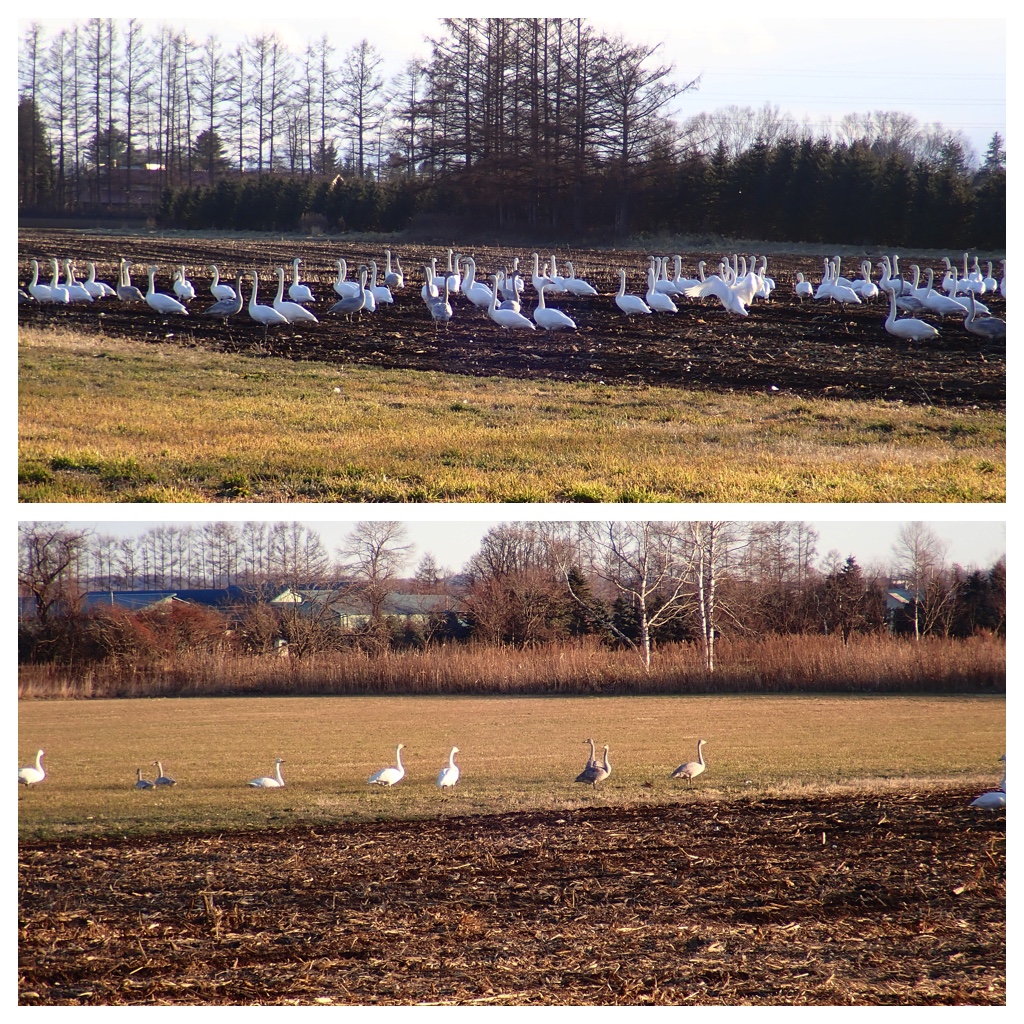
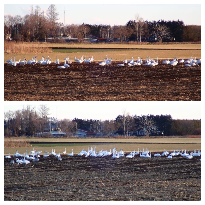
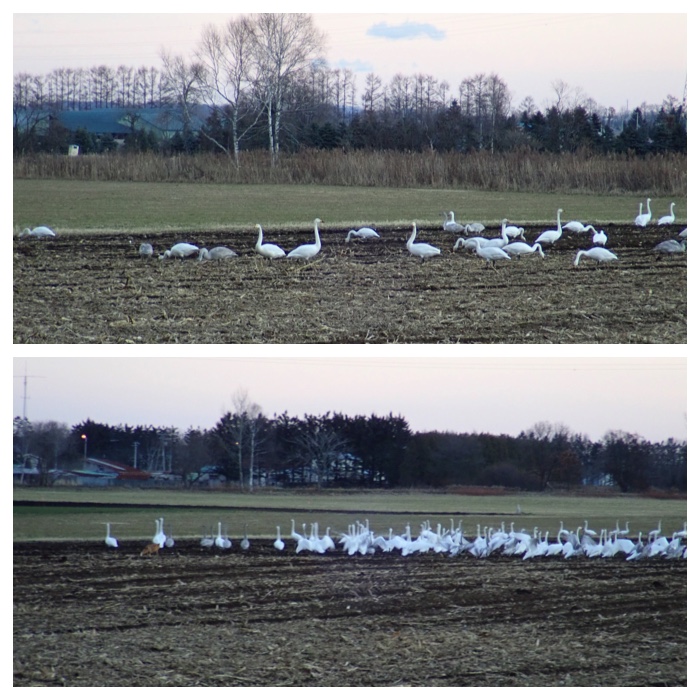
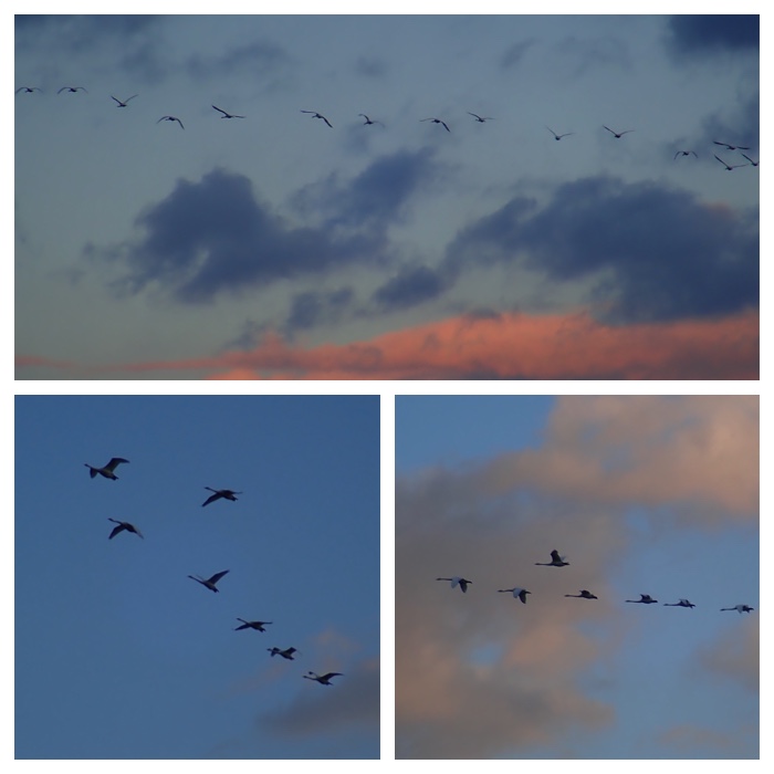
11月28日は散歩のコースを変えてみたところ、畑で休んでいる白鳥の群れを見ることができました。最初の目的はまだ見ていない三角点を確認することだったのですが、思わぬおまけがついて良かったです。
11月29日の午後も畑の白鳥を見に行ってきました。最後はキツネが現れたため、皆飛び立って行きました。16時少し前だったので、ちょうど飛び立つ準備をしていたところでしたが。
For the walking in this afternoon of November 28, I took a new route to search another triangulation point. On the way, I could find flocks of swans resting in the field. It was very lucky.
In the afternoon of November 29, I went again to the upland field where I visited yesterday to see the flock of swans. The place swans stayed was a little apart from the yesterday' s site. I stayed there from around 15:00 to 16:00. Finally, a fox appeared and approached the swans. The scared swans flied back to their sleeping place.
Triangulation points in Kawanishi town.
上:川西町西7号南15線(95.8 m)および下:西5号南14線付近(85.1 m) の三角点。
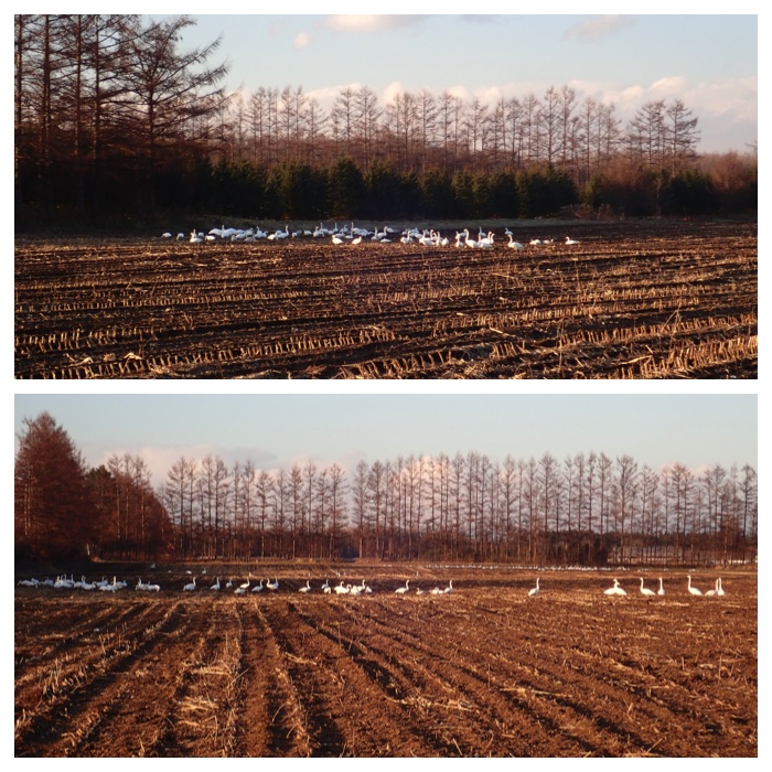
Swans in the field where dent corn was grown and harvested.
収穫後のデントコーン畑で休む白鳥の群れ。
Thirty minutes after the above photo.
上の写真の30分後。
Forty minutes after the above photo.
2番目の写真の40分後。
Forty minutes after the above photo.
2番目の写真の50分後。
A few minutes before 15:00 on November 29.
11月29日の15時数分前。
Many birds were sitting on the soil and other birds were feeding.
最初は多くの白鳥は地面に座っていましたが、畑で食べ物を探している鳥もいました。
From around 3:30, some swans started to leave the field.
3時半頃から少しずつ白鳥が飛び立ち始めました。
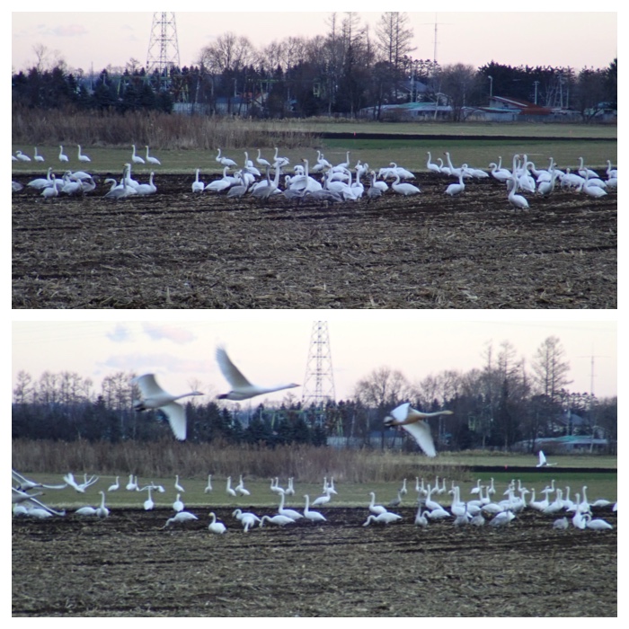
The remained birds also looked like to be ready for flying.
残された鳥たちも飛び立つ用意を始めたようです。
Some birds were still feeding the fallen dent corns in the field (upper photo). A few minutes before 16 o'clock, A fox approached the swans (lower foto).
まだ畑でこぼれ落ちているデントコーンを食べ続けている白鳥もいました(上の写真)。16時少し前、キツネが白鳥の群れに近づいていきました(下の写真)。
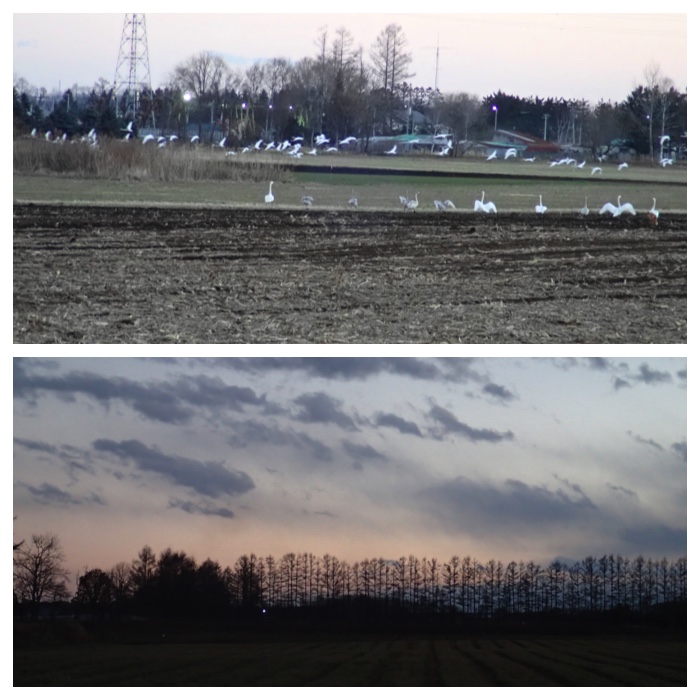
The fox seeing off the flying swans (upper photo) and the evening view of larch trees (lower photo).
飛び立った白鳥を見送るキツネ(上の写真)とカラマツ並木の夕暮れ(下の写真)。
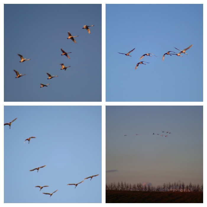
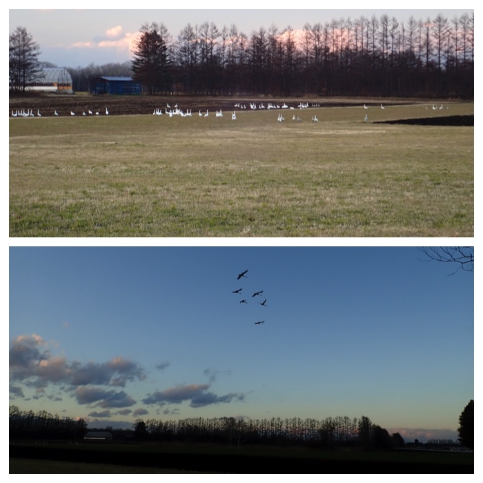
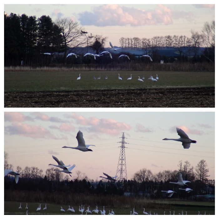
Swans flying over the pasture field of Obihiro Agricultural High School (on November 30).
帯広農業高校牧草地の上空を飛ぶ白鳥の群れ(11月30日)。
Flight of swans seen near the white birch rows in Seiryu (on December 1).
清流の白樺並木付近から見た白鳥の群れ(12月1日)。
"To Page Top"
12月2日の午前中、スコップと土壌調査道具を持って農業高校の森に行ってきました。昨日気付いた土壌断面をよく観察させて頂くためです。農業高校の方が穴を掘った理由はわかりませんが、土壌断面の観察に適した深さと幅に掘ってありました。ただし土壌断面の表面はガチガチに凍っていたので、スコップで削ってから観察しました。多分農業高校の職員の方による今年の作業はもう終わっていると思われたので、観察するだけなら許してもらえるだろうと思いました。断面は下半分が沖積層(4C, 5C層)で、その上に沖積の腐植層(4AC層)が乗っていました。断面上部は約9,000年前に降灰した樽前d火山灰から始まる火山灰層(3B, 3BC層)で、樽前dの腐植層(2A層)、約3,000年前に降灰した薄い樽前c火山灰層(1AC 層)、樽前cの腐植層(1A層)の順に堆積していました。農耕地でない土壌断面はめったに見ることができないので、大変有難い機会でした。土色や土性などは凍っていて観察できないので、土壌サンプルも少しずつ削って持ち帰りました。
In the morning of December 2, I went to the forest of Obihiro Agricultural High school to observe the soil profiles, carrying a shovel and the tools for soil survey. The pit was probably made by the staffs of the high school. Their work might have finished already, but the pit was left unburied. I thought that it will be allowed only to observe the profiles. The lower half of the profile was alluvial origin (5C and 4C layer), because the profile was located on the lower terrace. Around 5 cm thick humus layer (4AC) mixed with gravels covered the alluvial layer. The upper half was volcanic ash origin, starting from Ta-d volcanic ash (3B, 3BC, ca 9,000 YBP), overlain by its humus accumulated layer (2A), thin Ta-c volcanic ash layer (1AC, ca 3,000 YBP), and its humus accumulated layer (1A). I also brought some soil samples because it was difficult to check soil color and texture in the field. I was very lucky because we can rarely observe the undisturbed soil profiles. Before I went there, my wife said to me, "The pit must be a trap to hunt you". Yes, I was successfully trapped.
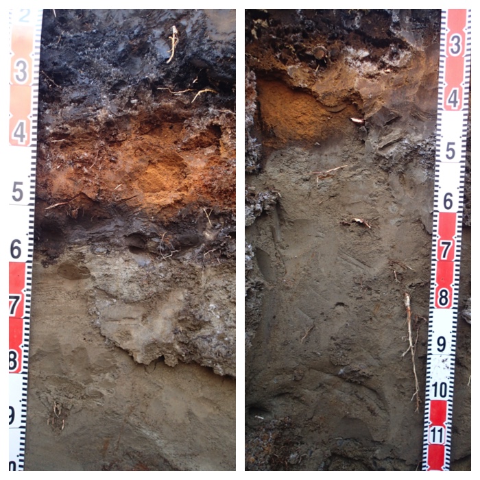
Soil profile 1 and 2.
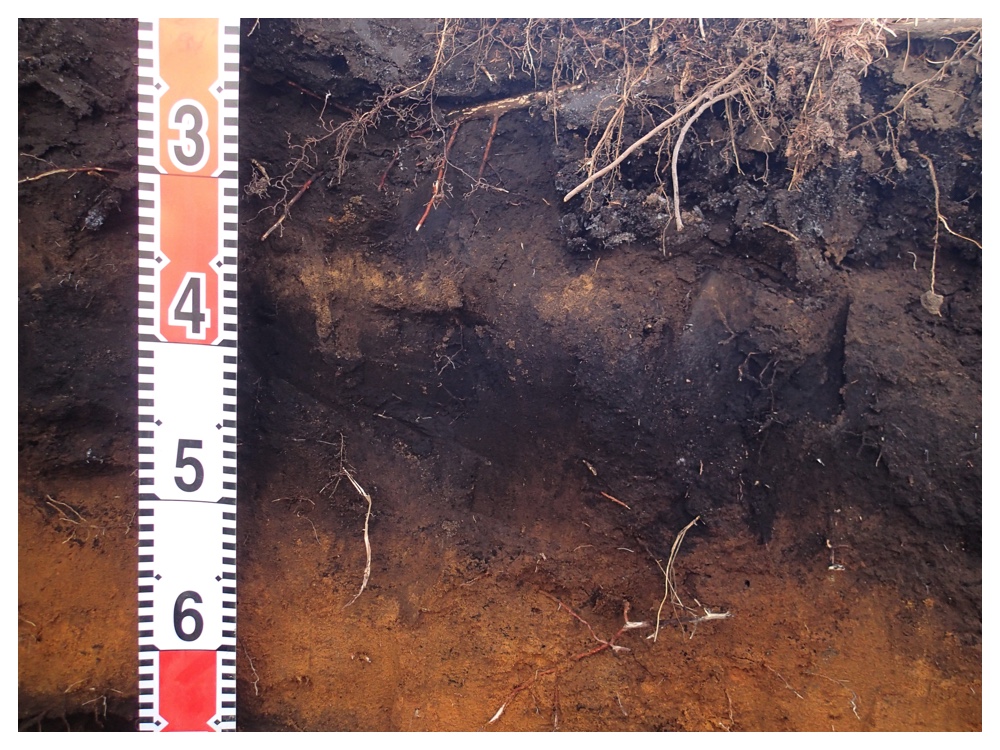
Soil profile 3. Thin Tarumae-c volcanic ash layer can be observed at 35-38 cm depth.
"To Page Top"
12月6日の夕方から7日にかけて帯広ではたくさんの雪が降るというので、12月6日の午後は売買川の堤防沿いを散歩しました。畜大の一番南の圃場から畜大北交差点のローソン付近までずっと堤防の上を歩きました。草が枯れていたので歩きやすかったです。まず最初に白鳥の群れを見ました。ちょうどその時、スラリー散布車が来て、白鳥のいる畑にスラリーをまき始めました。白鳥は場所を移動していましたが、飛び去りはしませんでした。でも白鳥にとっては迷惑なことだったことと思います。売買川堤防沿いの河畔林の中に、形が牛に似ているので気になっていた石がありましたが、今日近寄ってみたら、こわれた牛の像でした。頭の部分も同様にこわれて近くに転がっていました。中は中空で、張り子のように外側をセメントで固めたものでした。かなり古いもののようです。誰が作って、どうして壊されてここに置かれたのか知りたくなりました。その他、散歩しているといろいろと面白いものが見つかりました。
According to the weather forecast, we will have a heavy snow from the evening of December 6 to December 7. Therefore, I went out for walking in the afternoon of December 6. I walked along the bank of Urikai river from the southernmost field of OUAVM to the crossing to the north of the university. First, I visited the field where swans were resting. While I was watching them, slurry applying vehicle came and applied the digested slurry in the field. Swans did not escape but just moved a little. However, they must have been troubled because the slurry smells bad and their feeding field became dirty. I walked further along the river bank, and found many interesting things, cracked wood trunk, rotted disposed tire, ruined statue of a cow, fallen tree infected by fungi, and etcetera. I enjoyed also the view of quiet river flow and splashing dams.
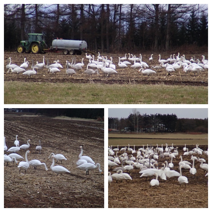
Swans in the field.
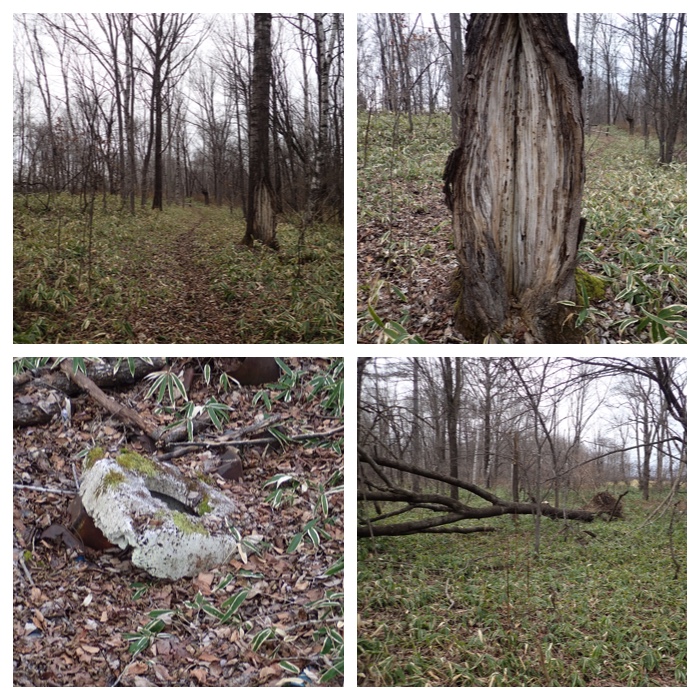
Views along Urikai river bank 1. Paths in the forest and the cracked tree. Rotten wheel tire and fallen tree.
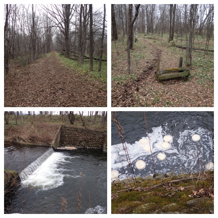
Views along Urikai river bank 2. Paths in the forest, horse trekking course, and a small dam.
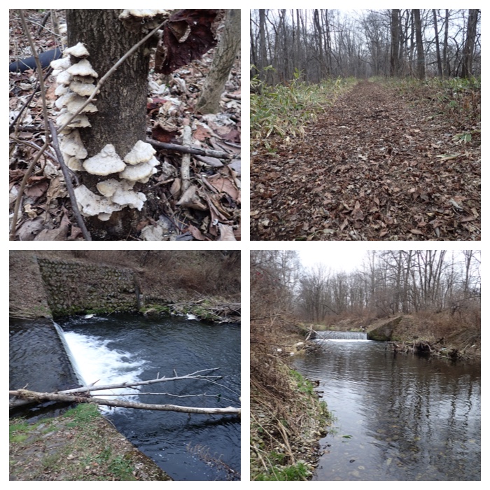
Views along Urikai river bank 3. Mushrooms, paths, and a dam.
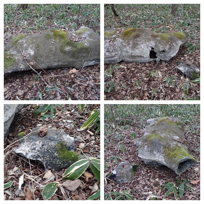
Views along Urikai river bank 4. Disposed, ruined sculpture of a cow.
Views along Urikai river bank 5. Dam, rotted tree, and the flows of Urikai river.
Views along Urikai river bank 7. Flows of Urikai river and twisted tree trunks.
"To Page Top"
12月6日の夜から7日にかけて天気予報通りこの冬初めての本格的な雪となりました。午前中に一度家の周りを除雪し、16時から17時にかけてもう一度除雪しました。午前中除雪したあとにさらに20cm ほど積もっていました。過去にも12月7日は大雪がよく降っているようです。
From the night of December 6 to 7, we had a heavy snow in Obihiro. I had to remove the snow around my house two times a day in the morning and in the evening on December 7. Total depth of the fallen snow was around 30 cm. Also in the past, we had very often heavy snows on December 7.
Views around my house in the morning of December 7, and the views in the Kikanko river park on December 8.
Views along Kikanko river and swamp ash trees on December 8.
Views in the Kikanko river park in the evening of December 8.
"To Page Top"
12月6日の午後は畜大の一番南の圃場に行ってみましたが、白鳥はもういませんでした。さらに売買川沿いの河畔林も歩いてみました。野生動物の足跡はたくさんついていましたが、人の足跡はありませんでした。
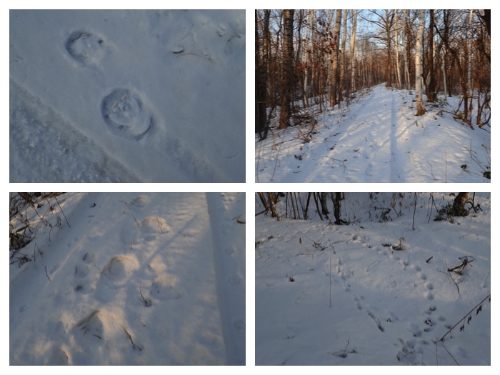
In the afternoon of December 11, I walked to the southernmost field of OUAVM. I could not find swans any more there. I walked further to the riverside forest of Urikai river. There were many footprints of wild animals, but no footprints of human. Next visitor will find my footprints.
1: Cowshed of the university field, 2: The field where many swans could be observed until December 6, 3: Sunset beyond the pasture field, 4: Wet forest where earth hammocks are observed.

1 & 2: Footprints of wild animals on the snow, 3: The path on the river bank, 4: A dam on the river. Water was partially frozen.
1 & 2: Shores of Urikai river, 3: Rotted fallen tree, 4: Ruined sculpture of a cow lying under the snow.
1: A row of larch trees beside the baseball ground, 2, 3: Mt. Tokachi-Poroshiri seen beyond the pasture field and wind break larch trees after the sunset.
"To Page Top"
The view around my walking path has changed after the snow. Today I walked along the path in the forest of Obihiro Agricultural High School after two weeks or so. I could walk through the forest without wearing the snowshoes. In the latter half of the path, I could find only the footprints of foxes. After coming out from the forest I could see the beautiful evening view of the row of white birch and Kikanko river.
I have also added some more photos of my favorite trees taken during my walk in the following days.
partially frozen.
"To Page Top"
12月23日はエゾリスの会の鳥類調査に参加しました。帯広の森の中の既定のルートを歩いて、出会った鳥を記録するものです。私は百年記念館の学芸員さんのグループに入れてもらいました。学芸員さんは鳥の声を聞くだけで何の鳥かわかります。私が気づいた鳥の数の10倍くらいは見つけておられました。調査で大学の研究室の卒業生さんに再会しました。ハシブトガラ、シジュウカラ、ゴジュウカラ、ヒガラ、エナガ、キバシリ、キクイタダキ、アカゲラ、ヒヨドリ 、ハシブトガラスなどを観察することができました。
On December 23, I joined the wild bird survey activity held by a volunteer's group "Ezorisu no Kai (Hokkaido squirrel lover's group?)". I could also luckily meet the lady who graduated my laboratory 8 years ago.
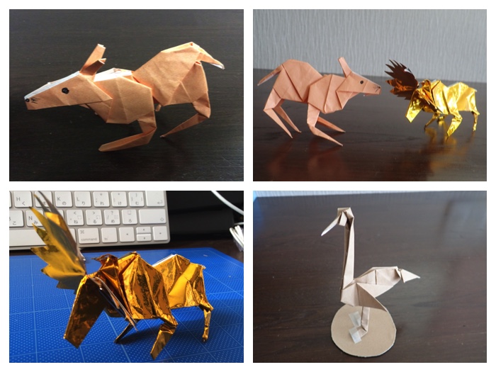
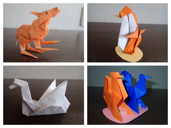
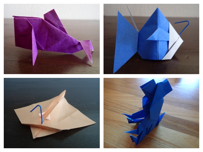
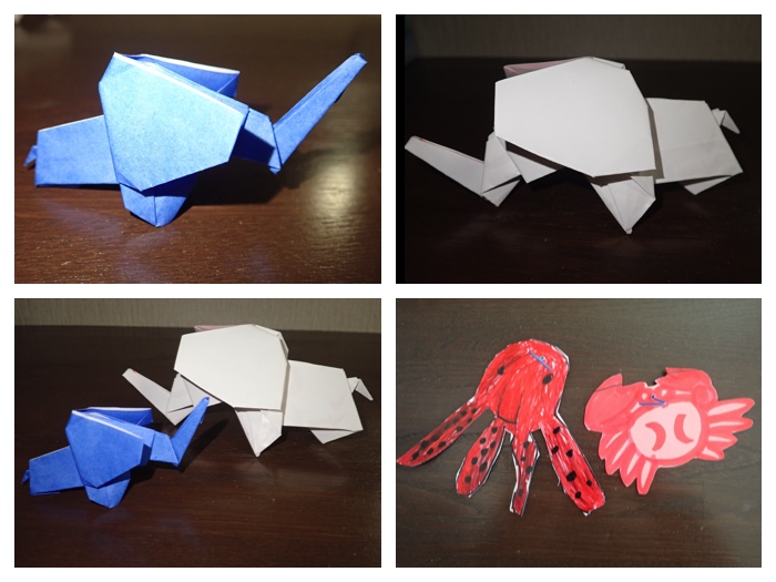
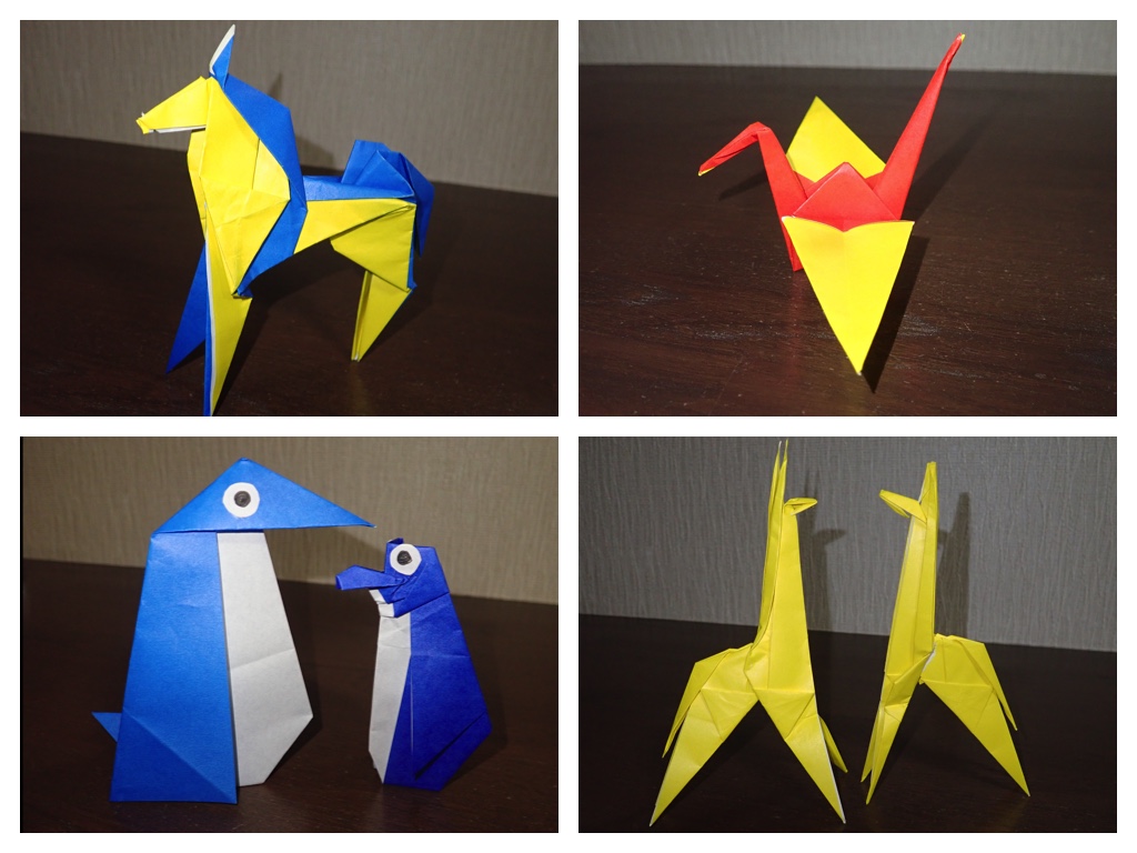
わが家のクリスマスの飾り付けと孫の要望で作った折紙です。
Photos of Christmas decorations in my house and the paper folding works prepared according to the request of my grandson.
"To Page Top"
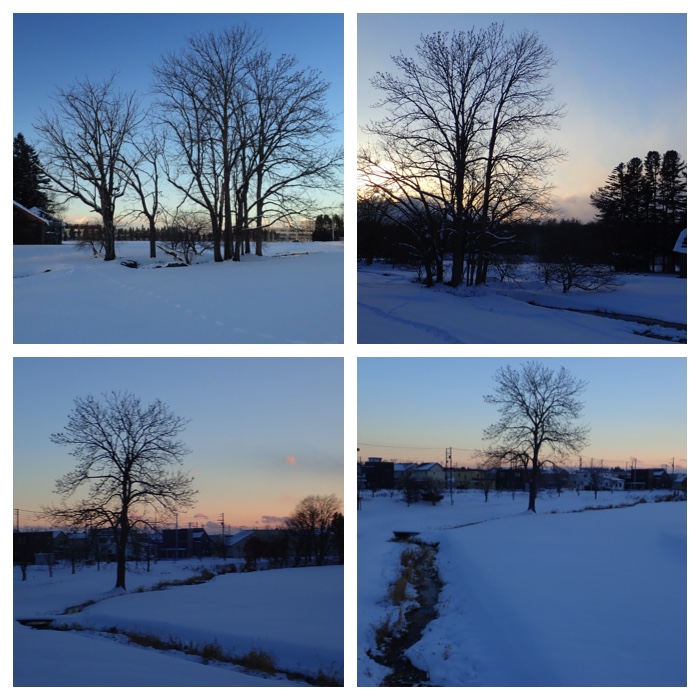
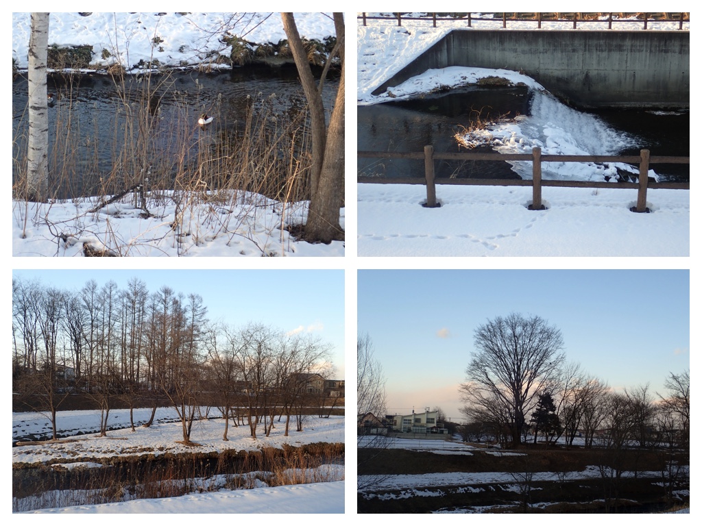
売買川堤防まで散歩。今年は雪が少ないので、真冬には普通歩いていけないところまで足を伸ばすことができます。1月5日には農業高校、畜大キャンパスを通って売買川の堤防を歩き、帰りは往路と違う道を通って帰ってきました。売買川の堰がしっかり凍っていました。その後の散歩の様子もこの項目に続けて載せることにしました。
Afternoon walk to Urikai river on January. Due to the very little snow in this year, I could walk to the place which is hardly accessible in normal years. The dam on Urikai river was frozen already. The views seen during my walk in the following days are also uploaded here.
White birch and larch trees (January 5).
Frozen dam on Urikai river (January 5).
Footprints on the snow (January 5).
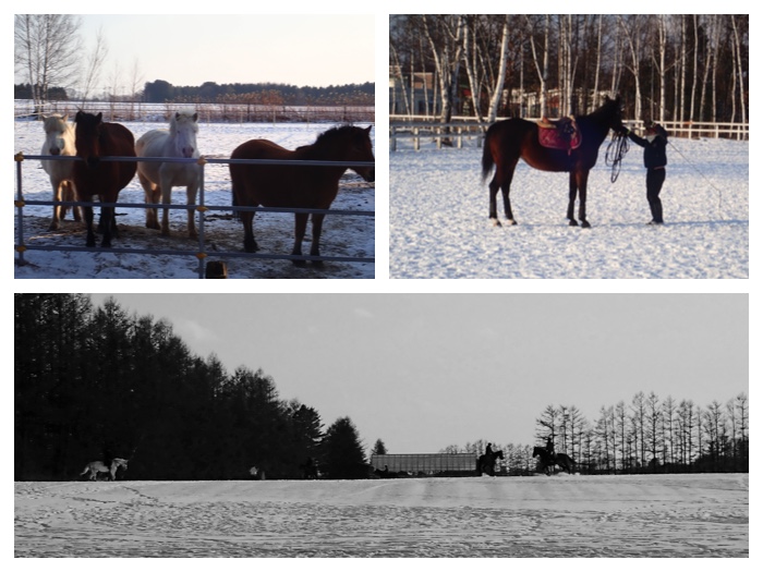
Horses in the campus fields of Obihiro University of Agriculture and Veterinary Medicine (January 5).
Views along the bank of Urikai river to the north of Inada elementary school where I walked next day (January 6). A pair of merganser was swimming in Urikai river. In the last winter, I also saw the pair of birds here.
Views along the bank of Kikanko river where I walked next day (January 6). 農業高校の森を通って稲田小学校の北の売買川堤防まで歩き、その後機関庫川沿いの道を帰ってきました。売買川ではカワアイサのつがいが泳いでいました。
Evening views from Seiryu town where I live (January 7). Photos taken during my evening walk are uploaded here. This morning, I had a lecture of soil science for the junior course students as a part time lecturer. After the lecture, I read the reports of students, and then joined a mini-volleyball game in the lunch break. I think, having a lecture once a week is very ideal for me, because I have enough time for preparing and reviewing the lecture.
Views along the bank of Kikanko river (January 7). 夕刻の散歩。今日は1時間目に非常勤講師(別科土壌作物栄養学)としての授業があり、ささやかな仕事始めとなりました。授業後1時間半ほど学生さんたちが提出したレポートを読み、昼休みにミニバレーをしてから帰ってきました。1週間に1度の授業というのは理想的です。
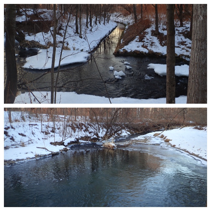
Elm trees (January 8). In the afternoon of January 8, I walked along Kikanko river to visit "Harunire" park where the symbolic elm tree of Obihiro city is growing. Then, I came home passing through the eastern bank of Satsunai river.
River side trees of Satsunai river (January 8). 機関庫川沿いの道を通ってハルニレ公園に行き、そこから札内川の堤防を通って帰ってきました。ハルニレ公園のハルニレの木は帯広市の保存指定樹第1号で見事です。
Satsunai river near the bridge of express highway (January 9). In the afternoon of January 9, I walked to the post office of Kawanishi town around 3 km far from my house, then came back walking along the bank of Satsunai river. On the way, I walked down to the river shore and watched the flow of the river. It was quiet and beautiful. The time to the post office was around 40 minutes and from the post office was around 1 hour. By car, it takes only 10 minutes from my house. When I become old enough, I will abandon driving, then it will become very difficult to go to post office.
Satsunai river to the east of "Obihiro-Kinen" hospital (January 9).
Road on Satsunai river bank and elm trees (January 9). 川西郵便局に用事があったので散歩がてら歩いて行き、帰りは札内川の堤防を歩いてきました。行きが40分、帰りが1時間くらいかかりました。帰り道は川岸まで降りて川の流れを見ていたりしたので時間がかかりました。車で行けば10分以内のところですが、年をとって車を運転できなくなったら、歩くことも困難なので困るだろうなと思います。
Stone and gravel excavation site and the volcanic ash layer appeared on the newly cut drain ditch (January 9). 堤防脇に側溝が掘られていました。薄い白い層があり、火山灰ではないかと思いました。
Riparian trees along the bank of Satsunai river (January 9). 札内川堤防沿いの河畔林。樹種についてはよくわかりません。
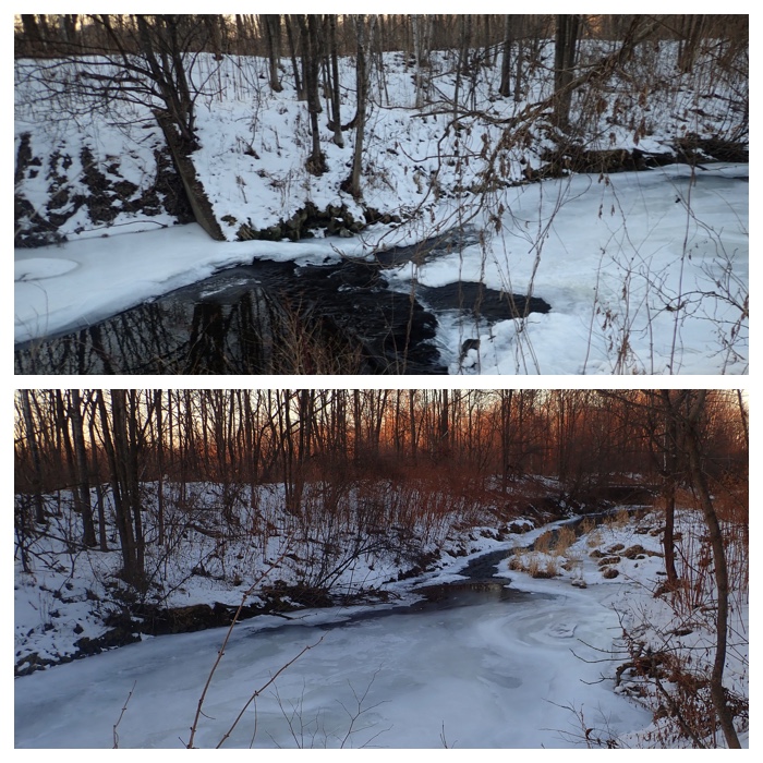
Frozen Urikai river (January 10). 凍った売買川の堰。
Frozen Urikai river (January 10). 凍った売買川。
Frozen Urikai river (January 10). 凍った売買川。
Trees on the sandbank of Urikai river (January 10). 売買川の中州の木立。
Evening glow at Kikanko river (January 10). 機関庫川の夕焼け。
Upper photo: Wall decoration of Obihiro Technology High School is reflecting the evening sun light. Lower photo: View of the bank of Satsunai river (January 11). 夕日を照り返す帯広工業高校の外壁の飾り(上)と札内川の堤防の風景(下)。
Upper photo: Riparian trees of Satunai river. Lower photo: View of Mt. Tokachi-Poroshiri (January 11). 札内川の河畔林(上)と十勝幌尻岳(下)。
Riparian trees of Satunai river (January 11). 札内川の河畔林。
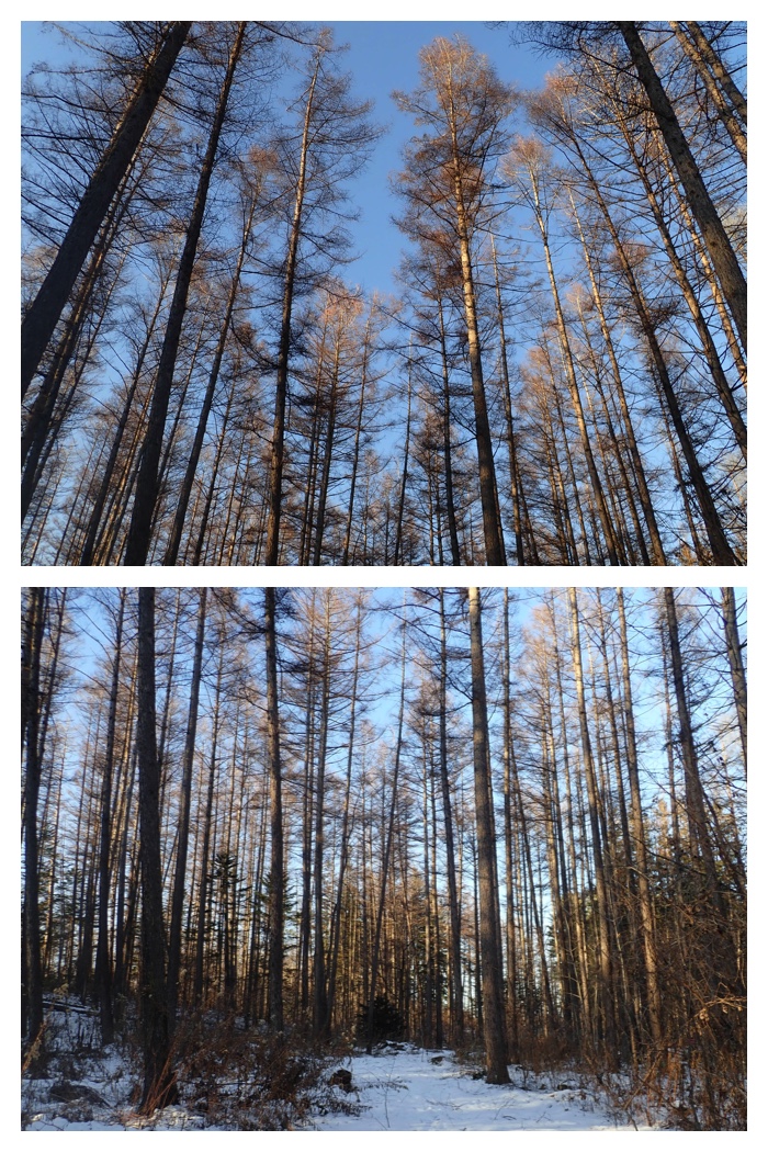
Larch forest of Obihiro Agricultural High School (January 12). 農業高校のカラマツ林。
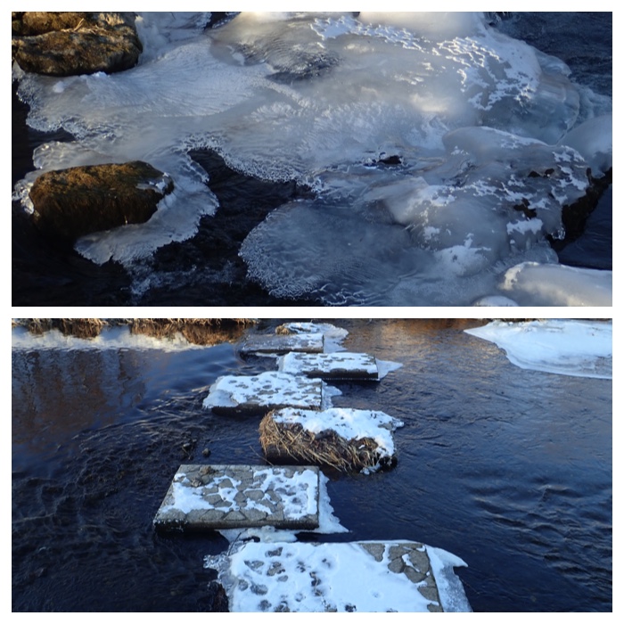
Frozen Urikai river and stone bridge (January 13). As the weather was calm and not windy, I walked along Urikai river bank a little longer than usual. I could see two pairs of common mergansers.
凍った売買川と飛び石。
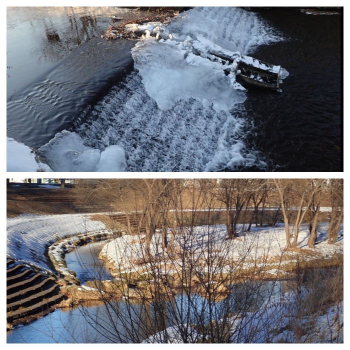
Frozen dam on Urikai river and sand-bank (January 13).
凍った売買川の堰と中州。今日も寒かったですが風もなく穏やかな天気だったので、売買川沿いに少し長めの散歩をしました。
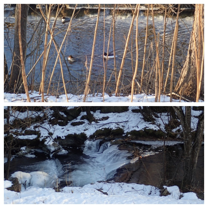
Common merganser on Urikai river and natural dam (January 13). 売買川のカワアイサと自然の堰。この日は4羽(2つがい)いました。
Mt. Memuro and the barnyard of OUAVM (January 13). 芽室岳と畜産大学の厩舎。
Oak tree in the field of OUAVM and Hidaka mountains beyond the wind break trees seen from Obihiro Agricultural High School field (January 13). 畜大圃場内の柏の木と農高圃場からみた防風林越しの日高山脈。
White birch trees in Seiryu town and Mt. Tokachi Poroshiri seen beyond the wind-break trees. (January 13). 清流の白樺並木と防風林越しの十勝幌尻岳。
This afternoon, I walked from the southern end of the university field to north along the bank of Urikai river. The river was totally frozen in this part. The evening glow on my way home was also beautiful (January 14). 今日は売買川沿いを畜大の圃場の南の端から北に向けて歩きました。歩き始めの部分では売買川は全面が凍っていました。堰の凍り具合も2週間ほど前に見た時よりもさらに進んでいました。帰り道は夕焼けが美しかったです。
Totally frozen Urikai river (January 14). 完全に結氷した売買川。
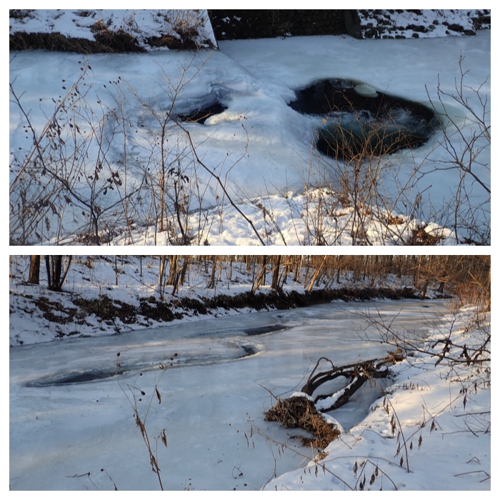
Totally frozen Urikai river (January 14). 完全に結氷した売買川。
Totally frozen Urikai river (January 14). 完全に結氷した売買川。
Frozen dam on Urikai river (January 14). 凍った堰。
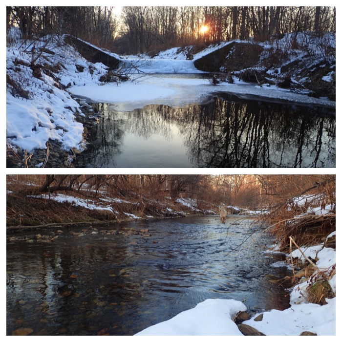
Frozen dam on Urikai river and its lower flow (January 14). 凍った堰とその下流。
Unfrozen part of Urikai river (January 14). 売買川の結氷していない部分。
Near the joint to the branch river (January 14). 支流との合流点。
Evening glow through larch trees (January 14). カラマツ林越しの夕焼け。
Evening glow through white birch trees (January 14). 白樺林越しの夕焼け。
"To Page Top"
"To Page Top"
"For the contents after January 2019, just click this line.
2019年1月からの写真はここをクリックしてください。"